How Technology is Transforming Land Rights in Tanzania

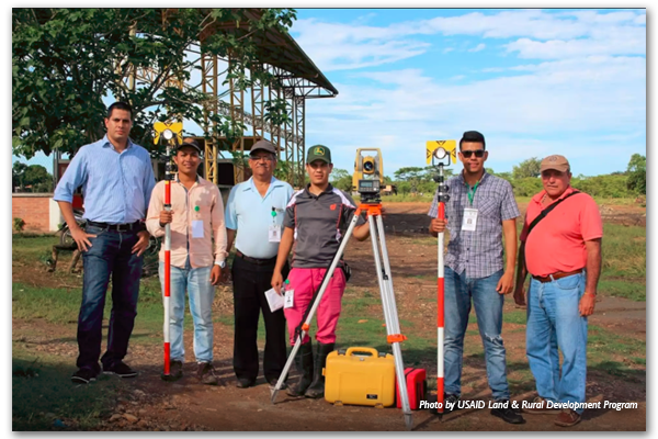
As part of the Feed the Future initiative, USAID is helping the Government of Tanzania to improve communities’ understanding of land rights, support village land use planning, and clarify, document and certify property rights. USAID anticipates that this program – the Land Tenure Assistance Activity (LTA) – will reduce land-tenure related risks and lay the foundation for sustainable and inclusive agricultural investment for both smallholders and large-scale commercial investors. The program is a positive example of how a USAID investment is catalyzing innovation and partnerships for economic prosperity and self-reliance in Tanzania.

By the end of 2019, LTA is expected to have registered – for the first time – over 50,000 parcels, benefiting over 14,000 Tanzanian villagers.

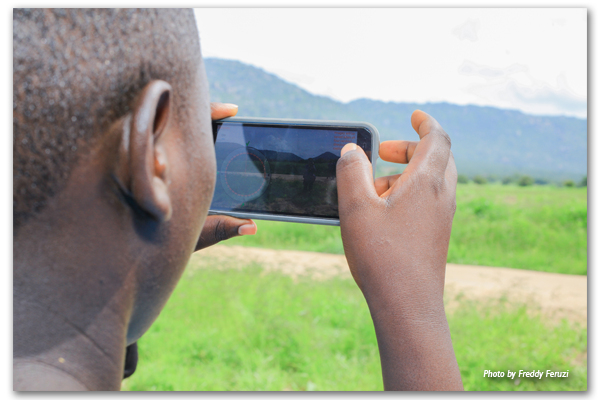
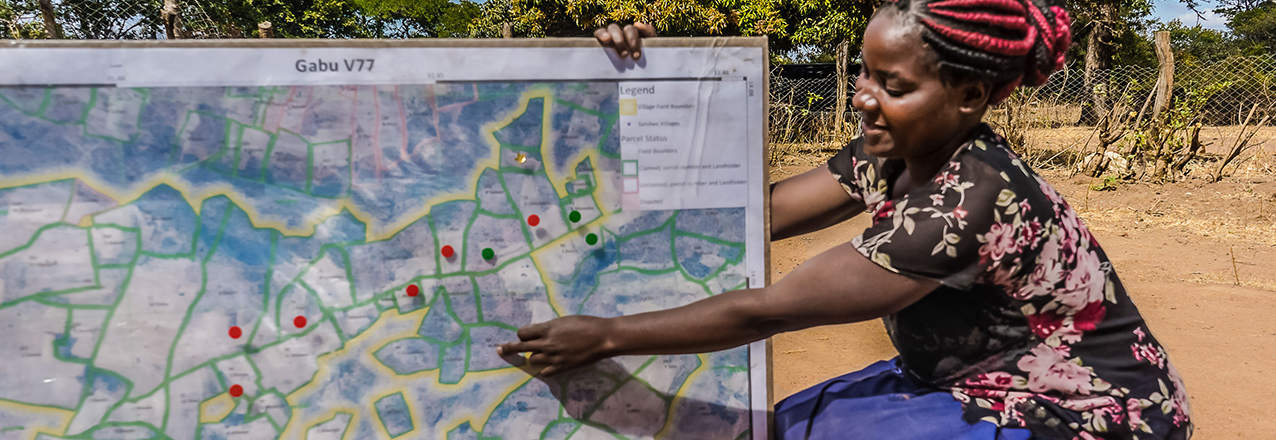
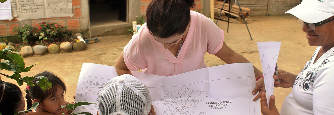
At the heart of the program is USAID’s Mobile Application to Secure Tenure (MAST), a suite of innovative approaches, inclusive methods, and mobile technology tools to efficiently, transparently, and affordably document rights to land and other resources. In addition to Tanzania, USAID is working with other governments and communities to use MAST in Burkina Faso, Myanmar, and Zambia.

Evolution of MAST

These days, smartphones and tablets are everywhere, even in some of the most remote villages around the world. To leverage these technologies to meet the challenge of providing affordable, accessible land administration services to rural areas, in 2014 USAID began working with the Tanzanian government and local residents to pilot MAST in Ilalasimba, a small village in Iringa District. The initial pilot was a proof of concept – to test whether the idea of using low cost mobile technology to map and register land rights would work and could be affordably scaled-up to the rest of the country.

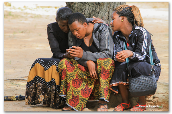
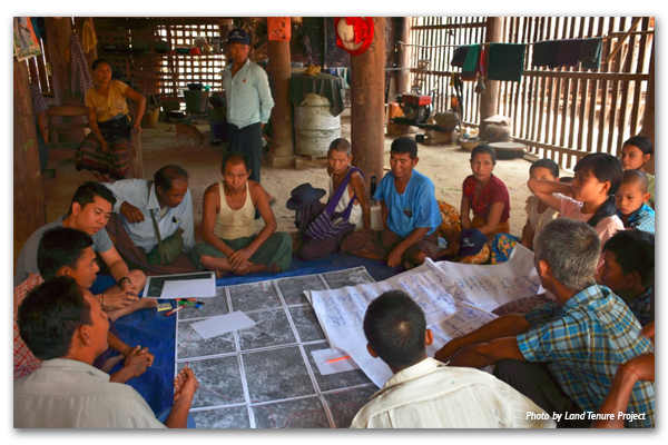
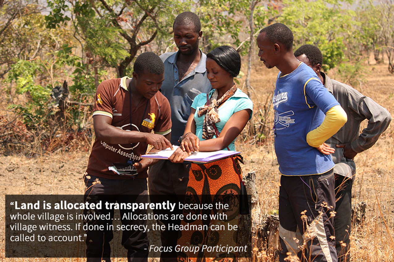
Central to the pilot was the assistance of and input from both the local government and community members themselves, in particular local youth who functioned as “trusted intermediaries,” helping to teach other villagers about MAST. Beyond just technology, the pilot project raised awareness among villagers about their land rights, with a special emphasis on women’s land rights. Only then did the project team map, record, and register those rights using MAST. As USAID/Tanzania’s Hal Carey explains, villagers were “interested and excited about [MAST] because it was an opportunity to participate in land governance…for women, it meant an opportunity to secure tenure for their children; for everyone, it meant access to finance. Everyone saw the potential, although there was some skepticism.”

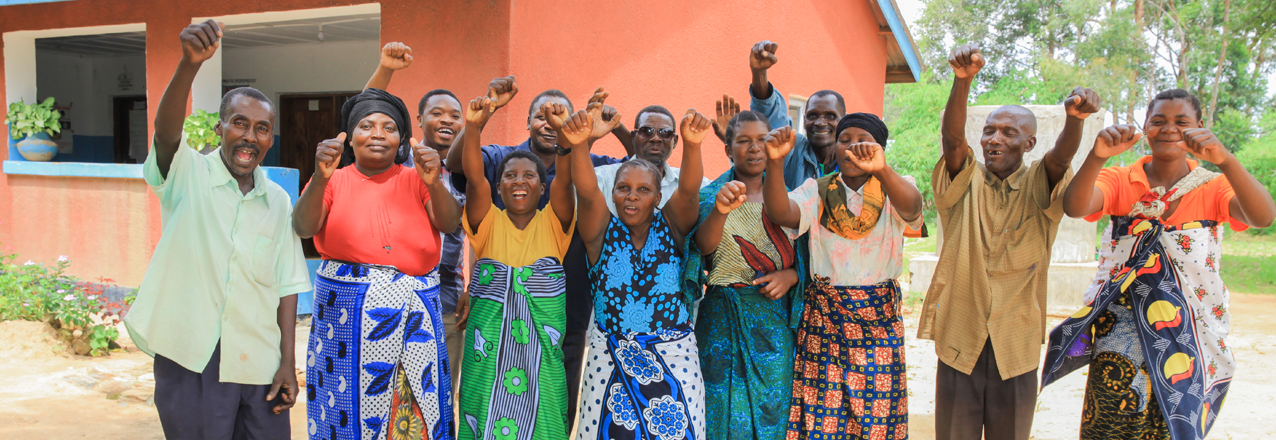
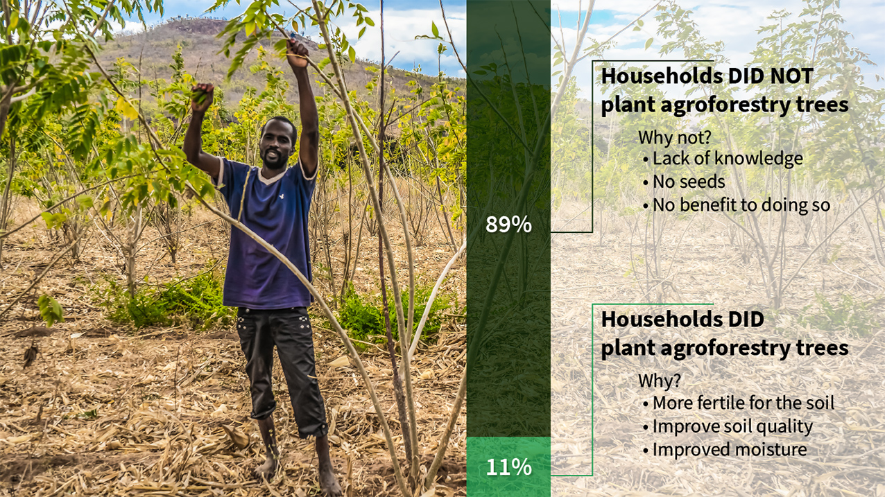
In that first village – Ilalasimba – the pilot team mapped, recorded, and registered 910 parcels using MAST, benefiting 345 families. Soon after, the District Land officials issued official land certificates – known in Tanzania as Certificates of Customary Rights of Occupancy (CCROs) – for each parcel. The number of registered parcels increased to 1139 for the second village and 1886 for the third. Importantly, despite early resistance from many men to the registration of women’s land rights, the pilot’s education, training, and outreach activities resulted in parity in land registration between men and women. For example, in Itagutwa village, 33% of the parcels were registered solely in women’s names, while 32% of parcels were registered jointly in women and men’s names.

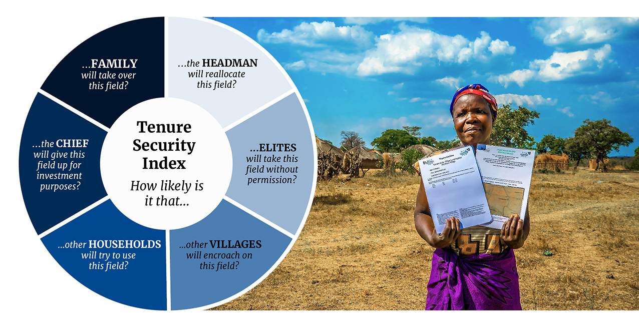
Now, with their land certificates in hand, residents of the MAST pilot villages enjoy greater clarity of their rights, including their parcel boundaries, enhanced tenure security, and stronger incentives to make long-term investments on their land. For example, families are using the certificates as collateral to invest in their businesses.

For USAID and the Tanzanian Government, the initial MAST pilot generated many lessons and produced a commitment to continue improving and scaling MAST, given its relative efficiency, low-cost, and user-friendly tools, compared with more traditional adjudication approaches that utilize labor intensive approaches and required expensive equipment and specialized inputs. The initial MAST pilot was judged a success for improving tenure security and in establishing and reinforcing participatory and transparent governance mechanisms at the village level which, in turn, have the potential to lead to greater smallholder and large-scale commercial investments in land.

USAID’s Land Tenure Assistance Activity expands MAST

Based on the success of the initial pilot, USAID launched the Land Tenure Assistance (LTA) activity in 2015 to scale-up the work to a much larger area. Under LTA, USAID has refined MAST’s technology and methods to deliver CCROs as well as village land use plans, which are a precondition for the issuance of land certificates under Tanzania’s Village Land Use Act. As Carey explains, “the [initial] tool had some shortcomings.” However, USAID “took the lessons learned from the MAST pilot and revised the application itself for more accountability…accuracy, and efficiency.”

Through 2017, the LTA program has achieved promising results, including:

  • Registering 14,747 CCROs, covering 20,000 hectares of land in 13 villages;
  • Empowering women to claim their land rights: 48% of all claimants were women;
  • Lowering the cost per parcel from $20.57 at project inception to $7.85;
  • Helping to establish 13 women’s groups and strengthen 32 others;
  • Training 17,714 individuals on land tenure and property rights;
  • Supporting the upgrading of 10 village registry offices;
  • Creating a radio program on land registration and the LTA project on five radio stations; and
  • Launching a youth sensitization program in secondary schools.

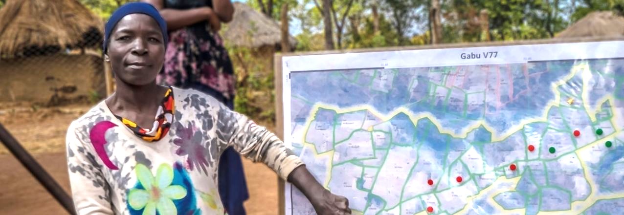
Semaly Kisamo, also from USAID/Tanzania, noted that MAST is a “very participatory process with villagers themselves participating. It’s generating ownership, sustainability, and trust… communities trust [each other] more. They are engaging and coming together to resolve issues. They are very appreciative of the project.”

The Government of Tanzania is now exploring opportunities to roll out MAST nationwide. While the Government looks to build a national land information system, which will focus first on the registration and administration of urban land, MAST offers a relatively low-cost, efficient, and user-friendly tool for formalizing customary rights in rural areas. As such, MAST provides an effective and sustainable tool that can easily be made compatible with the national land information system. It may prove beneficial to the Government in contributing to the activities focused on promoting transparency in the administration of rural lands, increasing tenure security, and ultimately enhancing the investment climate in Tanzania.

The Government recently decided that the Land Tenure Support Programme, which several European donors support in Tanzania’s Kilombero District, will use MAST and the same implementation protocols as the LTA program to support the systematic adjudication.

To learn more about MAST, see the MAST Learning Platform, a knowledge portal with documentation, tools, lessons learned, and best practices from existing MAST projects. The MAST Learning Platform also will feature upcoming MAST activities to be implemented under the USAID-supported Land Technology Solutions Project (LTS) and other USAID programs.

Land, Front and Center in Colombia

The history of land rights in Colombia is a centuries-old tale of colonialism, highly concentrated land ownership and unsuccessful agrarian reforms. Fifty years of civil strife have left vast sections of the country’s land undocumented, vulnerable to land record manipulation and outright lawlessness. Under the landmark peace agreement, the Government of Colombia has committed to addressing the land issues that have so often been at the heart of the nation’s conflicts – by formalizing property rights across the country, organizing the national registry and recovering lands that belong to the state.

In a warehouse on the outskirts of the capital, the nation’s property registry authority—the Superintendence of Notary and Registry (SNR)—stores over 80,000 paper-based property ledgers, some dating as far back as the 18th century. In 2015, the Constitutional Court ordered the government to restore, transcribe, digitize and conserve the records, seeking to modernize the disorganized and unreliable land administration system that had persisted for generations.

In addition to organizing the historical documents, the court ordered the SNR to determine how much land had been acquired irregularly (without formal documentation) and continued to be held unofficially. A year-long investigation showed that at least 30 percent of the nation’s territory—some 5 million hectares of land—was acquired irregularly.

“The state had no idea,” explains Clara María Sanín, a land expert working with the SNR. “Colombia’s history has been characterized by a government incapable of protecting its territory, a centralized administration that allowed faraway, rural regions to do what they want with land ownership.”

Now, in the post-conflict era, the national government has pushed rural land reform to the forefront of national dialogue by creating a new land administration authority, the National Land Agency. The agency is mandated to begin an ambitious land formalization campaign—in response to the fact that six out of every ten parcels in Colombia are informally owned—and coordinate rural development strategies with its sister agencies: the National Development Agency and the Agency for Territorial Renovation.

As the three agencies maneuver in unprecedented ways to ensure that sustainable investments reflect an integrated development approach, USAID, through its Land and Rural Development Program, plays a key role as facilitator. On its surface, USAID’s program acts as a conduit between national, regional and municipal administrations, improving intergovernmental coordination and making it easier for sub-national government agencies to mobilize domestic resources to address land issues and rural development. At a deeper level, the program is fostering critical public policy and governance changes that are improving Colombia’s land regulatory framework.

Piloting Massive Formalization

In partnership with the National Land Agency and the National Planning Department, USAID is spearheading a high-profile land formalization pilot in the municipality of Ovejas, a priority municipality in the nation’s post-conflict environment that was devastated by two decades of guerrilla and paramilitary violence. The pilot—which will soon title 3,000 parcels—is streamlining the collection and processing of property and cadastral information in order to reduce costs and provide government land agencies with integrated and reliable land data. The government is monitoring the Ovejas pilot carefully as it looks to learn about the most promising technologies and approaches as it prepares to undertake its own national land titling campaign.

“In the past, the government formalized property in an absolutely isolated manner. This pilot changes the way we do things in rural land administration. In Ovejas, we are focused on resolving all types of land conflicts, from parcel to parcel. The strategy is new, it is massive and it requires a higher degree of institutional coordination than we have ever seen,” explains Juliana Cortés, director of land tenure at the National Land Agency.

The Ovejas pilot is part of the government strategy to move away from a demand-driven land administration policy to one in which the government assumes the cost of first-time formalization. By doing so, it will alleviate major time and cost burdens that prevent most low-income rural landholders from seeking a valid title. Once a property is registered, future title transfers will be much less time and cost intensive.

State Presence

To get to this point, the USAID program has worked for nearly five years on creating an environment where government entities are more willing to share information and coordinate efforts to strengthen land tenure, improve land use and catalyze rural development.

“By framing land tenure with institutional strengthening, USAID is testing a new approach that no longer patches holes along the way. We believe the Colombian government to be capable of land administration—we merely support them in certain activities and put effective tools in their hands in order to ease the process,” explains Marcela Chaves, USAID/Colombia’s land tenure expert.

At the core of strengthening Colombia’s land institutions is access to information and the use of IT systems to manage and ultimately protect the country’s land and property data. The information gathered through the pilot is stored in a central database that merges former data collection systems, and is shared with the property registry authority. At the same time, USAID is assisting in the digitization of over four million land documents, which represent one-fifth of the country’s area.

“One of our biggest challenges in formalizing land is the ability to count on and trust the information that we have. What we have now is basic data that is not specific enough to make clear decisions in the public policy forum,” says Cortés.

Better land tenure policies and systems are already catalyzing rural development. In the new, land-conscious Colombia, municipalities are prioritizing titling public properties, such as schools, to stimulate rural investments with national funding. Beyond land tenure, this innovative USAID program is using its rapport with government entities to broker public-private partnerships, in which more than half of the funds are from the domestic government.

Making domestic public entities—rather than USAID—the face of development continues to increases the public’s confidence in their leaders and institutions. In a country long wracked by corruption and war, a little bit of confidence goes a long way.

From the Ground Up: Participatory Rights Documentation for Healthy Landscapes

Much of the world’s rural landscapes are technically managed by national governments with limited recognition of, or support for, the rights and management responsibilities of the rural poor who live in these areas. In an era of large-scale land acquisitions for global commodity production, this has led, in some cases, to governments allocating vast tracts of land and resources to companies with limited or no consultation of the people affected. These cases pose risks to all stakeholders, including: potential eviction or loss of livelihoods to the communities; reputational risk and operational challenges to companies (including responsible businesses); and the undermining of public confidence in government. Participatory documentation of land and resource rights, using state of the art technology and robust, inclusive processes, is creating an enabling environment to address existing land and resource conflicts, avoid future disputes and create improved land use plans for the future.

Since 2014, USAID’s Tenure and Global Climate Change (TGCC) program has piloted bottom-up participatory approaches to document and, in some cases, achieve government recognition of community land rights in five countries. Working in the diverse locations of Paraguay, Ghana, Zambia, Vietnam and Burma, USAID identified and tested a range of approaches to document land rights to inform conflict resolution and improve planning.

USAID found that, when it comes to addressing land rights challenges, sometimes the best information can’t be collected from satellites, or often even from government offices in capital cities. The information has to come from the ground-up, often through participatory dialogues with the land users themselves. Effective approaches ranged from documenting parcel-level rights for individual farms to clarifying boundaries between communities or documenting broader indigenous group claims.

For example, in Zambia, TGCC carried out household-level land certification of customary land rights, documenting the rights of over 50,000 individuals across more than 15,000 parcels of land. In Burma, by comparison, the allocation of vacant, fallow and virgin land to domestic and foreign investors has been so dramatic in recent years that TGCC found that rapid documentation of village tract boundaries and community land uses was effective in providing a degree of security to both land holders and investors. In Paraguay, TGCC worked through a Federation of Indigenous Peoples groups to consolidate and digitize over six hundred existing land claims into an open platform that commodity financers can use to asses deforestation and land conflicts risks in their investment decisions.

In many cases, rights documentation may not seek to identify one owner, but rather identify many overlapping users of a landscape to help improve management. For example, in Vietnam, TGCC used participatory coastal resource assessments to map overlapping resource rights of different stakeholders including line, net and boat fishermen, as well as aquaculture farmers and shell gleaners within the same coastal mangrove forests. The results ultimately improved mangrove co-management regimes through the development of coastal spatial plans. In other cases, rights documentation sought to clarify tenant rights to make improvements on the land. In Ghana, TGCC recognized that a huge portion of cocoa farmers (in some cases, over 70 percent) were effectively prohibited from participating in industry-funded cocoa intensification / rehabilitation efforts by their existing long-term tenancy arrangements. In response, USAID provided support to document tenant-landlord agreements in a way that promotes farm rehabilitation and reduced deforestation through partnerships with global chocolate and commodity companies: The Hershey Company and ECOM Agroindustrial.

With an increasing recognition of the value of bottom-up land documentation, there has been a wave of technology-based solutions that allow communities to map their own rights. This democratization of technology has allowed communities to move from paper-based participatory mapping to smartphones that can collect boundary points or even draw parcel boundaries directly on a screen over satellite imagery. Tools and platforms, such as the Social Tenure Domain Model, Open Tenure, Cadasta and USAID’s Mobile Applications to Secure Tenure (MAST), are offering low cost solutions to collect and in some cases administer land tenure information. TGCC deployed these tools and platforms, relying on a range of MAST solutions to push forward inclusive land documentation processes.

While mobile solutions undoubtedly reduced costs and increased data quality, they did not replace the most time consuming (and thus costly) elements of land tenure documentation: deep community engagement, trust building, participation and validation of results. In the end, these pieces were the centerpiece of developing transparent and legitimate products. This mix of attention to social processes and standardized tools increased quality and consistency of data collected, and have allowed for the products to be used by the communities themselves, private sector investors, other donors and government.

Impact Evaluation of the Tenure & Global Climate Change Project in Zambia

USAID’s E3/Land and Urban Office supported the design and implementation of a rigorous impact evaluation of the Tenure and Global Climate Change (TGCC) project in Zambia (2014-2017). This project explored the relationship between secure customary land tenure and development goals related to climate change adaptation and mitigation. Prior to the evaluation, there was little or no evidence on whether granting customary documentation to a farmer makes her or him more likely to adopt climate smart agricultural practices.

The overarching policy question and theory of change that motivated this evaluation is:

The USAID TGCC Zambia project was a 3.5-year intervention that supported agroforestry extension services and worked to increase customary tenure security at the village and household levels in the Chipata District of Zambia’s Eastern Province. The project supported USAID development objectives of reduced rural poverty through improved agricultural productivity of smallholders, improved natural resource management and improved resilience of vulnerable households. The TGCC project interventions included:

The evaluation was designed as a four-arm randomized control trial to assess the direct and joint impacts of the agroforestry extension services and land tenure interventions on various outcomes. Villages were randomly assigned to receive one of the following activities:

  • Land tenure interventions
  • Agroforestry extension services
  • Both agroforestry extension services and land tenure interventions
  • No intervention of either kind (control group)


Zambian ContextMethodsBaseline FindingsEndline FindingsKey FindingsTheory of Change

ZAMBIAN CONTEXT

Land tenure security and property rights governance issues represent a central focus in Zambia for a range of rural development initiatives to address agricultural livelihoods and poverty reduction. Customary land represents the majority of land in Zambia and is allocated and administered by traditional authorities, led by a chief and based on the application of customary practices. Smallholders commonly have no documentation of their land rights, which can result in complex land disputes over boundaries, defense of land rights or reallocation of land by chiefs or headmen. This is an especially pressing issue in the rural areas of Zambia, where insufficient access to arable land is a recognized driver of conflict. Both traditional leaders and village members are increasingly attuned to a need for documentation to assist in long-term land management.

To encourage food security, Zambian agricultural policy has encouraged climate smart agriculture, and a number of organizations have actively promoted conservation agriculture and agroforestry, especially in Eastern Province. However, uptake of climate smart agriculture practices, in particular agroforestry, remains limited, despite the expected benefits to Zambia’s smallholder farmers who struggle with low yields, unreliable access to fertilizer and vulnerability to climate change.

While there has been a great deal of USAID and other donor research on constraints facing smallholder farmers, the influence of resource tenure and the effects of tenure security on smallholder investment in long-term land productivity in the country is still not fully understood. As the Government of Zambia develops a new land policy and launches a land audit, national land titling program and new forest and wildlife acts, it is important to demonstrate cost-effective models for customary land documentation, administration and management that strengthen the role of local institutions and result in sustainable land and resource management.

EVALUATION METHODS

The evaluation team collaborated closely with the TGCC project prior to develop a robust evaluation design. The impact evaluation is designed to assess the direct and joint impacts of the agroforestry extension intervention and tenure security strengthening intervention on five main types of outcomes:

  • Tenure security
  • Agroforestry uptake and survivorship
  • Land governance
  • Field investment
  • Long-term agricultural productivity and livelihood improvements

The evaluation study area included four chiefdoms in the Chipata District of Eastern Province, Zambia. The chiefdoms are: Mnukwa, Mkanda, Mshawa, and Maguya.

The evaluation was designed as a four-arm randomized control trial, the gold standard of evaluations, in which villages were randomly assigned to receive project interventions across the four chiefdoms in the Chipata District. As shown in the graphic below, villages received one of the following activities:

  • Land tenure interventions
  • Agroforestry extension services
  • Both agroforestry extension services and land tenure interventions
  • No interventions of either kind (control group)

The evaluation assesses the impact of the TGCC project in Zambia on household and field-level outcomes using four primary sources of baseline (2014) and endline (2017) data from 285 communities. These data sources include household surveys (2,896), village leader surveys (271), key informant interviews (568), focus group discussions with women, youth and land-constrained households (62) and project monitoring and evaluation data collected by TGCC and the evaluation team.

For more information about the evaluation design, please see the TGCC Zambia Impact Evaluation Design Report.

PERCEPTION OF TENURE SECURITY

Prior to TGCC, households felt secure that their fields would not be taken away from them from: family members, the village headman or neighboring villages. This expectation held true for the short-term and the future. The general security of land is demonstrated by less than 1% (N=55) of households indicating having any land reallocated in the past.

At the same time, households showed concern over their future security. Forty percent (N=1,409) of households believed it likely that the chief or government would give up at least one of their fields for investment purposes. Over 90% (N=3,224) expressed they would like to obtain paper documentation for their farmland. Focus group participants also indicated this strong desire for paper documentation and believed that this documentation would strengthen tenure security by providing proof of ownership, promoting dispute resolution and solidifying claims to land.


CONFLICT & DISPUTES

Even though people felt secure about their land, disputes over fields still existed, particularly over field boundaries and inheritance. Overall, the total number of disputes over fields were low with only about 11% (N=1,007) of fields reported as disputed.

AGROFORESTRY 

Planting agroforestry trees is encouraged as these trees fix nitrogen in their roots and leaves, improving soil fertility and reducing farmers’ need to purchase chemical fertilizers. Better soil quality leads to improved crop productivity and increased yields. The long-term benefit is improved livelihoods for farmers.

Baseline results indicated that there was a low rate of agroforestry uptake with only 11% (N=383) of households practicing agroforestry across 5% (N=404) of fields in the study. Fields were defined by how they were used for cultivation—for example a field used for maize cultivation versus a field that has been left fallow. Results suggested this low uptake rate may have been driven by a lack of access to seedlings and farmers’ lack of knowledge of the benefits that planting trees may provide. While the majority of these fields were planted with agroforestry trees to improve the fertility of their soil, only about half of the fields had seen benefits at baseline data collection.

The most popular type of agroforestry species planted across the villages was the Musangu (pictured below), followed by Sesbaniaseban and Gliricidia trees.

LAND GOVERNANCE & MANAGEMENT

Overall, households agreed that they were satisfied with their community leaders and land governance over a variety of metrics including their leader’s transparency about their decisions, fair allocation of land across households and accountability for their decisions. Focus group participants also indicated that they felt the land allocations were transparent and just.


The most common land management rule regulates the grazing of livestock on communal land. Nearly 90% (N=225) of headmen report their village has a rule about grazing livestock on communal lands and over 80% (N=181) of headmen reported that at least half of the households in the village follow grazing rules. After grazing, tree cutting was the most prevalent rule, followed by rules about fires or burning. Most headmen reported that their communities have a good understanding of the rules.

For more information about the baseline findings, please see the TGCC Zambia Baseline Impact Evaluation Report.

PERCEPTION OF TENURE SECURITY

There is strong evidence that the TGCC process of boundary demarcation and expectation of receiving paper documentation substantially increased perceptions of tenure security.  At both baseline and endline, households were asked to assess the short-term (1-3 years) and long-term (4+ years) likelihood that each plot of land would be reallocated or encroached by various entities including their chief, a neighbor or family. These short-term and long-term measures were combined to create an index for perception of tenure security as shown below.

Households in villages that received the land tenure interventions are more likely to express confidence that their farmland is secure from internal and external sources of encroachment or reallocation. As seen in the graph below, the percentage of households fearful of encroachment or reallocation decreased across various entities.  Households across every treatment group demonstrated a large decrease in their fear of unauthorized land reallocation or expropriation by chiefs. It’s also apparent that households’ greatest fear at endline was that other households will try to use their field.

Focus group participants also revealed that households believe that the primary drivers of this increased sense of tenure security are having well-known and clearly defined boundaries through the demarcation process in combination with paper evidence of their customary land holdings.

Roughly 80% (N=488) of households that received the land tenure intervention believe that having a customary land certificate will make it less likely for their land to be taken, both now and in the future, as shown in the graph below.

Overall, as seen during baseline, disputes were low. Households believe that customary land certificates have reduced disputes about inheritance (39%, N=195) and even more believe they will do so in the future (52%, N=255).

AGROFORESTRY UPTAKE & SURVIVORSHIP

For the overall household sample, the agroforestry extension services were successful in motivating greater uptake of agroforestry as shown in the map below.

In villages that received the agroforestry extension services, vulnerable groups such as female-headed households, youth, elders, poor and land-constrained groups also show significant uptake in agroforestry across fields. The graphic below shows the increase in the average number of agroforestry trees per field across all treatment groups by each vulnerable group. For example, female-headed households receiving both the agroforestry extension services and land tenure strengthening interventions moved from an average of 0.06 trees per field at baseline to 0.28 trees per field at endline.

For the overall study sample, there is no evidence of improved benefits for households that received the additional land tenure support compared to those that only received agroforestry extension services. However, the study finds marginal benefits to linking land tenure and agroforestry for female-headed households, poor and elder respondents. This finding provides limited support to the argument that, at least for vulnerable groups, stronger property rights affect a farmer’s decision to practice agroforestry.

In communities where the agroforestry extension services were offered, roughly a third of households had at least one household member participate in the program. Of the households that did not participate, one key reason was that they were unable to attend the initial meeting. Focus group participants also indicated that they did not participate because they preferred a program that provided inputs such as seeds.

Musangu tree is the most common tree species planted across every treatment group. It can be grown amidst any crop, but the program encouraged farmers to plant their fields where Musangu seedlings were being grown with low-growing crops such as groundnuts, to ensure that the seedlings would get enough sunlight. The second most common species of agroforestry tree is Gliricidia, which is normally planted along the perimeter of a field as a type of hedge.

The expected benefits of planting agroforestry trees such as Musangu trees are well known to households in Chipata district. The most common expected benefit cited both now and in the future is improved soil fertility. As shown below, the number of households who expect to see this benefit in the future for their Musangu tree is about double the number of households who currently see the benefit, indicating that households understand that the benefits of agroforestry accrue in the future. 

Despite understanding the benefits, some households are still skeptical that these benefits will actually materialize for them, both now and in the future.  At present, 38% (N=228) of households that received agroforestry extension services see no benefits to their Musangu trees. This number drops substantially when households are asked about benefits they expect in the future (13%, N=71). Additionally, agroforestry adoption also does not appear to strengthen household’s perception of tenure security. Almost no households believe that planting agroforestry trees strengthens land tenure or raises the value of their land for collateral, either now or in the future.

Within areas receiving agroforestry extension services, seedling and tree survival rates are low. Across all years of the program, over a third of households who engaged in agroforestry report that less than 25% (N=183) of their Musangu and Glyricidia seedlings survived.  Seedling survival declines over time and is the lowest in 2016, after the agroforestry extension services were withdrawn. The map below shows average survivorship rates by village across all treatment groups.

The most common challenges to agroforestry seedling survival include a lack of water for seedlings, fires burning trees, pests killing the trees and animals grazing in the field. Despite additional program efforts to construct wells and boreholes, focus group participants noted the continued lack of water.


Photo by Jeremy Green / The Cloudburst Group

The difficulties with seedling survival show that despite interest in, and knowledge of, agroforestry, sufficient labor and time inputs remain an essential missing piece for smallholders.

INVESTMENTS IN FIELDS

An important finding is the weak but positive evidence of a link between strengthening customary tenure and enhanced field investments. There is statistically significant evidence of improved labor or cost intensive long-term field investments (an index comprised of planting basins, rotating crops, fallowing and fertilizer application) for households receiving the land tenure intervention. This long-term field investment index in addition to the percent of households that feel secure by treatment group is shown below.

However, the standalone results for fallowing might also indicate that households do not feel as secure as some of the perception of tenure security results indicate. For example, leaving fields fallow is particularly important for soil fertility, but is often feared because uncultivated fields are more likely to be reallocated or encroached on than cultivated fields. As shown below, fallowing is low across all treatment groups indicating that households may still fear that their land will be reallocated if their field is not in use. Additionally, the graph indicates significant variation in the types of field investments undertaken across the study area.

LAND GOVERNANCE & MANAGEMENT

TGCC sought to clarify resource tenure over private, community, and open access resources, and supported dialogue over community resource rules. TGCC worked with each community to document their land and resource governance rules. However, there is no change in household’s perceptions of land management decision making or their satisfaction with customary leaders. Satisfaction with customary leaders was relatively high at baseline, which may explain the lack of statistically significant findings on this issue.

However, there appears to be positive impacts on satisfaction with community leaders for female-headed households. As demonstrated in the graphic below, there is a clear shift from the total number of female-headed households at baseline with low satisfaction of their community leaders to a higher level of satisfaction at endline across all treatment groups compared to the control households.

KEY FINDINGS

  • There is strong quantitative evidence that TGCC has a positive impact on household perceptions of improved tenure security. Households receiving informal customary certificates report approximately a half point increase on a six-point index measuring their perceived security of tenure from unauthorized land expropriation.
  • However, there is no evidence that strengthening land tenure motivated increased agroforestry uptake for the household sample, although there is evidence of a link between stronger land rights and other labor and cost intensive field investments.
  • The results show increased rates of agroforestry adoption, although the actual tree planting and seedling survival rates remain low.
  • Vulnerable subgroups may have experienced additional benefits. The study finds several positive tenure and agroforestry adoption impacts for female-headed, youth, elderly, poor and land-constrained households.
  • As expected, the analysis found no evidence of a TGCC impact on crop yields or livelihoods as these are long-term impacts requiring an additional round of data collection.

POLICY RECOMMENDATIONS

  • The findings support the scale-up of TGCC’s documentation and boundary demarcation approach in Zambia and program piloting, and potential scaling, in other customary land systems in Africa.
  • The benefits of the agroforestry extension should be reexamined and other climate-smart agriculture activities considered, such as minimum tillage or crop rotation, given the large labor investment and challenge to keeping seedlings alive.
  • If the agroforestry extension is continued, future programs should consider strengthening land management rules that would limit seedlings being grazed by cattle or burned by fires, and ensure villages have access to water for the nursery. Introducing incentives for seedling survival or adding monitoring visits might also increase the success of the program.

DID THE THEORY OF CHANGE SUCCEED?

This impact evaluation provides evidence to assess TGCC’s program effectiveness and theory of change. As shown in the graphic below, receiving the land tenure intervention in addition to the agroforestry extension services does not generate increased agroforestry adoption over the extension services alone. While the land tenure intervention had a positive impact on perceived tenure security and the agroforestry extension services had a positive impact on agroforestry uptake, there is no evidence to support the hypothesis that combining the interventions led to greater rates of agroforestry uptake in the short-term for the overall household sample. These short-term results may indicate that households need to feel secure for some time before they begin adopting more time and labor intensive investments.

Overall, the evaluation does not find evidence of a program impact on long-term outcomes such as seedling survival, agricultural productivity, or livelihood improvements. This is not surprising given the short three-year time period between baseline and endline data collection. There is strong reason to expect that the project effects in the long-term may differ from those in the short-term. It may take time for households to trust that the guarantees of land tenure will be honored. Households that adopt agroforestry may subsequently abandon it. These longer-term indicators should be potentially explored during subsequent rounds of data collection with the same households that took part in the baseline and endline surveys.

EVIDENCE-BASED PROGRAMMING

The new knowledge generated from this impact evaluation will be used to make more evidence-based decisions, ensuring that USAID continues to make targeted and sustainable investments in future programming. Another round of data collection would provide further understanding about the long-term impact and benefits of the TGCC project in Zambia. This will promote a better understanding of the TGCC program’s full policy potential and value for money, and inform other stakeholders’ decisions to take the program to scale in Zambia and other African countries with similar customary land systems.

All photos by Sandra Coburn / The Cloudburst Group, unless noted otherwise.

Understanding and Resolving Land Conflicts is the First Step

Q&A with Juliana Cortés, Director of Rural Land Tenure & Land Use Planning, National Land Agency

THE NATIONAL LAND AGENCY CURRENTLY HAS 23 LAND FORMALIZATION PILOT PROJECTS IN DEVELOPMENT. WITH THE FUNDING AND SUPPORT OF USAID, THE PILOT PROJECT IN THE MUNICIPALITY OF OVEJAS IN THE DEPARTMENT OF SUCRE IS THE MOST ADVANCED AND REPRESENTS AN OPPORTUNITY TO REACH THE GOALS OF THE PEACE ACCORDS, WHERE LAND USE PLANNING IS A TOP PRIORITY. JULIANA CORTES LEADS THE DIRECTORATE FOR RURAL LAND TENURE AND USE PLANNING AT THE NATIONAL LAND AGENCY (NLA) AND IN THIS INTERVIEW SPEAKS ON THE IMPORTANCE OF THE PILOT AND NEW STRATEGIES FOR SUSTAINABLY FORMALIZING PROPERTY IN COLOMBIA.

Q: How would you explain this massive land formalization pilot project in Ovejas to someone who is unfamiliar with land and property issues?

A: Previously, land formalization was done in a completely isolated and independent manner, and now this pilot project is changing how things are done in the rural sector. We selected the Municipality of Ovejas, in Sucre, and are focusing on resolving all the conflicts and situations regarding land in that area. To do this, we visit each plot of land to uncover these situations in order to find solutions. This is an innovative pilot performed on a massive scale and requires coordination among various agencies that know the area, such as the Agustin Codazzi Geographic Institute (IGAC), the Superintendence of Notary and Registry, and the community – especially community leaders. We received the support of USAID to establish the methodology we are using and to fund the pilot project.

Q: How important is land formalization to this administration?

A: This government is very committed to organizing property and formalizing land. We have a significant amount of national resources that have allowed us to cover more area than ever before in the history of Colombia. These resources have also allowed us to implement this massive land formalization methodology in many other municipalities. There is always a need for more resources, but we expect to achieve solid and well-structured results. And we hope that these types of programs continue in the next administration.

Q: How does the Ovejas Pilot Project fit in with the framework of the Peace Accords?

A: Rural reform is the backbone of the Havana Peace Accords, which has very ambitious goals for land formalization. The Ovejas Pilot Project represents a new way of operating. It uses the big picture approach, a massive sweep methodology, allowing us firsthand knowledge of the number of plots of land and the types of conflicts in the territory. This methodology also involves community participation, which is also a part of the Peace Accords.


Can You Picture a Water Secure World?

USAID’s Global Waters team invites readers, implementers, mission personnel and other water professionals to help illustrate the next phase of USAID’s commitment to addressing the world’s water challenges as outlined in the newly released U.S. Government Global Water Strategy through photos. USAID is contributing to the Strategy through its Water and Development Plan by providing 15 million people with sustainable access to safe drinking water services and 8 million people with sustainable sanitation.

The #WaterSecureWorld photo contest will help highlight the many different people, places and activities that are part of USAID’s ongoing efforts to improve access to water supply, sanitation and hygiene (WASH).

The winning photos will be announced and displayed with full credits in USAID’s Global Waters magazine and promoted on Globalwaters.org and USAID.gov. Quality submissions may also be featured on the @USAIDWater Twitter feed and other water-related publications such as Water Currents, which collectively reach thousands of subscribers. Winners will also be featured on USAID’s Global Waters Flickr page.

All photographs must be submitted no later than 12 a.m. EST (New York time), March 9, 2018. For full contest details and guidelines visit USAID #WaterSecureWorld Photo Contest or download the pdf version.

We look forward to your submissions!

Ask the Expert: An Interview with Tao Van Dang, Tenure and Global Climate Change – Vietnam

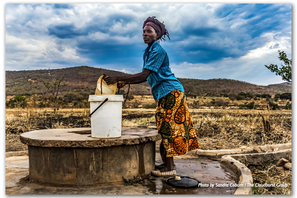
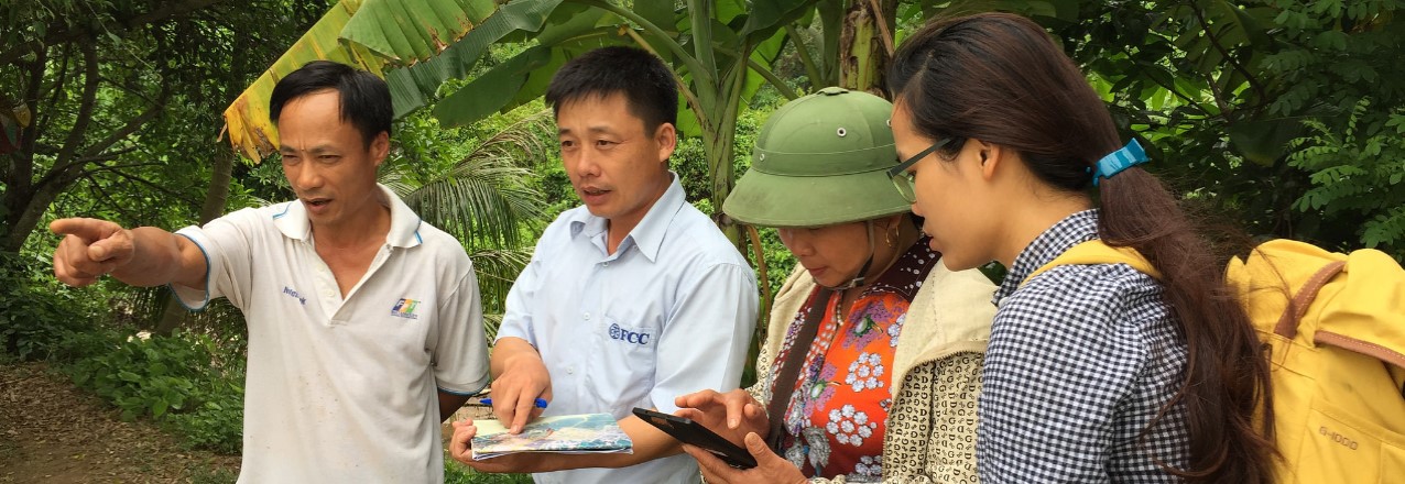
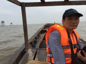
Tao Van Dang has served as the activity manager for the Participatory Coastal Spatial Planning and Mangrove Governance project in Vietnam since 2015. With more than 20 years of project management experience, particularly in non-governmental organizations, Dang has overseen mangrove re-forestation and disaster preparedness projects throughout Vietnam.

Tell us about the USAID pilot project, “Our Coast – Our Future.”

I led a team to implement the “Our Coast – Our Future” activity under USAID’s Tenure and Global Climate Change program, which piloted a Participatory Coastal Spatial Planning process (PCSP), including a low-cost participatory spatial mapping for mangrove governance in three coastal communes of the Tien Lang district in Hai Phong municipality in Vietnam from October 2016 to December 2017.

Starting with stakeholder engagement, we introduced the project’s participatory mapping process to a range of stakeholders from local government, political and social organizations and coastal resource use groups. This first step in the process was to share the pilot’s objectives, processes, the current state of mangroves in the area and the planned benefits. From this step, more than 150 people were selected to continue the work on a Participatory Coastal Resource Assessment (PCRA) within the three coastal communes of Vinh Quang, Dong Hung and Tien Hung. The Participatory Coastal Resource Assessments were used to develop coastal profiles on current uses, management of coastal resources and tenure. Next, results of the Participatory Coastal Resource Assessments were combined with the instruction and creation of spatial maps to provide a clear picture of coastal resources uses and governance on the ground.

Through the Participatory Coastal Resource Assessments and mapping activities, we worked with commune members on identifying development goals and determine future coastal resource use, including how strategically placed mangrove plantations can help protect livelihoods and coastlines. Finally, we supported Tien Lang district to finalize their coastal spatial planning report and mangrove co-management report. These reports were shared widely with ministerial agencies and 25 coastal provinces of Vietnam. Thanks to great local-community participation, our team produced a toolkit, which included three guides for Participatory Coastal Spatial Planning, two gender briefs and one lessons learned brief to guide future projects.

Why is this work important?

In Vietnam, mangroves have experienced consistent deforestation pressures since the 1980s because of agriculture development, aquaculture farming and other infrastructure development. However, it is increasingly clear that mangrove forests hold considerable importance within Vietnam’s coastlines because they provide a buffer against intensifying coastal disasters such as typhoons and adapt to rising sea levels. They also provide important sources of livelihoods, including aquaculture, coastal gleaning and fisheries, as well as biodiversity conservation. The negative impacts of mangrove loss such as broken dyke sites, saltwater intrusion and farming failure become clear several years after mangrove deforestation. Therefore, mangrove replanting and conservation has been carried out since the 1980s, but to varying degrees of success. USAID’s “Our Coast – Our Future” pilot project is different because it promotes the design of coastal spatial scenarios to inform participatory, tenure-responsive approaches to coastal spatial planning. The pilot identified ways to improve the management of specific coastal natural resources by examining who has access, use, management and exclusion rights to specific resource areas of the coastal landscape.

What are key achievements/successes from Tenure and Global Climate Change’s work in Vietnam?

In Vietnam, the Tenure and Global Climate Change project developed many realistic best practices, including a toolkit, a refined process on strengthening tenure in coastal communities and a lessons learned report describing pitfalls to the pilot’s work in land tenure. These outputs will be used by the World Bank’s Forest Sector Modernization and Coastal Resilience Enhancement project in nine coastal provinces of Vietnam, scheduled from 2018 to 2022.

What were the key lessons learned?

  • During the stakeholder engagement step, it became clear to our team how “support from key leaders facilitates broader engagement.” This was essential to the project’s success. The Participatory Coastal Spatial Planning process requires substantial and wide-ranging stakeholder engagement, from the provincial to the village level. It showed us how essential it is to have the right representatives involved at each level to ensure participation and eventually, the acceptance of project results at the activity’s completion.
  • Another important lesson learned is how “community participation in mapping and coastal profile development yields robust plans.” The pilot project took steps to ensure that men and women from all coastal-area resource user groups participated at the commune-level workshops and activities. This was achieved by careful facilitation of event location and timing, as well as discussion content, to meet the needs of all the groups the project sought to engage.
  • The project also noted how “gender-targeted engagement leads to inclusive planning” as participatory spatial planning requires engagement from all social groups. Women and men access, use and manage coastal natural resources differently, and therefore, there was not, nor could there be, a one-size-fits-all approach.

Where can I find more information?

Project information and documents on Tenure and Global Climate Change‘s work in Vietnam can be found on the LandLinks project page, here.

Ask the Expert: An Interview with Catherine (Kitty) Courtney, Tenure and Global Climate Change – Marine Tenure

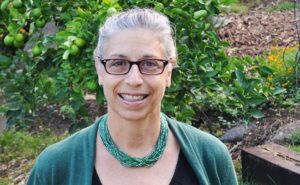
Catherine (Kitty) Courtney has more than 25 years of international and domestic experience in marine and coastal management, climate change adaptation and coastal community resilience.

Courtney has worked for Tetra Tech since 1990 and has supported federal and state agencies, nongovernmental organizations and private companies on projects to design, implement and administer coastal resource management and marine environmental research programs in temperate and tropical ecosystems throughout the Pacific.

What is USAID’s interest in marine tenure and small-scale fisheries (SSF)?

Through its commitment to reducing poverty and empowering communities to manage their own development, USAID is interested in developing a deeper understanding of the role marine tenure plays in supporting sustainable small-scale fisheries. Toward this end, USAID’s Tenure and Global Climate Change (TGCC) program developed a Sourcebook of good practices, emerging themes and entry points for programming in marine tenure. The Sourcebook drew upon the findings of scholarly research, policy documents, development projects and publications by development practitioners, researchers and nongovernmental organizations. In addition, the TGCC program developed a Primer and support tools for USAID staff and partners as a companion document to the Sourcebook. The Primer is designed to integrate consideration of marine tenure explicitly in the design of programs and projects involving small-scale fisheries by providing tools that can be applied at different phases of the programming cycle. The need for, types, and testing of these support tools were informed by stakeholder consultations and field visits in Bangladesh, Indonesia and the Philippines.

Why is this work important?

Largely invisible in development programming, small-scale fisheries contribute to a diverse array of development activities including economic development, biodiversity conservation, food security, and poverty alleviation. Small-scale fishers typically form the food security and economic backbone of coastal communities. Small-scale fishing is typically part of a family livelihood strategy that combines multiple livelihood activities employing different members of the household. Small-scale fishing not only supports subsistence household needs, but also engage in fish production for local and global markets. They are active all along the value chain from pre-harvest, harvest to post-harvest with both men and women undertaking specific tasks. As such, there is a need for development programs to look to the sea to secure marine tenure and sustainable small-scale fisheries.

Tenure and property rights problems can significantly undermine or prevent successful implementation of development programs. Small-scale fishers and coastal communities with secure tenure over a given fishery, fishing ground or territory have a strong interest in acting collectively to manage their resources sustainably. The diversity of community-managed marine tenure institutions in the world reflects the importance of adapting the details of marine tenure governance and resource rights arrangements to suit social, cultural, political, economic and ecological conditions. Although these marine tenure institutions are extremely diverse in terms of membership, governance systems, technology, leadership and geographic scope, understanding how they endure and identifying emerging threats provides lessons on how they can be strengthened in the face of new challenges such as climate change and globalization. As such, this work helps shine a spotlight on the need for explicitly integrating marine tenure in development programming.

What are key achievements/successes from this TGCC activity?

A key achievement of the work was the articulation of a theory of change for supporting sustainable small-scale fisheries that begins with secure marine tenure rights for resource users, supported by effective co-management arrangements and embedded in an ecosystem based management approach. This theory of change encapsulates key themes in the Voluntary Guidelines on Securing Sustainable Small-scale Fisheries in the Context of Food Security and Poverty Alleviation (SSF Guidelines; FAO 2015).

One of the support tools in the Primer is designed to help USAID staff and partners take stock of the status of implementation of the Securing Sustainable Small-scale Fisheries Guidelines and identify gaps and recommendations that can be addressed through program and project design. Though USAID staff and partners were aware of the SSF Guidelines, few had reviewed or applied them to take stock of the foundation needed to support sustainable small-scale fisheries in their own programs or projects. The development and field testing of an assessment framework based on the SSF Guidelines increased awareness for the need for a holistic approach to securing sustainable small-scale fisheries that includes marine tenure as a key element.

What were the key lessons learned by TGCC, particularly those that can be applied to other activities?

  • Sustainable small-scale fisheries can support multiple development objectives. USAID has a long history supporting an array of coastal and fisheries management projects to support biodiversity conservation objectives. The development context for sustainable small-scale fisheries, however, is much broader than biodiversity conservation. Development partners should seek innovative ways to diversify and align investment portfolios to support the enabling conditions for securing sustainable small-scale fisheries. This work identified opportunities for supporting a range of programs by focusing on the role marine tenure and small-scale fisheries can play in achieving multiple development objectives.
  • Responsible governance of tenure in small-scale fisheries needs to be considered explicitly in program and project design. Responsible governance of tenure involves respecting the rights of small-scale fishers and fishing communities to the resources that form the basis of their social and cultural well-being, their livelihoods and their sustainable development. National legal and policy frameworks, administrative and judicial systems, effective co-management arrangements, dispute resolution mechanisms, local participation and empowerment, and strengthened institutional capacity are all key ingredients of responsible governance of marine tenure. A more explicit approach would seek to (a) define and secure the full bundle of tenure rights, including exclusion, withdrawal/access, management, enforcement and alienation rights; (b) identify and build the capacity of national and local tenure governance bodies to secure these rights; and (c) invest in the generation of social-ecological system knowledge to better characterize the complexities through supporting baseline assessments and monitoring. The integration of marine tenure in situation models and theories of change will strengthen development programming in rural coastal areas.
  • Marine tenure systems need to be supported by effective co-management arrangements and embedded in an ecosystem approach to management. There are many social, economic and environmental drivers of change that are beyond the capacity for small-scale fishers and coastal communities to address. For marine tenure systems to be resilient under changing conditions, they need to be embedded within effective co-management arrangements with government and other partners who maintain a demonstrated capacity to recognize and support the community’s resource use rights. As such, if macro-scale drivers of change and ecosystem-scale pressures beyond the control of local resource users and communities, such as population growth and urbanization in the coastal environment, overfishing from competing large-scale fishers, habitat degradation from land-based pollution and land reclamation and climate change are identified and addressed at multiple scales of governance for multiple sectors, then community-scale marine tenure institutions will have the capacity to support a range of broader development goals including economic growth, food security and resilience.

Where can I find more information?

Project information and documents on TGCC marine tenure and mangrove management work can be found on Land-Links.org here

Ask the Expert: An Interview with Matt Sommerville, Tenure and Global Climate Change – Global

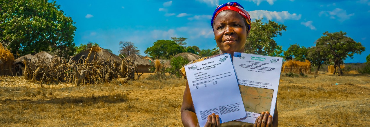
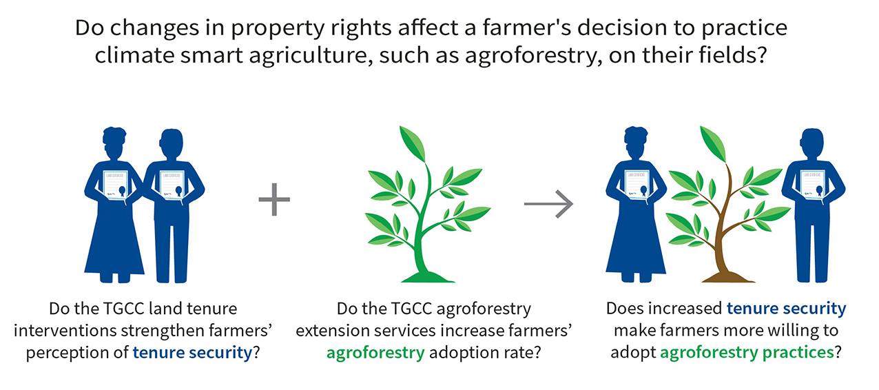
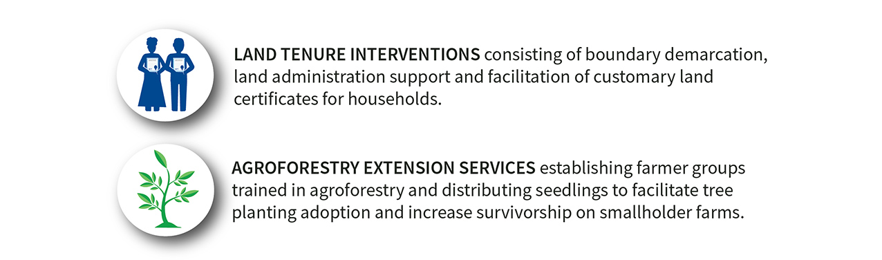
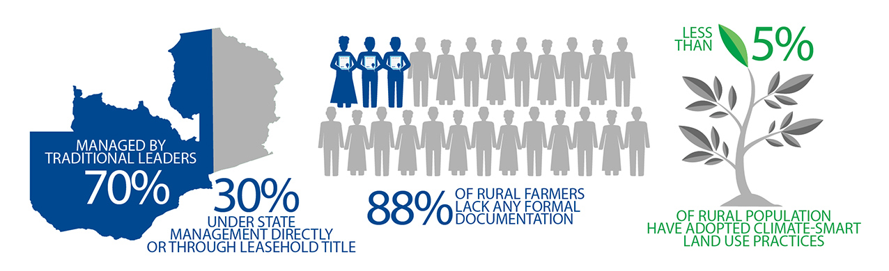
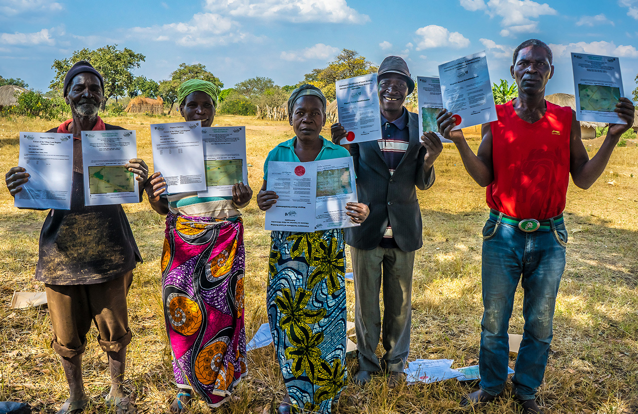
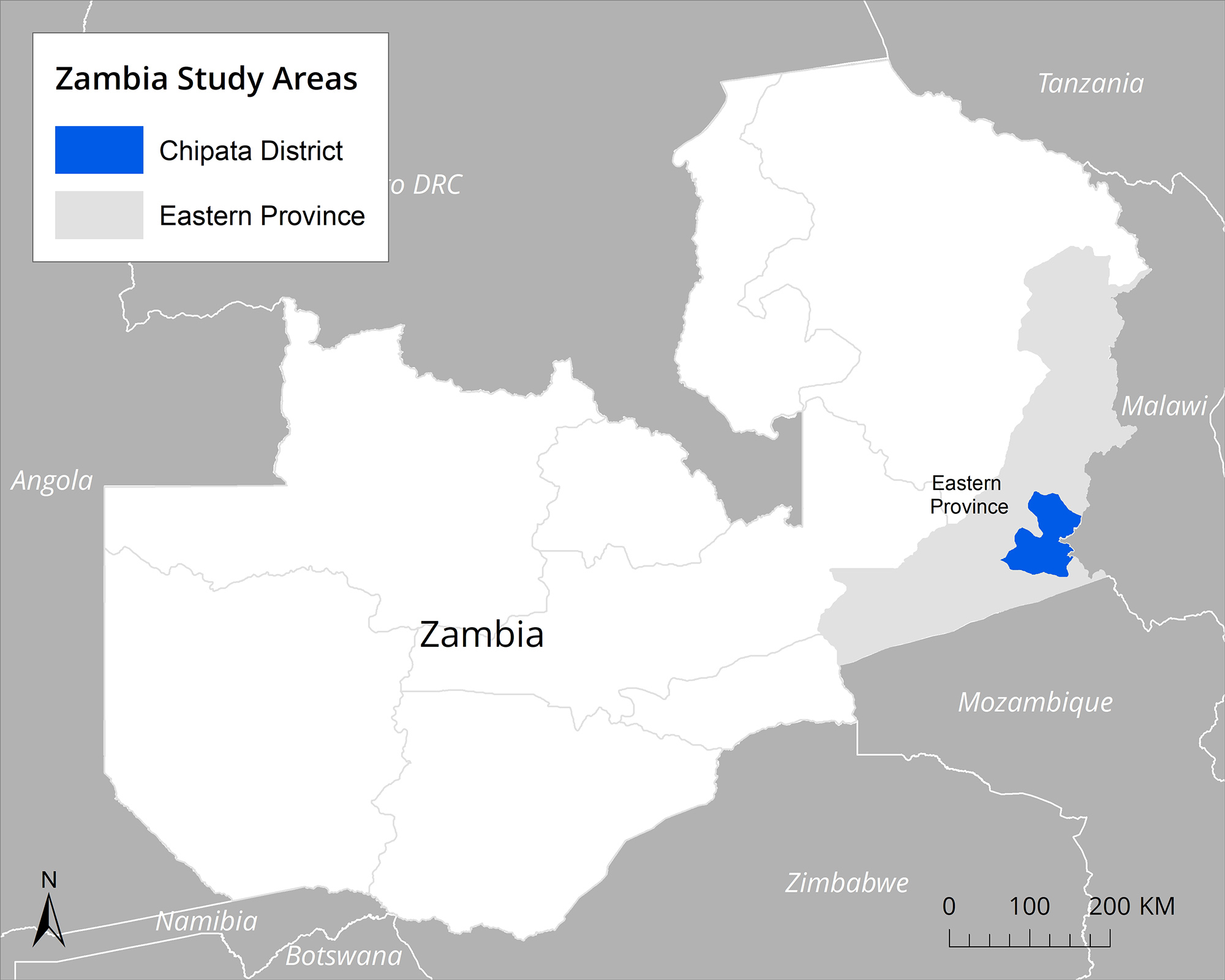
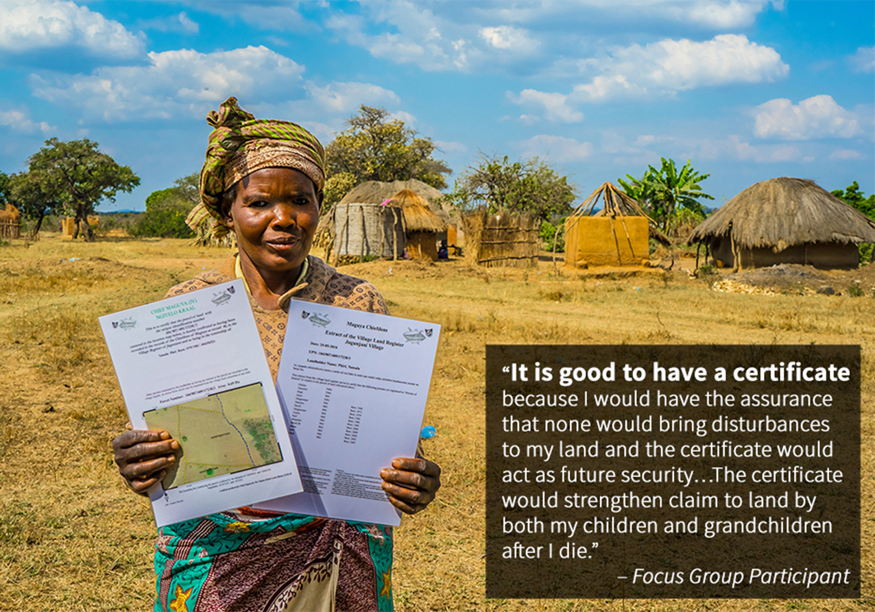
Dr. Matt Sommerville is the chief of party of the USAID Tenure and Global Climate Change (TGCC) program, which has implemented research and pilot activities to improve sustainable land management through strengthening land and resource rights. The program was active in Zambia, Burma, Vietnam, Ghana and Paraguay. From 2014 to 2017, Sommerville was based in Zambia, backstopping a customary land certification process that resulted in the documentation of over 15,000 parcels of land across five chiefdoms in Zambia’s Eastern Province.

Tell us about the Tenure and Global Climate Change project in Zambia.

USAID began supporting customary land documentation in Zambia to test a simple question: Does the documentation of land rights influence farmers’ decision to adopt sustainable farming practices? The intervention was designed as a randomized control trial impact evaluation, and includes almost three hundred villages that were split between four treatment groups: one that participated in a land-tenure-strengthening intervention, a second that participated in an agroforestry intervention, a third that participated in both land tenure and agroforestry interventions and a control group.

As TGCC began to work with local chiefs, it became apparent that there was national interest across Zambia, from chiefs, civil society, and the Ministry of Lands, in low-cost, mobile technology-based, robust processes to document the land rights of Zambia’s millions of landholders. With the Urban and Regional Planning Act of 2015 and the Forest Act of 2015, new opportunities emerged for coordination between state and customary leaders on land use planning and resource management. Based on this, USAID began supporting civil society partners to undertake land documentation at scale. In addition, we also worked across interest groups to build communication and transparency between chiefs, communities and government ministries to improve land and resource management.

Why is this work important?

Zambia has historically been a large land area / low population country and land has been perceived as abundant. However, since liberalizing land markets in the mid-1990s, demand for land has skyrocketed, both from large-scale investments, as well as from middle and upper-class Zambians looking to access small farms in Zambia’s rural customary land.

Zambia’s centralized land record system is incomplete on government administered leasehold land, and is non-existent in the majority of the country under customary management. Incomplete records alongside limited transparency or communication between customary and state systems has created conflicts, disadvantaged women who lack documentation of their rights, reduced economic investment from the private sector, and robbed government of tax revenue.

Customary land documentation and increased transparency between the state and customary systems and presents a solution to the above challenges. With more complete land records and tax systems, the Ministry of Lands can contribute to the national Treasury. With the clarity of land allocations and existing customary rights on land, communities and district councils will be able to undertake land use planning, particularly in peri-urban customary areas, which will subsequently inform private investors, and reduce risks of conflicts related to their developments.

What are key achievements/successes from TGCC’s work in Zambia?

TGCC has contributed significantly to opening up communication among government, civil society, donors, chiefs and communities on land issues, and created opportunities to find common objectives. Through this process, TGCC has supported over thirty consultations across the country on Zambia’s draft land policy, which has evolved significantly over the past three years as a result and is expected to be sent to Cabinet in 2018.

TGCC’s support to the Petauke and Chipata District Land Alliances, local civil society organizations, has demonstrated the ability of civil society organizations to play an active role in delivering land-administration services, acting as an honest broker between chiefs, communities and the district government. Through this work, the two district land alliances have mapped over 15,000 land parcels and documented individuals with ownership and other interest rights in that land. Nearly half of the parcels have a female landholder associated with the parcel, representing equal rights of ownership over the land.

Zambia’s government accepted these customary land parcels into the same national spatial data infrastructure that houses state land. For the first time, this allows the general public to see customary and state land allocations together.

Based on business as usual, the task of documenting the land rights across of Zambia’s land surface would take over 1,000 years. USAID’s participatory process and mobile tools developed under TGCC could bring this work down to under a decade. However, the costs would be substantial. To address this, TGCC has helped coordinate donor engagement with government and among each other to leverage investments in the land sector, and develop tools that can be cost-effectively replicated by government.

With respect to the impact evaluation goals of the program (testing how stronger property rights affect a farmer’s decision to practice climate-smart agriculture, including agroforestry), evaluators found success in each intervention. In terms of strengthening tenure security and increasing investment in agroforestry practices, however, the interactions among the two are more ambiguous. TGCC found some evidence that households with secure land rights invested more in some sustainable land-use practices and that women with secure land rights were marginally more engaged in agroforestry adoption. Indeed many factors go into the decision to adopt sustainable land use practices. However, it is clear that land tenure impacts take time to be felt.

What were the key lessons learned?

  • The process of carrying out customary land documentation can be as important or more important than the document itself, because it can help farmers identify and resolve their long-standing disputes, and involves jointly walking boundaries.
  • Inter-ministerial coordination is essential to resolving land and resource governance disputes as no single ministry has complete authority over land and resources in an area.
  • While mobile tools can support data collection and data entry, they do not replace the need for paper receipts and reference maps in the field.
  • The social dimensions of building understanding of customary land certification processes and goals, and the use of local civil society partners for implementation is essential to build trust and partnerships from local communities.

Where can I find more information?

The Tenure and Global Climate Change program in Zambia developed an abundance of resources including:

  • Films documenting the work on:
    • aligning land-tenure activities with traditional land governance (forthcoming)
    • women’s empowerment (forthcoming)
    • the strength of partnerships (forthcoming)
    • how land tenure helps promote better farming techniques (forthcoming)

These resources and more information about the TGCC program in Zambia can be found at Land-Links.org here.

Ask the Expert: An Interview with Yaw Adarkwah Antwi, Tenure and Global Climate Change – Ghana

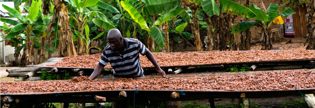
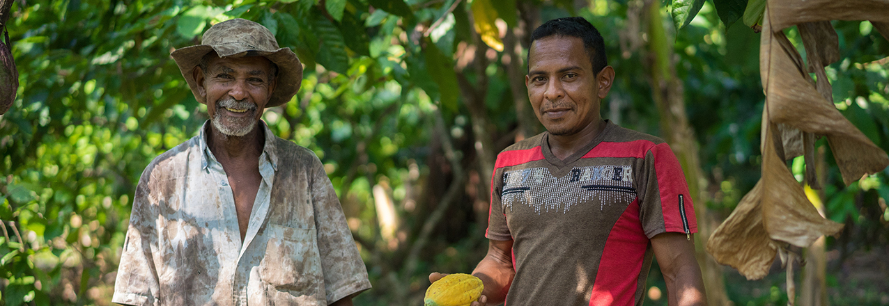
Yaw Adarkwah Antwi has more than 20 years of experience in land tenure and administration policies and holds a Ph.D. in Sub-Saharan Africa Urban Land Markets and an M.A. in Property Valuation and Law. Antwi has helped to develop land policies, particularly on the topics of land tenure, land management and agricultural development, in Liberia, Ghana, Nigeria, Sierra Leone and, within the COMESA region, Kenya and Sudan. Antwi is currently the country lead and senior land tenure expert on the Improving Tenure Security to Support Sustainable Cocoa project funded jointly by USAID and Hershey’s.

Tell us about the Tenure and Global Climate Change Project in Ghana.

Starting in 2016, Hershey’s and AgroEcom Ghana Ltd (ECOM), a supplier of cocoa to Hershey’s, began collaborating with USAID’s Tenure and Global Climate Change (TGCC) Program to gain a better understanding of how to address the complex challenge of deforestation around smallholder cocoa farming in Ghana. This initial work resulted in an assessment and recommendations for a future pilot, captured in the report Land and Natural Resource Governance and Tenure for Enabling Sustainable Cocoa Cultivation in Ghana. Over the period from February to December 2017, a pilot in Nyame Nnae, a cocoa farming community in the Asankrangwa district of Ghana, was initiated to clarify and document rights to land and trees, and to develop a financial model for cocoa rehabilitation. Through this pilot, we sought to encourage tree planting on existing cocoa farms to reduce pressure on the forest fringe.

Why is this work important?

Worldwide, forests are being lost at an alarming rate driven by the expansion of internationally traded commodities. In response, companies have begun to remove deforestation from their supply chains, catalyzing the creation of the Tropical Forest Alliance 2020—a global public-private partnership aimed at reducing commodity induced deforestation. In Ghana, cocoa produced by smallholders has been the leading agricultural product driving deforestation for many years. Cocoa is a critically important commodity because it provides significant economic benefits that include jobs, improved livelihoods and social welfare, expanded tax base, higher family and corporate income and foreign exchange earnings growth. Cocoa production has been on the decline due to land and tree tenure insecurity, an elderly cocoa farming population, over-aged cocoa trees, high costs of cocoa tree removal, high incidence of pest and diseases and poor farm management practices.

In 2016, Ghana’s Cocoa Board announced plans to more than double cocoa output to 1.6 million tons by 2026. Ghana’s Intended Nationally Determined Contribution to the Paris Agreement on Climate Change specifically includes a 45 percent reduction of greenhouse gas emissions from the cocoa landscape. These two objectives require a new approach to sustainable cocoa production that controls forest cutting, builds back secondary growth forests on fallow cocoa lands, and increases cocoa productivity. Expansion of shaded cocoa systems would help Ghana achieve its greenhouse emission and cocoa production targets, improve the livelihood and resiliency of Ghana’s cocoa farmers and increase the sustainability of the global cocoa value chain, thereby benefiting global producers and consumers.

What are key achievements/successes from TGCC’s Ghana work?

We began field implementation of the pilot in April 2017 and concluded in December 2017 and achieved the following outcomes:

  • Mapped the boundaries of the community and individual cocoa farms, and clarified and documented rights between 190 landholders and farmers in Nyame Nnae community including 120 (63 percent) males and 70 (37 percent) females.
  • Working with migrant and indigenous farmers, documented three types of customary land tenure arrangements and negotiated agreements that reinforce the rights of farmers in seeking landowners’ consent to replant cocoa trees.
  • Successfully tested alternative dispute resolution systems of Asankrangwa Stool to reduce conflict and strengthen application of local systems for future documentation efforts.
  • Working with ECOM staff, developed a financial model for cocoa rehabilitation that shows it is possible to pay-back rehabilitation costs in three years while boosting farmer income and food security.
  • Developed and successfully piloted a model of public-private partnership between USAID, Hershey’s, and ECOM that leveraged 1:1 private sector investment with field implementation costs along with other support that included office space, vehicles, planning assistance and provision of extension personnel.
  • Provided training to community, traditional authorities and ECOM extension staff that proved effective and are transferable to future cocoa rehabilitation efforts.
  • Developed and piloted a comprehensive model of land rights documentation, alternative dispute resolution, finance, community and traditional authority engagement and cocoa rehabilitation for purposes of further refinement, replication and scaling up.
  • Assisted ECOM to successfully include tenure as a variable in their supply management and monitoring system.

What were the key lessons learned by TGCC, particularly those that can be applied to other activities?

  • The project successfully demonstrated that a public-private partnership linking tenure documentation, alternative dispute resolution, community engagement and financial modelling with cocoa rehabilitation was feasible. Upon completion, farmers were happy that the process protected rights of both indigenous landholders and migrant farmers including men, women, and youth. Traditional authorities from Asankrangwa district appealed for expanded participation of farmers to create peace in the community and for partners to replicate and scale up cocoa rehabilitation efforts. They further offered their leadership to advocate and support future projects with traditional authorities in other areas.
  • The process of building tree tenure security, which takes into account deforestation, cocoa productivity, environmental quality and farmer livelihoods, can take many years. Trees and cocoa systems need maturation before many of the pilot outcomes can be realized. An evolving policy and high costs of tree tenure documentation were seen as unsustainable, requiring more strategies to lower costs and address perverse incentives that lead to loss of tree cover.
  • The project studied how public goods and services (seedling supply, extension services, land administration and dispute resolution) can be covered given cocoa value chain constraints and tight government budgets, particularly as these costs are beyond private sector expertise and support. The project noted the necessity for dialogue and cooperation between the private and public sectors to develop strategies for lowering costs and designing innovations that promote sustainable cocoa cultivation. This cooperation can help improve the livelihoods of Ghana’s cocoa farmers, improve the profitability of the chocolate industry, provide consumers worldwide with high quality chocolate sourced from Ghana and use forest resources sustainably.

Where can I find more information on the project?

More information can be found on this TGCC project in Ghana here: