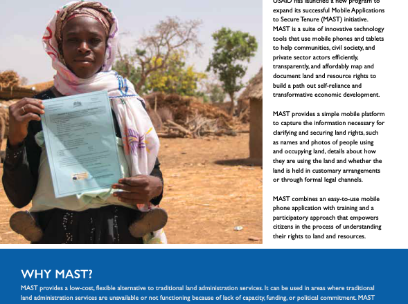
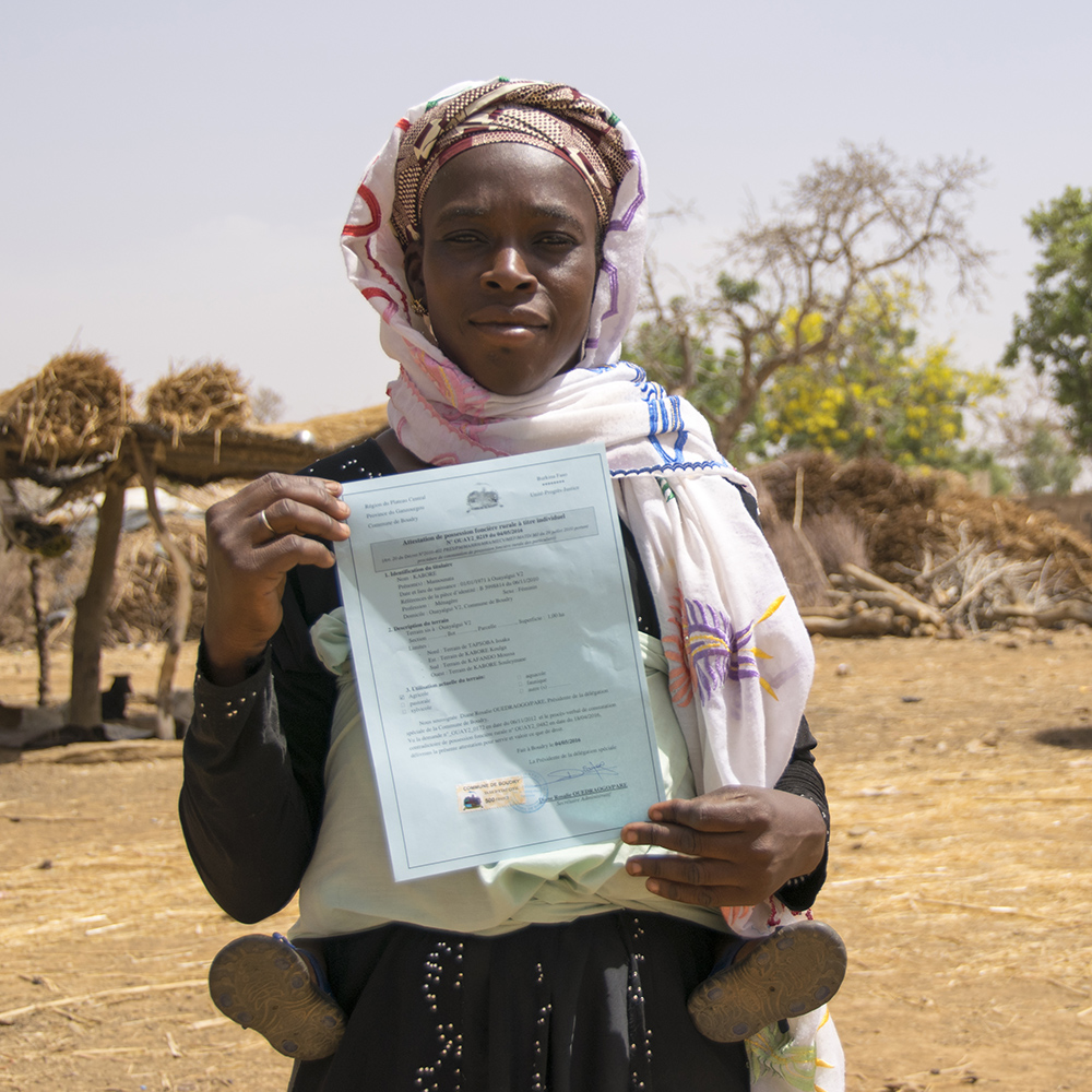
 USAID has launched a new program to expand its successful Mobile Applications to Secure Tenure (MAST) initiative. MAST is a suite of innovative technology tools that use mobile phones and tablets to help communities, civil society, and private sector actors efficiently, transparently, and affordably map and document land and resource rights to build a path out self-reliance and transformative economic development.
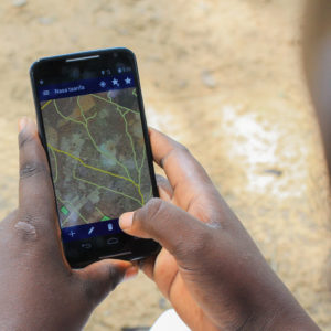
MAST provides a simple mobile platform to capture the information necessary for clarifying and securing land rights, such as names and photos of people using and occupying land, details about how they are using the land and whether the land is held in customary arrangements or through formal legal channels.
MAST combines an easy-to-use mobile phone application with training and a participatory approach that empowers citizens in the process of understanding their rights to land and resources.
WHY LAND MATTERS
 Hundreds of millions of people around the world lack documented land rights. Lack of documentation weakens farmers’ and communities’ hold over their most important asset – land – disincentivizing critical long-term investments that improve harvests and lives.
Strengthening land tenure and property rights is critical for:
- Promoting stability by preventing and mitigating conflict over land and resources
- Creating incentives to improve agricultural productivity, reducing hunger and poverty
- Promoting gender equality and enabling women’s economic empowerment
- Promoting resilience and a path to self-reliance
- Creating incentives to manage natural resources efficiently and sustainably
- Improving governance
 Due to the cross-cutting nature of land and resource rights, MAST can be used in a variety of programming contexts:
- Feed the Future
- Democracy and Rule of Law
- Gender Equality and Women’s Economic Empowerment
- Conflict Mitigation and Management
- Economic Growth
- Environment, Biodiversity, and Natural Resource Management
HOW TO ACCESS MAST
USAID’s E3/Land and Urban Office has launched a new program, Land Technology Solutions (LTS), that is designed to refine MAST and support its expansion into new countries. LTS is an integrated knowledge transfer, capacity building, and technical assistance program that helps eligible countries rapidly deploy a customized version of MAST either as a stand-alone pilot project or an integrated activity supporting an existing program.
SERVICES OFFERED BY LTS
- Technical assistance in designing specialized land mapping or registration pilots or activities;
- Assistance in supporting the creation of a country-specific, customized version of MAST that is adapted to local needs;
- Training and capacity building at the national, regional and local levels; and
- Ongoing technical assistance and evidence-based monitoring and evaluation support for sustaining interventions or for future scaling by host countries.
MORE INFORMATION
For more information on accessing LTS Services, please contact Ioana Bouvier, USAID E3 Senior Geospatial Analyst or LandMatters@USAID.gov