USAID Improves its Innovative Technology to Strengthen Land Tenure: MAST

USAID’s Land Technology Solutions Project (LTS) has recently completed a comprehensive update to Mobile Applications to Secure Tenure (MAST) which uses innovative technology, including GPS enabled phones and tablets, to efficiently and effectively document land rights. Countries, communities and companies interested in meeting their commitments to establish deforestation-free value chains, boost agricultural productivity, quickly inventory land and document holdings or clarify and document land uses can now harness a much-improved suite of tools to expedite their work.

LTS now provides a suite of integrated support services to USAID Missions to promote and scale the use of MAST worldwide. LTS services focus on meeting the needs and interests of USAID Missions and their implementing partners to achieve host country strategic development objectives, including those outlined in the Global Food Security Strategy, the USAID Gender Equality and Women’s Empowerment Policy, and the USAID Biodiversity Policy. The tool is yet another example of how USAID works as a catalyst to help others, including civil society, corporate partners and other governments, expedite their efforts to achieve development goals and create a durable path out of poverty.

What is MAST?

USAID’s MAST is a suite of innovative technology tools paired with inclusive training and approaches that use mobile phones and tablets to efficiently, transparently and affordably map and document land and resource rights. MAST can help people and communities define, record and register local land boundaries and important information, such as the names and photographs of people who use the land and information about how they use it. MAST combines an easy-to-use mobile phone application with a participatory approach that empowers citizens in the process of understanding, mapping and registering their own rights and resources.

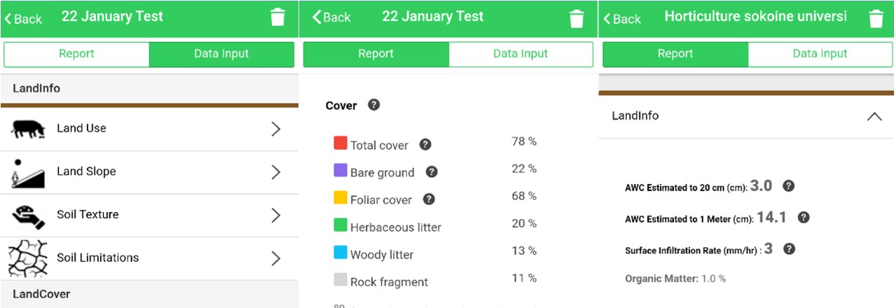
The MAST application provides a suite of tools to support the collection and management of land rights information, including a mobile application to capture land rights information in the field and a back-end land rights data management application with tools to manage an inventory of land information. MAST Mobile is an Android mobile application.

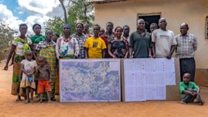
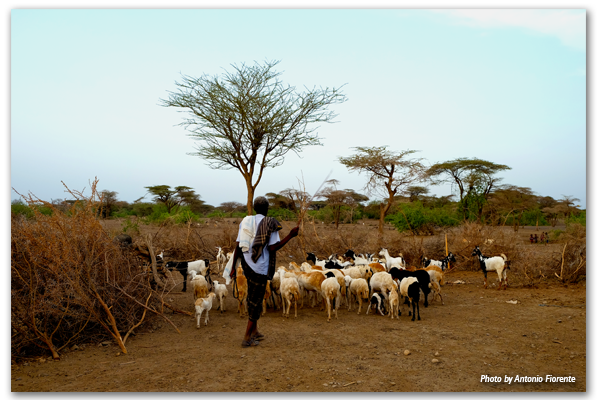
Since 2014, MAST has been used by stakeholders in Tanzania, Zambia and Burkina Faso, to clarify and document claims to land. In these countries, MAST has provided transparent and effective mechanisms to improve land governance, build institutional capacities, engage citizens and help them understand their rights and responsibilities.

Enhanced Technology

Over the last eight months, LTS has refined and improved MAST technologies and approaches. LTS has updated key components of the MAST software application framework and upgraded the MAST data model from Social Tenure Domain Model (STDM) to more common standard Land Administration Domain Model (LADM). With an updated Data Model, MAST is now more compatible with models used in larger, more formal land administration or registration systems.

Enhanced Land Record Management

A more robust land registration module has been integrated into MAST based on feedback and lessons learned in Tanzania and Burkina Faso. In these countries, users identified the need for a land registration module. This has been integrated and configured to manage a series of prototypical subsequent land registration transactions such as transfers, sales, leases and mortgages. The modular nature of its integration into MAST provides enhanced functionality, and an important base for country-specific customization, but doesn’t reduce its flexibility and responsiveness for community mapping.

Improving Efficiencies and Eliminating Errors

To improve data capture of individual land holdings, a tasking and data collection manager has been implemented in MAST. The tasking manager does away with the need to manually assign work areas to surveyors and uses integrated geospatial tools. Integrated tools allow users to define and assign work allocation units to surveyors to increase efficiencies and avoid capture of redundant data. To further address issues associated with online data management and mapping tools on slow and unstable internet connections, a QGIS plugin has been modified to be used with MAST. Integrating QGIS tools allows administrators the ability to download geospatial data, utilize QGIS to edit data in offline mode and to sync data back to the main MAST database. Such editing functions have been augmented by the integration of topology tools that can be used to flag and check errors.

Extending Tools for Resource Management

The MAST mobile application has also been updated. The parcel mapping tool has been extended to incorporate tool sets derived from USAID’s Land Tenure Assistance program in Tanzania, which extended MAST to include more robust data editing functions and to document new, existing and/or disputed claims to land. MAST mobile has also been linked via Bluetooth connection to several consumer-grade GPS tools to improve accuracy of mapping available on native mobile devices. Most importantly, MAST Mobile has recently been extended to include a resource mapping module. The resource mapping module uses a hybrid land classification system to collect resource information such as point of interest, road networks, forest areas or water bodies to enrich the base data in MAST and the availability of data to communities.

Continued Deployments, Continued Refinements

These improvements to MAST will enable users to capture and process land and resource rights more efficiently, although MAST still requires technical knowledge and advanced skills to set up and configure.

As the suite of tools is used in other geographies and for new purposes, LTS will incorporate new features and/or improve existing ones. And as an open source project, MAST will be continually improved upon and updated. LTS will maintain a core MAST platform and incorporate the best of these improvements.

LTS will continue to work across organizational boundaries to make MAST a truly global tool, and an empowering experience, to address land tenure insecurity.

Chengue Dances

A 2016 land restitution sentence brought little solace, but when government agencies began delivering on orders, despair turned to joy and inspired a party in this forgotten village.

Originally appeared on Exposure.

For the last seventeen years, residents of Chengue have found few reasons to dance. They fled their small village in the heart of the tropical hill country of northern Colombia after living through a bloody massacre perpetrated by a group of paramilitaries in 2001. That day, 60 uniformed killers ended the lives of 27 villagers with hammers, rocks, and machetes, and burned down dozens of houses. They told the survivors to never return, because from that point forward.

FIESTAS PATRONALES

In 2017, hundreds of Chengueros proved their attackers wrong and organized the first fiestas patronales in more than 20 years. On the same plaza where their fathers, brothers, uncles, and cousins were killed, residents danced to the local rhythms of porro and gaita music. The historic festivities—held in the first week of July—were colorful scenes of people dancing, women stirring pots of sancocho (turkey soup), poker-faced elders playing cards and drinking beer, excited children flipping marbles on the roads, and agile horseback riders on display.

The fiesta was the latest attempt by Chengue families to show one another that their former lives are not gone—rather, those two-day bacchanals that once made Chengue famous are back with the same pomp and pageantry of days past.

Chengue is located in the region known as Montes de María, where, following the demobilization of Colombia’s brutal paramilitary groups in 2008, the government began the slow process of land restitution and reparations for victims. A decade after the massacre, the government created the Land Restitution Unit (LRU), which has set out to recognize the land rights of victims, provide reparations, and allow victims to return to their homes and their lives. More than 10,000 people who survived the violence and were forced to leave their homes have since processed land restitution claims with the LRU.

By the time the LRU was created, the more than 300 Chengueros had nearly lost all hope for any justice related to the massacre, a tragedy that, in their eyes, seemed tethered to a corrupt and bureaucratic system. In 2006, a local judge determined that the police and the Colombian armed forces did not do their job to prevent the attack, awarding a settlement of more than US$1 million. Eventually, approximately 100 surviving families were paid around US$10,000 each, a paltry sum compared to the amount the court originally awarded. Then In 2008, the man who had ordered the massacre, Juancho Dique, was sentenced to just eight years in prison as part of the government’s paramilitary demobilization program; He was released in 2015.


Announcing the Release of LandPKS 3.0

The Land Potential-Knowledge System (LandPKS; landpotential.org) team is happy to announce that we have released a new and improved version of the LandPKS app.  This new version is a result of months of hard work for everyone on our team, as well as helpful feedback from our users around the world.  The LandPKS app helps users make more sustainable land management decisions by assisting users to collect geo-located data about their soils, vegetation and site characteristics; and returning back to users useful results and information about their site.  It also provides free cloud storage and sharing, which means that you and others can access your data from any computer from our Data Portal at portal.landpotential.org.  The LandPKS app does not require a data connection to be used, and users can upload their data when they next have connectivity. The LandPKS app includes two modules: LandInfo and LandCover.  The LandInfo module walks a user through how to determine the texture of their soil, which is critical information for smallholder farmers and can help them plant crops suitable to their soil type.  The LandCover module walks a user through how to collect vegetation cover data, important for vegetation monitoring and ecosystem restoration. The LandPKS app Version 3.0 is free and available now on the Google Play Store and iTunes Store.

What’s New?

  • Updated and improved user interface
  • Easy navigation between data input and report (results) screens
  • Graphical LandCover results including cover trends over time
  • Graphical LandInfo results with a table of texture and rock fragment volume by depth
  • Available Water Holding Capacity and Infiltration calculations for your soil
  • Upload data to the Data Portal at any time by hitting the “Synchronize Now?” button

Other Improved Features Include:

  • A simple, primarily graphics-based interface that minimizes language and literacy requirements
  • Embedded tutorials and explanations to guide the user through the app
  • Offline data collection
  • Unlimited access to stored data via our Data Portal at http://portal.landpotential.org

Learn more about the LandPKS app on the landpotential.org website.  Training resources, including guides and online trainings, are also available on the website. The LandPKS app was developed by the LandPKS Team for the Land-Potential Knowledge System (LandPKs) with support from USAID and USDA-ARS.   Please contact us at contact@landpotential.org with any questions, comments or feedback.

Land Front and Center in Colombia

Leveraging institutional strengthening to improve Colombia’s land governance and rural development capacity.

The history of land rights in Colombia is a centuries-old tale of colonialism, highly concentrated land ownership and unsuccessful agrarian reforms. Fifty years of civil strife have left vast sections of the country’s land undocumented, vulnerable to land record manipulation and outright lawlessness. Under the landmark peace agreement, the Government of Colombia has committed to addressing the land issues that have so often been at the heart of the nation’s conflicts – by formalizing property rights across the country, organizing the national registry and recovering lands that belong to the state.

In a warehouse on the outskirts of the capital, the nation’s property registry authority—the Superintendence of Notary and Registry (SNR)—stores over 80,000 paper-based property ledgers, some dating as far back as the 18th century. In 2015, the Constitutional Court ordered the government to restore, transcribe, digitize and conserve the records, seeking to modernize the disorganized and unreliable land administration system that had persisted for generations.

In addition to organizing the historical documents, the court ordered the SNR to determine how much land had been acquired irregularly (without formal documentation) and continued to be held unofficially. A year-long investigation showed that at least 30 percent of the nation’s territory—some 5 million hectares of land—was acquired irregularly.

“The state had no idea,” explains Clara María Sanín, a land expert working with the SNR. “Colombia’s history has been characterized by a government incapable of protecting its territory, a centralized administration that allowed faraway, rural regions to do what they want with land ownership.”

Now, in the post-conflict era, the national government has pushed rural land reform to the forefront of national dialogue by creating a new land administration authority, the National Land Agency. The agency is mandated to begin an ambitious land formalization campaign—in response to the fact that six out of every ten parcels in Colombia are informally owned—and coordinate rural development strategies with its sister agencies: the National Development Agency and the Agency for Territorial Renovation.

As the three agencies maneuver in unprecedented ways to ensure that sustainable investments reflect an integrated development approach, USAID, through its Land and Rural Development Program, plays a key role as facilitator. On its surface, USAID’s program acts as a conduit between national, regional and municipal administrations, improving intergovernmental coordination and making it easier for sub-national government agencies to mobilize domestic resources to address land issues and rural development. At a deeper level, the program is fostering critical public policy and governance changes that are improving Colombia’s land regulatory framework.


USAID and IUCN Partner to Advance Gender in the Environment

Noting World Water Day and reflecting on International Women’s Day movements and Women’s History Month in a number of countries, USAID and IUCN examine their partnership on Advancing Gender in the Environment (AGENT), which aims to improve development outcomes by strengthening environmental programing through gender integration and achieving gender equality outcomes.

Originally published on IUCN’s blog.

Around the world, women play a critical role as natural resource managers –often tilling land and conserving biodiversity while managing household food and energy needs. This close relationship with the environment also means that women face higher risks and suffer disproportionate burdens from environmental impacts and degradation. This is due also in large part to entrenched socio-cultural biases, such as women and girls being primarily responsible for the majority of unpaid care work like cooking and water collection.

These considerations emphasize that gender equality and women’s empowerment–particularly when it comes to ensuring that women and men have equal opportunities in accessing, benefiting from and participating in environmental decision-making–are essential for effective conservation and sustainable development.

A few weeks ago, marking International Women’s Day, IUCN’s Director General made a strong statement on the importance of women in conservation and sustainable development. Today, we are joining advocates from around the world to also mark Women’s History Month and noting the importance of women on World Water Day. We’ve recently expanded our USAID-International Union for the Conservation of Nature (IUCN) partnership into a broader program that enhances environmental programming in a wide range of sectors through the robust integration of gender-responsive approaches and actions throughout USAID programs focused on biodiversity, energy, land rights, urbanization and forestry, among others.

Through Advancing Gender in the Environment (AGENT), USAID Transforms communities by ensuring that environmental programs advance a more sustainable and equitable future for all by recognizing women as agents of change; valuing the diverse knowledge, experiences and capacities of women and men alike; and working to bridge gender gaps.

Over the last year, USAID and IUCN conducted research, and created knowledge products and tools, on the status of women and relevance of gender issues across the environmental sector. When studying national energy policies and frameworks, we found that less than a third of 192 frameworks from 137 countries identified issues that have gender dimensions–i.e. some policies note that women suffer from energy poverty disproportionately–and/or included objectives and strategies that have gender considerations. Furthermore, when women are mentioned, they are often characterized as potential stakeholders or beneficiaries and seldom as innovators or leaders in solutions.

AGENT is underscored by the knowledge that gender equality and women’s empowerment are powerful levers for change: women are vital to conservation and resilience-building efforts and contribute valuable perspectives. For example, in Malawi, when local communities were asked what trees they would like to have planted, men were the majority of respondents, and they requested trees that provide non-renewable sources of income like timber and charcoal. However, when efforts were made to ensure women were surveyed, they asked for fruit-bearing and medicinal trees that provide added nutrition, health benefits and income–all without cutting down trees, thereby helping ensure the success of reforestation objectives.

We know from these kinds of experiences that gender equality and women’s empowerment are intrinsically linked to achieving sustainable development. Yet, as highlighted, critical gender inequalities and gaps persist that limit the ability of women to access markets, capital, training and technologies.

Women also do not have the same rights as men when it comes to customary or legal rights to land, property and resources. This reduces their access to critical means for survival and resilience. Data demonstrate a solemn reality on this issue; women do not have the same legal rights as men to own and access land in over 100 countries. Also, in 90% of 143 economies studied have at least one law restricting women’s economic equality.

Women are often underrepresented or restricted from participating in environmental decision-making and their contributions, innovations and leadership are frequently overlooked. The result is a lost opportunity for environmental initiatives to achieve multiple benefits, scale impacts and increase effectiveness.

Over the next year, AGENT will build new evidence on many important topics, such as why women’s empowerment and participation matters in the power sector, the connections between gender-based violence and the environment, and which gender issues are most prevalent in urban services. Platforms and curated resources are supporting forest and biodiversity programs, and networks of experts will be convened to share best practices and identify new areas of research.

USAID and IUCN are committed to filling critical information gaps on gender and environment, and will work to ensure that strategies and approaches for environmental sustainability are more effective and benefit all people. We are equipping our projects, programs and partners with data, analysis and tools. By doing this, we are working to ensure USAID Transforms by advancing a sustainable future — one that delivers gender equality and women’s empowerment outcomes.

Read the original article on IUCN’s blog.

7 Ways USAID is Strengthening Land Rights

In dozens of countries, we’re addressing a wide range of issues, including conflict minerals, women’s rights and policy reform

Around the world, millions of people, communities and businesses lack secure rights to one of their most important economic assets — land.

Up to 70 percent of land in developing countries is unregistered and, in many countries, the systems that govern land access and property rights are weak or ineffective. For women, who generally have less access, control and ownership of land than men, this insecurity impacts them disproportionately.

Weak property rights and poor land management represent fundamental barriers to our top priority at USAID — advancing free and prosperous societies that progress beyond the need for foreign assistance. Also, given the role it plays as a source of wealth and power, land is often at the center of violent conflicts.

The evidence is clear that strong property rights are an essential foundation for economic growth and responsive democratic governance. And from Colombia to Kosovo, experience has shown that resolving land disputes and clarifying property rights can help reduce tension, create lasting stability and set the stage for productive investments and economic growth.

So, what is USAID doing to advance land rights around the world? The answer is — a lot!

We are working in dozens of countries to address a wide range of land and property rights issues — from conflict minerals to women’s rights to policy reform. Here are seven examples of some of USAID’s most promising and effective programs from across the world:

Land surveyors document property boundaries in Meta, Colombia with the support of USAID. / Jeremy Green, USAID

1. Formalizing property rights in post-conflict Colombia

Land issues were at the heart of Colombia’s long-running violent conflict, displacing an estimated 6 million people and leaving large portions of the country essentially ungoverned. Now, with a landmark peace agreement in place, USAID is working to help resolve critical land issues by supporting the Government of Colombia to formalize property rights across the country, organize the national land registry and return land to those who lost it in the civil war.

A woman in Tajikistan proudly displays the crops growing on her land. / Sandra Coburn, The Cloudburst Group

2. Enabling a land market to take root in Tajikistan

Transitioning from Soviet-style collective farms to property rights for individual farmers and a fully functioning land market are essential steps for unlocking Tajikistan’s economic growth potential and setting the country on a path to greater self-reliance. USAID is supporting land policy reforms and capacity building programs that are enabling a nascent land market, in which individual land use rights can be bought and sold, to take root.

A Tanzanian youth proudly displays USAID’s Mobile Application to Secure Tenure, a simple smartphone-based mapping tool for documenting land rights. / Freddy Feruzi for USAID

3. Documenting land rights in Tanzania with a mobile app

In rural Tanzania, USAID is using an inexpensive mobile phone-based mapping app to document land rights. Traditional land surveying equipment and processes can be very expensive and time consuming. To map and document all of the unregistered areas in rural Sub-Saharan Africa using traditional methods would take decades and cost billions. USAID’s low-cost solution has produced remarkable results — 15,000 land certificates issued to date, many to women who had been locked out of land ownership in the traditional system.

A pastoralist points to his herd of animals in Afar, Ethiopia. / Antonio Fiorente for USAID

4. Reducing tensions between farmers, herders in Ethiopia

Disputes over land access and grazing rights have long been a source of conflict between farmers and herders in Ethiopia. Since 2014, USAID has been working with pastoral herding communities to certify their rights to rangelands, building on successful previous work certifying farmers’ land use rights. Clarifying and documenting the rights of each group is helping reduce tensions and create incentives for investments and economic growth.

In Liberia, as in much of the world, women have less access and control of land than men. / Ben Ewing, The Cloudburst Group

5. Ensuring Liberian women’s land rights

Even when countries enshrine protections for women’s land rights in national laws and policies, traditions and customs can block women from actually exercising their rights. That’s why USAID is working with Government of Liberia and community leaders to address the complex mix of social and institutional barriers to women’s land rights that persist despite the country’s progress on legal reforms. This nuanced approach is working to change behavior on the ground, not just amend laws on the books.

Artisanal miners sifting for diamonds from a deposit outside of Bobi, Côte d’Ivoire. / Moustafa Cheaiteli for USAID

6. Reducing conflict over minerals

Competition over scarce minerals like diamonds and gold has driven destabilizing conflicts in countries like Cote d’Ivoire, the Central African Republic and the Democratic Republic of the Congo, with property rights struggles often at the core of these disputes. USAID is working in these three countries to reduce conflict over minerals, including by clarifying property rights and access to subsurface resources for small-scale miners.

A community in Zambia’s Eastern Province proudly displays the maps resulting from USAID-supported community participatory mapping efforts. / Sandra Coburn, The Cloudburst Group

7. Using participatory community mapping

When it comes to land rights, sometimes the best solutions come from the ground up. In Burma, Ghana, Paraguay, Vietnam and Zambia, USAID is using bottom-up participatory community mapping to directly engage land users who have traditionally been overlooked. This will help empower land users themselves with the tools and understanding to better control and manage their own resources.

Read the full piece on Medium.

Full Rights for All: USAID Works with the Government of Liberia and its Partners to Address Gender Dimensions in Land Governance

Addressing gender disparities in the context of land reforms is not easy. Effectively addressing gender issues takes time and effort, which can sometimes make it more expensive in the initial stages of a project or program. However, evidence shows that integrating gender throughout land reform interventions not only increases benefits for women, but strengthens the intervention overall. Meaningfully including gender into land reform approaches often requires a change in behavior among decision-makers and program participants that, in some cases, may take years, even decades. In the meantime, land reforms can sometimes move faster than changes in gender stereotypes that impede women’s land rights. If land reform efforts and the donors that support them do not urgently and specifically focus on the inclusion of gender issues, these reforms may solidify and perpetuate land rights inequities for women and girls.

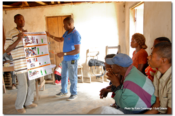
In Liberia, the community organizers for USAID’s Land Governance Support Activity (LGSA) program on community self-governance understand this. In a packed meeting room in LGSA’s office in January 2018, women and men community organizers engaged in an interactive gender and women’s land rights training, sharing stories, challenges and approaches to addressing gender discrimination in customary land governance. The discussions grew lively as participants tackled difficult issues and challenged their own beliefs around gender and land rights. In the midst of a discussion on whether special efforts should be made to secure women’s rights to land, one woman organizer coined the phrase “full rights for all,” which the group enthusiastically agreed should be the goal of all community-level efforts to implement Liberia’s 2013 Land Rights Policy.

Achieving full rights for all requires a deep understanding of the status quo, including who does and does not have rights within both formal and customary systems. To fully understand this context, LGSA and its partners recently completed report on Women’s Land Rights in Liberia. The report draws on past and recent USAID-led research on customary norms, as well as legal analysis, including statutes related to land, family matters, succession, immigration, and Supreme Court case law related to land and gender. In addition, the report incorporates 2017 field research, conducted in three counties by a joint team from LGSA, Landesa, the Female Lawyers Association of Liberia, and the Women’s NGO Secretariat of Liberia. Key findings from the study include:

  1. Women’s access, use, and control of land differ from, and are less secure than, those of men. Rural women depend on accessing and using community land for their housing, livelihood, and welfare, but face discrimination and barriers not experienced by men. This makes their land and property rights insecure, particularly in customary settings. Most women access land through their male relatives, and do not approach chiefs directly for land. Women’s use of land is often temporary and limited to planting seasonal crops.
  2. Laws and practices around marriage reinforce land-related gender biases. The laws governing women’s land rights are inconsistent, do not achieve their intended purpose of treating all “wives” equally, do not treat men and women equally, only cover privately owned land, and do not cover all relationships where land rights matters arise. Civil marriages are rare, customary marriages are on the decline, and marriage informality is increasing. Women in de facto unions do not have recognized rights upon separation or abandonment, even when they have contributed to the family property and its maintenance.
  3. The law regulating inheritance contains critical gaps. Liberia’s laws on inheritance vary for civil and customary marriages, and the latter appears only to apply to private land, which excludes much of the land held within customary marriages. In much of the interior, inheritance of land is customarily reserved for men. In practice, women in customary land tenure systems are not entitled to their husband’s land; if the husband dies, the wife is expected to re-marry a member from his family and to transfer family property to him.
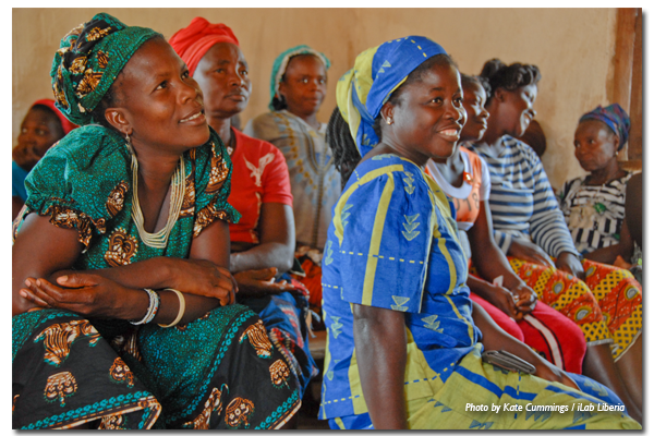
  4. Women’s participation in land governance is low, and in certain cases absent, in both statutory and customary governance systems. Women are disadvantaged in both statutory and customary land governance systems due to underrepresentation, customary norms requiring male accompaniment, lack of consultation and information, low recognition of women’s legal rights to land and inheritance, and the dual system of land governance, both of which contain biases against women.
  5. Access to justice and dispute resolution systems for land are largely biased against women. While the formal court system is out of reach for most rural women as compared to men – requiring language skills, education, money, travel time and access to lawyers that most lack – customary justice institutions, run almost exclusively by men, often reflect customary biases against women and fail to deliver gender-equitable outcomes.
  6. Women in concession areas face unique, gender-specific challenges to land rights. In all the three counties researched, the women affected by concessions mentioned that they were faced with scarcity of food and could not gather herbs to treat the ill members of their families. The concessions drastically disrupted women’s lives through destruction of farmlands, pollution of drinking water, and restrictions from accessing the forests which, among others, provided food, medicinal herbs, and crops for the market.

While more research must be done to inform gender-equitable implementation of Liberia’s Land Rights Policy, the LGSA report on Women’s Land Rights in Liberia is part of a growing movement among donors, civil society, and the Liberian Land Authority to seriously consider gender disparities in the land reform process and their impact on sustainable development. Like the LGSA community organizers, people representing a range of institutions in Liberia increasingly realize that moving forward toward community land governance without a gender-responsive plan in place would compromise the end goal of the reforms, including gains in productivity, and food security.

As Liberians chart a path forward toward gender-equitable and responsive land governance, USAID will support the shared vision of socially inclusive land reform that could become a model for other countries and contexts. The Women’s Land Rights Study represents an important milestone in this regard.

Learn more about USAID’s work on land rights in Liberia.

Formally Recognizing Pastoral Community Land Rights in Ethiopia

For hundreds of years, pastoralists in Ethiopia’s lowlands have relied on strong customary land tenure systems to survive. Historically, legislation has failed to clearly define communal rights to rangelands, and the specific roles and responsibilities for both communities and local government to administer and manage these resources. This legislative deficiency prevented pastoral communities from fully exercising their constitutional rights to land (Ethiopia’s Constitution broadly recognizes pastoral communities’ right to access land and prevents their involuntary displacement). Past legislation also created an institutional vacuum in which government officials no longer consulted community leaders on decisions to convert pastoral rangelands to plantation-style irrigated agriculture. Restricting access to pastoral land has devastated livelihoods by severely curtailing access to dry season pastures, depleting wet season pastures and degrading rangeland resources leading to bush encroachment and shrinking livestock herds.

USAID’s Land Administration to Nurture Development (LAND) project has been working with the Ethiopian government to certify pastoral communal land use rights, negotiating a resolution to a long-held impasse between government and pastoral communities. In 2014, the project began collaborating with Ethiopian government officials in the Oromia regional state to pilot methodologies that would formally recognize communal pastoral landholdings.

LAND started by reviewing international experience in protecting pastoral land rights in 11 countries, including eight in Africa. The project also studied customary organization and management of rangelands by pastoral groups in Oromia and the successful methods developed to date. The project also determined that strengthening pastoral land rights required legislation that recognized and defined rights to communal rangeland held and used by a group of pastoralists.

The ideal legislation had to allow for a legal entity to hold group title to such landholding on behalf of a community, specify procedures to map the boundaries of the landholding, and define the different responsibilities of local government and communities to manage the land and its natural resources. The hardest obstacle to developing this legislation was obtaining agreement between government officials and the pastoral communities over the size of the communal pastoral landholding to be registered and certified.

The pastoralists in the Guji and Borana pilot areas wanted their customary dheedas (traditional grazing areas) to be the unit of landholding to be certified and registered. But dheedas can cover hundreds of thousands of hectares and straddle multiple administrative boundaries. Oromia officials were reluctant to certify a landholding this massive in the name of a single community. Further, they argued that the dheeda had to be subdivided per administrative boundaries to be more effectively administered and managed by local land administration officials. The pastoral communities steadfastly argued that the government must recognize their constitutional rights to land based on customary possession and certify the uncontested boundaries of their landholdings, as was done previously in the highland regions.

LAND facilitated learning workshops and negotiations between the parties to resolve the impasse. It provided government with evidence-based research demonstrating that administrative boundaries do not accommodate access to seasonal pastures and the mobility necessary for viable livestock production. After nearly three years of negotiations, Oromia officials accepted the communities’ arguments and developed, with assistance from LAND, legislation providing the legal basis to register and certify community landholdings and enable customary institutions to function as Community Land Governance Entities (CLGEs) that will hold title to communal land, manage rangeland resources and represent the community in dealings with third parties, including the government and the private sector.

In November 2017, LAND assisted three communities to establish their land governance entities in compliance with the legislation. LAND trained community members on their roles and responsibilities under the legislation, and on the procedures to demarcate and register the boundaries of their dheeda landholdings. LAND will further support the governance entities through training to help them establish more transparent and accountable governance practices, and build skills in financial management and negotiations with government agencies and third parties.

USAID’s assistance to Oromia regional state to produce legislation that strengthens land rights of pastoral communities and build government capacity to implement the legislation will enable the federal Ethiopian government to replicate and scale up these interventions nationally to help secure pastoral land rights, prevent rangeland degradation, improve productivity of rangeland resources and increase economic opportunities for Ethiopia’s 12 million pastoralists.

The Malbe dheeda customary leader, Mr. Dima Doyo summed it up well, “The Borana community’s grazing system and its customary institutional leaders have been neglected by the formal administration, and this negligence has caused numerous rangeland problems. The recent recognition of our governance system has already empowered us to take some important measures and manage our rangeland resources in a better way.”

This blog post is made possible by the support of the American People through the United States Agency for International Development (USAID). The contents of this blog post are the sole responsibility of Tetra Tech and do not necessarily reflect the views of USAID or the United States Government.

The Interface between Surface and Sub-Surface Rights in the Artisanal Mining Sector in West and Central Africa

The artisanal mining sector in West and Central Africa is a rapidly expanding economic force employing millions of young people, often those who are the most vulnerable. Numerous ancillary informal economies are associated with the export of what are commonly known as “conflict minerals” such as diamonds, gold and coltan. Women grow crops and process food for the labor force of young men digging deep into the ground to pull out the ore and precious metals and stones. Shopkeepers and other merchants sell tools and supplies to the communities built up around the rich yet dispersed mineral resources of the regions. Complex flows of capital and credit reach the most remote parts of the continent to pre-finance the extraction and sale of conflict minerals. Few recognize the importance of property rights in these flourishing economies.

Two USAID activities – the Property Rights and Artisanal Diamond Development Project II (PRADD II) project, which works in Côte d’Ivoire and the Central African Republic, and the Capacity Building for Responsible Minerals Trade (CBRMT) project, which works in the Democratic Republic of the Congo – know that securing rights and access to subsurface minerals is critical to sustainable resource management and transparency. Based on years of experience, PRADD II and CBRMT developed and refined approaches and techniques to help governments formalize land ownership to two asset classes – the bundle of surface rights (land, trees, water, etc.) and the sub-surface rights often viewed by the state as its exclusive domain. The formalization process is complex because there is often a disconnect between national law and the reality on the ground. Even though land policy and laws may transfer ownership of land to the state itself, and then to mining companies through concessions, rural populations often contend that customary tenure arrangements still prevail and that both surface and sub-surface resources belong to them.

There’s no easy way out of this conundrum, but the PRADD II and CBRMT experiences show that both the state and customary authorities must be brought into the process of resource tenure formalization. This is particularly true for post-conflict countries, where the authority and legitimacy of customary authorities over these resources often supersedes the power of the state. In post-conflict environments the state is commonly weak and is unable and/or unwilling to clarify and formalize the institutions and rules governing access to mineral resources, in part because these resources are often illegitimately funding the purchase of weapons and ammunition (by special interests that hold considerable power and authority over government itself).

Imagine the case faced by many villagers in West and Central Africa. Farm families have invested significant labor in clearing the land, planting crops and harvesting. Most of the work is done by women. One day, a wife notices that a stranger is digging a deep and narrow pit along the shores of a stream passing through her rice fields. When she asks, “Why are you digging this deep hole,” the stranger replies, “I am exploring for diamonds and gold. I have received the authorization of the chief to prospect and this seems to be a good site.” Several weeks later, to her surprise, a large team of young men is digging a deep pit into her fields. “Why are you here?” she asks. “Your husband has given us authorization to dig for diamonds in this place because the prospector found signs of diamonds.” When the wife confronts her husband about the trampling of her fields by the diamond digger, he replies, “Don’t worry, I have negotiated with the chief and the head of the work team that we will receive one third of all diamonds found in this place. We’ll be rich, your trampled fields are no loss.”

As is often the case, once diamonds are found in an area, hundreds of people invade the area to try their luck. If the site is indeed productive, it becomes well known throughout the country. Outside investors are sometimes attracted to the area to try their luck as well. At this point, the diamond diggers might be surprised when an agent of a foreign owned company arrives one day to say, “I have a government issued permit in my hand. I own the concession under this land, and this site is now mine. You are to leave immediately.” The diamond diggers refuse, and go to the local authorities to complain. The regional representative of the Ministry of Mines might throw up his hands, “Well, you know, the law states that all sub-surface mining rights belong to the state, so you really are illegally mining the land and you have no rights. The concession permit is valid so you must depart immediately or we will bring in the police to evict you.” Deeply disappointed, the villagers return home to plan how to respond to the threat of expropriation. And so, the tensions grow. The outcome is uncertain.

Formalizing supply chains for artisanal minerals, including through the formalization of rights and access to subsurface resources, is an important step to establishing responsible supply chains. USAID, through PRADD II and CBRMT, is a pioneer in assisting governments and the private sector in this complex endeavor. However, these USAID projects reveal that this approach can lead to the exclusion of some actors (including the state), particularly those who have long benefited from an opaque tenurial status and the associated lack of clearly recognized and secured rights. When customary authorities are inadvertently excluded, they mount surprisingly effective forms of protest and resistance. Angry villagers have sabotaged diamond mining companies in the Central African Republic because operators failed to respect areas set aside for artisanal mining. Similarly, village diamond miners in Côte d’Ivoire brought a diamond mining company to its knees by threatening to destroy buildings and equipment unless the concessionaire’s permits were opened up to artisanal mining. This type of proactive resistance is an increasingly common sign of the growing power of organized West and Central African rural populations to defend their perceived rights to customarily-owned lands.

A valuable lesson from PRADD II and CBRMT is the understanding that more attention should be focused on how to manage conflicts over who controls and manages rights of access to both surface and sub-surface natural resources. Training in conflict management cannot be directed solely to government officials; such capacity building initiatives must also include powerful traditional authorities, artisanal miners, civil society and actors within the private sector.

Tajikistan’s Path to Prosperity Depends on Creating an Accessible, Equitable Market for Land

Tajikistan is on the cusp of achieving its vision of a fully-functional market that allows land-use rights to be bought and sold. The transition from a post-Soviet system of regulation and control to market-based principles represents the culmination of over a decade of donor-supported commitment and effort to unlock significant economic growth potential in Tajikistan and support the country’s transition away from donor assistance.

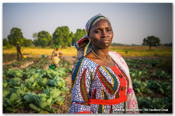
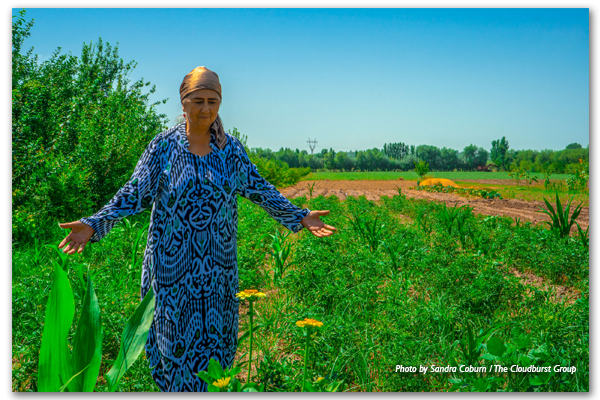
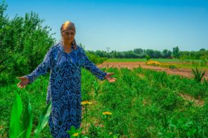
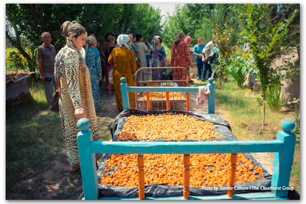
Tajikistan’s arable land is limited, covering just seven percent of its territory. Without a land market, land cannot easily be transferred from less to more efficient types of use, hindering efforts to alleviate the country’s significant rural poverty and food security challenges. Tajikistan’s robust agricultural sector accounts for 57 percent of employment and nearly a quarter of the national GDP. The emergence of a land market is critical to spurring equitable economic growth, and empowering entrepreneurial farmers to either expand their land holdings or lease them.

These new opportunities are particularly relevant to Tajik women, who make up around two thirds of Tajikistan’s agricultural workforce. After the fall of the Soviet Union, Tajik men left the country in droves in search of better economic opportunities abroad, leaving behind female family members to care for the farms. Donor support, led by USAID, has consistently prioritized the establishment of a legal framework for protecting land holdings, and helping women to overcome adversity as they exercise their land use rights.

Informing to Empower

Land in Tajikistan is owned by the government, with individuals holding rights to use the land. Following independence from the Soviet Union in 1991, the country’s agriculture sector was dominated by large-scale collective farms, which were gradually reorganized into dehkan farms — smaller farms held by an individual family or group of shareholders who willingly joined their land together. With the support of the USAID-funded Land Reform and Farm Restructuring Project (LRFRP), the 2016 Law on Dehkan Farms clearly defines dehkan farms as legal entities and provides better protection of legal rights of farmers that will support the emergence of a market in land use rights.

While donor efforts have helped make new legislation gender-equitable, Tajik women face barriers in taking advantage of their new rights. In some cases, it’s because they lack access to information about the new rights they have, or how to exercise them. In other cases, it is the result of cultural norms which lead local authorities to block attempts by women to register their farms.

To overcome these barriers, USAID-supported projects borrowed from the land reform experience of Tajikistan’s neighbor, the Kyrgyz Republic, by establishing a network of local volunteer experts: tashabbuskors. Modeled on the Kyrgyz demilgechi network, tashabbuskors serve as local land reform experts with whom farmers can consult on a variety of issues, such as disputes with neighbors and settling alleged tax debt. When an issue requires legal support, tashabbuskors can guide the farmer to a local Legal Aid Center to receive professional legal support. Through the Legal Aid Centers and tashabbuskor network, both LRFRP and the ongoing Feed the Future Tajikistan Land Market Development Activity (LMDA) help women and men understand and defend their land rights as land users under the emerging land use market.

Documenting Property Rights

In Tajikistan, ownership of land use rights is documented through certificates issued by the State Unitary Enterprise for the Registration of Immovable Property (SUERIP). However, complicated documentation requirements and unclear procedures have historically frustrated efforts by Tajik women to register property rights. In addition, as SUERIP offices are predominantly staffed by men, cultural norms will cause some women to send a male relative to register land they own. Without their name on the certificate, women are unable to exercise their rights as a landholder.

The tashabbuskor network helps women register their land by providing information and building confidence in how to file their paperwork. Moreover, the Feed the Future Tajikistan Land Market Development Activity is working with SUERIP to hire and train more female registrars, helping create an environment more suited for the agency’s clientele, as well as supporting efforts to improve registration office procedures to save time and cost.

The Emerging Market

By the end of 2016, following the passage of the new Law on Dehkan Farms, large-scale collective farms made up less than one percent of arable land in Tajikistan, and registered small-holder dehkan farms made up 81 percent. In addition to ensuring the rights of dehkan farms as legally-recognized entities, the law advanced the ability for landholders to leverage land use rights in civil transactions, such as leasing and mortgage. Once final legal instruments are in place, farmers in Tajikistan will be able to transact land use rights. This could include a farmer mortgaging land to provide a mechanism for financing investment, or a farmer having the opportunity to lease or sell the rights to his or her property upon retirement.

The success of the land market depends on a supportive enabling environment and the sustainability of the underlying institutions. The modernization of SUERIP offices and dissemination of information through the tashabbuskor network is only the beginning. The National Association of Independent Appraisers has been established to develop the professional capacity of Tajikistan’s nascent land valuation service providers. The taxation of dehkan farms is under review to ensure fair and equitable taxation of farm activities. A sustainable model of free or low-cost legal aid to farmers whose land use rights are challenged is being developed and implemented. As these initiatives progress and come together, a viable market for land use rights is within reach, advancing Tajikistan further along the path toward greater economic self-reliance and resiliency.