Small-Scale & Artisanal Mining Impacts on Biodiversity in Latin America

Executive Summary 

Artisanal and small-scale mining (ASM) is a global phenomenon that supports tens to hundreds of thousands of workers in many Latin American countries. Although much of the work is difficult, dangerous, and often at the subsistence level, the pay is usually better than the alternatives in many of the rural areas where it occurs and can help support impoverished communities.

The extent of impacts on biodiversity from artisanal and small-scale mining (ASM) depend on the type of mining, the area in which it is occurring, and the location. Some communities have practiced local small-scale hard-rock mining for generations with minor local impacts. Other regions, such as the Madre de Dios in Peru, have experienced widespread devastation of primary tropical forests, with illegal alluvial gold mining serving as the leading cause of deforestation in the region. Although the Madre de Dios region receives the most media attention due to the graphic nature of the destruction, illegal and/or Artisanal and Small-Scale Gold Mining (ASGM) occurs in every department in Peru.

ASGM is also a leading cause of deforestation in highly biodiverse regions of Colombia, where most mining is also informal or illegal. Brazil has the largest ASGM mining area in the world in the Tapajos River basin, which is a tributary to the Amazon (Section 2.3.3). Less of the mining in Brazil is illegal, although conflict with indigenous community lands is increasing and regulatory oversight is often conflicting among agencies. ASM is less well documented and seems to be less pervasive in Central American countries, but still occurs in areas of high biodiversity. Although ASM may be a leading cause of deforestation in the areas where there are significant mining communities in Central and South America, it is dwarfed by forest loss due to agricultural conversion to ranching and farming land. (Section 4, Figure 13).

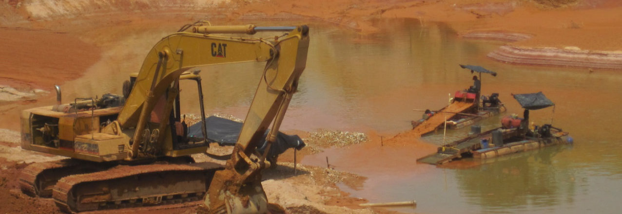
Impacts on biodiversity from ASM range from local destruction or degradation of habitat to watershed-scale impacts from pollution to global lethal and sublethal effects of mercury bioaccumulation (Section 3). Multiple studies and projects have documented the extent of deforestation in the target countries using remote sensing, primarily in South America. Multiple studies in South America document severe water quality impacts from mercury, sedimentation, and acid mine drainage. Massive amounts of sediment are released into waterways from alluvial mining, causing downstream sedimentation, increases in turbidity, and changes in aquatic biota. Several studies showed changes in freshwater fish populations due to sedimentation from mining. Sediment plumes can impact rivers for many miles downstream and may also affect estuaries and coral reefs.

Many global studies and a few studies in Latin America have described impacts of mercury contamination on wildlife (Section 3.5.3). ASGM (artisanal small-scale gold mining) is the leading contributor of mercury to the environment globally, and the effects and extent of mercury contamination have been documented at the local, regional, and global scale. Mercury contamination is widespread in the Amazon basin both from natural sources and from widespread mercury use in ASGM. Methyl mercury, the more biohazardous form, bioaccumulates in the food chain and has been documented at high levels in people and wildlife near mines, in indigenous peoples far from active mining areas in the Amazon basin, and in fish and wildlife as far away as the Arctic, where breeding bird populations may be declining due to elevated mercury deposition. In addition to global transport of mercury, contamination can impact large areas downwind and downstream from mines and processing centers.

Acid mine drainage is typically associated with hard rock mining, where sulfide-bearing rocks are exposed to oxygen and produce sulfuric acid. Heavy metals can also be released when cyanide is used to process gold-bearing ore since it also effectively leaches other metals. Studies along the Puyango-Tumbes river in Ecuador and northern Peru have documented extensive cyanide, mercury, and heavy metal contamination and associated impacts on biodiversity (Section 3.5.2).

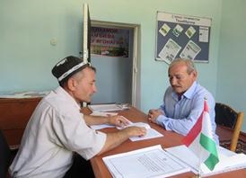
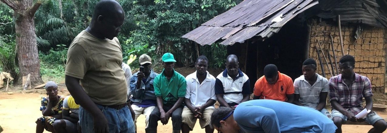
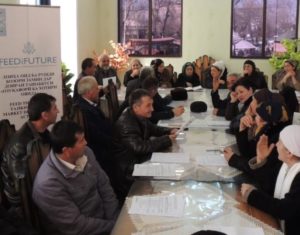
The drivers of ASM depend on local conditions and are a complex mix of poverty, corruption, weak or conflicting regulatory oversight, economic pressures, organized crime, tradition, and lack of access to opportunity and education (Section 1.3.2). Attempts to reduce the impacts from ASM on the environment and on human communities have met with mixed results. Efforts to date have focused on education, formalization, enforcement, remediation, and reduction of mercury use in the case of ASGM. As with the wide array of biodiversity in the target countries, there is a wide diversity of conditions under which ASM is occurring and there appears to be no single approach that is proving most effective to reduce its negative impacts (Section 5).

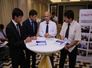
Many organizations are working on aspects of the Minamata Convention, that, while focused on reducing mercury use and consumption, also includes reducing worst-practices, providing education, and formalizing ASGM. It is a global treaty with significant resources for implementation and most Latin American target countries have ratified the agreement, excepting Colombia and Guatemala, who have signed, but not ratified the treaty. A summary of existing treaties, policies, and programs addressing ASM is included in Section 5.


Strengthening Tenure and Resource Rights (STARR) II IDIQ Contract Mechanism Info Sheet

 A GLOBAL IDIQFOR LAND TENURE, PROPERTY RIGHTS, AND RESOURCE GOVERNANCE

The STARR II IDIQ—managed by the E3/Land and Urban Office—is a $650 million, multi-faceted field support mechanism available for field Missions and other USAID Offices and Bureaus to buy in to for activities through July 2025. STARR II is designed to provide short- and long-term technical assistance to improve land tenure, property rights, and resource governance through targeted interventions or integrated activities in support of broader development objectives.

Given the cross-cutting nature of property rights and resource governance issues, Task Orders under STARR II can cover a wide variety of sectors, including: food security, economic growth, conflict mitigation and management, democracy and governance, environment and natural resource management, artisanal and small-scale mining, and key self-reliance issues, such as domestic resource mobilization and women’s economic empowerment. USAID’s Land and Urban Office in the E3 Bureau has a cross-cutting team of lawyers, economists, researchers, geospatial specialists and other technical experts available to assist missions in planning and designing activities under STARR II.

LRFRP Success Story: Legal aid centers protect farmers’ rights to land

Tashabbuskor of jamoat Dehkonobod in Jillikul district Rahmatullo Bobomurodov advices farmer on land use issues.

Bobomurodov Rahmatullo, a primary school teacher, lives in jamoat Dehkonobod of Jillikul district. He has worked as a teacher since 1988 and educated several generations within his village. Over the years, people have come to trust Bobomurodov’s advice, and have turned to him for advice on a variety of different problems, including land issues. As an active participant in his community, Bobomurdov has attended various events, including seminars and trainings implemented by USAID projects operating in Jilikul District. At a seminar organized by public organization “Zanoni Dehot” at the end of 2013, he was elected to become a Tashabbuskor in his jamoat. Since then Bobomurodov has become more familiar with the land reform process, and farmer’s right to land, and he began providing informational consultations for the villagers on land issues and has repeatedly assisted them resolve land disputes.

Recently, a dispute arose between Zavkieva Rajabgul the head of dehkan farm “Farovon” and Ganiev Abdukarim the head of dehkan farm “Boboi Nurmuhammad” about the border of their farms. For nearly a year they argued with each other and could not resolve their dispute and determine their farms’ land boundaries. Because of this dispute, the relationship between the neighbors deteriorated more each day – to the point where other farmers in their village encouraged them to ask Tashabbuskor Bobomurodov Rahmatullo to find a solution to their dispute. After listening to their problem, Bobomurodov was able to get the farmers to agree to a meeting with a specialist from the Land Committee of Jillikul district. The specialist found the archival documents of the land parcels and was able to demonstrate the original boundaries of their farms. As a result, both farmers agreed to reinstate the borders and were thankful to the Bobomurodov who helped them resolve their dispute and bring back peace to the village.

LRFRP Success Story: USAID LRFRP trains young lawyers on land legislation in Tajikistan

University teachers and students examine the textbook “Land Law on Tajikistan” during presentation of the textbook in Dushanbe, June 30, 2016.

USAID Land Reform and Farm Restructuring Project (LRFRP) supports the development of land legislation in Tajikistan. One of the priority areas of the project is to increase capacity of young lawyers.

In partnership with the NGO “Huquq va rushdi jomeai dehot”, LRFRP has implemented the program aimed at improving the ability and skills of practicing lawyers and representatives of local public authorities to provide efficient services on land reform issues.

In cooperation with the Ministry of Education and Science of the Republic of Tajikistan, LRFRP has introduced special courses on land law for students of the Finance and Economics Institute of Tajikistan for two years; and together with NGO “Huquq va rushdi jomeai dehot”, has developed the textbook “Land Law of Tajikistan”. This is the first textbook developed based on Tajik land legislation. Before, all universities were using textbooks based on Russian and Belarus land legislation.

The first edition of the textbook was published in 2015. The textbook was used throughout the courses on land law at the Financial-Economical Institute of Tajikistan on pilot base. On December 30, 2015, the Ministry of Education and Science of the Republic of Tajikistan recommended the textbook be used in all higher educational institutions of the country.

The project republished the textbook “Land Law of Tajikistan”
(1,500 copies in Tajik and 500 copies in Russian languages) and included approved Regulation of the Government of Tajikistan on Establishing Public (Involuntary) Easement and the Law of the Republic of Tajikistan “On Dehkan Farms” based on new land legislation of the RT.

The publication is designed for students, teachers, practicing lawyers, graduate students of law faculties, as well as all land users interested in land law issues.

LGSA Success Story: Community Mapping Through Mobile Technology

SDI works with community members to test mobile technology

Recognizing the importance of community mapping in the proposed Land Rights Act and its general application to land reform in Liberia, the Sustainable Development Institute (SDI) conducted a one day GIS training workshop at the office of the Interim Land Task Force (ILTF) on November 28, 2016. The training was supported by Tetra Tech, under a USAID supported project, the Land Governance Support Activity (LGSA).

Twenty-four people benefited from the training: five community based GIS animators, four staff from ILTF, four staff from Tetra Tech/LGSA, three Monrovia based GIS trainees, two Tenure Facility staff and six SDI field and office staff.

The training was divided into two main sections. 1) concept and applications of the GIS materials and 2) field testing of GIS materials. Participants were given an introduction to GSI with a review of GIS concepts and associated tools, including opportunities and limitation of field applications, especially in rural areas.

Participants were then led through a one hour field testing of these tools. Each trainee had the opportunity to use the available tools to collect data points. Those points were then entered into a GIS. Technical interactions included:

  • A boundary walk through the Sinkor neighborhood;
  • Collection of points of interest;
  • A map with a date base behind it;
  • Virtual representation of the real world and its infrastructure; and
  • Satellite imaginary— looking down from the top.

After the training participants were urged to return to their communities and explain to their community members basic concepts and intent of the training. Community animators relayed to their communities that the training was just the beginning and that LGSA, through SDI, will officially introduce the activity in the field, and test the methodology in the coming months. The results of the pilot community mapping utilizing mobile technology will inform the larger methodology to recognize customary land rights, as identified by the National Land Rights Policy and the Draft Land Rights Bill currently before the Legislature.

LGSA Success Story: Local Journalists Share Best Practices on and Experiences with Reporting on the Liberia Land Sector

Dr. Marquardt and Mr. Burphy of LGSA sit with local journalists from four countries discussing their reportage of the land sector.

The United States Agency for International Development (USAID) funded Liberian Land Governance Support Activity (LGSA), a five-year project that focuses on improving Liberian land rights institutions while bolstering access to land for all Liberians. LGSA hosted an all-day training session in Monrovia for journalists from Monsterrado, Bomi, Grand Cape Mount, and Gbarpolu counties who had previously met in Monrovia for a Liberia Land Authority/UNMIL awareness campaign on the Land Authority and the pending Land Rights Bill.

The local journalists, who had participated in an earlier Interim Land Task Force/LGSA media training program, were asked to share experiences on their coverage of the Liberian land sector. The workshop was moderated by LGSA Communications and Outreach Specialist, Richule O. Burphy who thanked the press for their immense work in reporting on the events and happenings in the land sector.

In his opening remark, LGSA Chief of Party, Dr. Mark Marquardt, emphasized the importance of holding meetings through which journalists can get together and share experiences and learn from one another. “We are relying heavily on the media to provide the public with clear information on what’s happening and going on and provide information on what’s happening and going on and provide information to people as the land reform processes move forward,” relayed Dr. Marquardt.

In sharing his experience, Henry Gboluma, Program Director of Kpo Radio in Gharpolu, as he recounted some of the infamous land disputes in Gbarpolu County, mentioned that “[LGSA’s] training inspired me to do more work on the land sector, and I was able to follow me to do more work on the land sector, and I was able to follow the geographic disputes that affected the voter registration exercise in the Jungle James Mining Camp in Gbarpolu. Because of the quality of my report, it was published on the Local Voices Liberia website.”

Also serving as program Director but for Radio Cape Mount in Senjie, Grand Cape Mount county, Jenneh Kemokai, after participating in a LGSA-supported media training in Tubmanburg, she introduced a one-hour weekly radio program dubbed ‘Our Land Business,’ that is currently on the radio.
During the discussions, participants reached the conclusion, among others, that journalistic collaborations and comings together enable them to reach a wider and more diverse audience while making a strong impact. Participants also saw the need for strong networking among journalists for continued experience sharing, which will be part of LGSA’s continued and future activity programming.

During the discussions, participants reached the conclusion, among others, that journalistic collaborations and comings together enable them to reach a wider and more diverse audience while making a strong impact. Participants also saw the need for strong networking among journalists for continued experience sharing, which will be part of LGSA’s continued and future activity programming.

LGSA Success Story: LGSA and Stakeholders Consult on the Land Rights Bill

After being introduced to provisions in the draft land law, chiefs met in small groups to discuss and come up with recommendations to the lawmakers

The newly established Liberia Land Authority (LLA), through the support of the United States Agency for Development (USAID) funded Land Governance Support Activity (LGSA) held a series of consultative meetings with traditional leaders, civil society organizations and professional bodies to discuss the proposed Land Rights Law currently before the Legislature.

In outlining the objectives of the consultations, Chairman of the LLA, Dr. Cecil T.O. Brandy, laid out for stakeholders the outstanding obstacles challenging the passage of the Land Rights Bill. Particularly contentious were the 1) 99-year grace period before the transfer of customary land and 2) maximum amount of 150 acres of land that can be owned in customary area.

“We want to discuss these issues with you and know your mind and recommendations so that we can forward them to the legislature,” he added. Facilitating the discussions were human rights lawyer, Cllr Tiawan Gongloe; Commissioner Designate, Atty. J. Adams Manobah; and Dr. Brandy.

The meeting in Gbarnga brought together paramount chiefs and other traditional leaders from all 15 countries of Liberia. Bong Country Superintendent, Hon. Selina Mappy, expressed how grateful she was that her country was selected to host such a historic meeting while recognizing the long distances traveled by many participants.

Dr. Brandy further welcomed the stakeholders to what he termed a new institutional framework: moving from the Land Commission to the Interim Land Task Force and now the Land Authority.

At another meeting in Monrovia, consisting of representatives from legal and professional bodies, on January 31, 2017, the President of the Liberia National Bar Association (LNBA), Cllr. G. Moses Paeger, raised concerns over future reviews of existing concession agreements, future new concessions, and the role of communities in the negotiation processes.

Another issue that came to light during these consultations was in reference to the tribal certificates that are not yet deeded and are to be issued by chiefs and elders, many of whom do not know what an acre is or how to measure land in in order to accurately allocate it.

In troubleshooting this issue, stakeholders called on the government to ensure that all tribal certificates are deeded to avoid future conflicts. Land Authority representatives were highly receptive to this and other feedback, which demonstrates the merit of having such consultations.

LGSA Success Story: Enabling Sustainable Peace in Rural River Cess County

Dorbor community members mapping boundary points that were memorialized in a MOU ceremony

In anticipation of the passage of the historic Land Rights Act, which will give communities a mechanism to own land for the first time in Liberia’s history, USAID’s Land Governance Support Activity (LGSA) has been facilitating processes aimed at building the capacity of communities and local governance institutions, so that once the Law is enacted, communities will be able to own their land as seamlessly as possible. In order for communities to gain title, they must agree on their membership and harmonize their boundaries with neighboring communities. LGSA and its partners have been working in communities, throughout Liberia, to prepare them for customary land ownership.

After working with communities in rural River Cess County to self-identify, this quarter, LGSA supported the signing of a memorandum of understanding (MOU) among four clans – Banama, Voor, Garezohn, and Togbayakun – along with the GPS mapping of the clans’ shared community, Dorbor in Fan River District. The MOU signing on boundary demarcation brought together community members, stakeholders, and formal and informal influential leaders, which included the Fan River District Commissioner, Unification Town Chiefs, Paramount and Clan Chiefs, and youth and women group leaders.

The collaborative and participatory process for establishing boundaries left community members feeling empowered and confident in the MOU’s sustainability. As Mary Beh, a resident of Gbalah town, relayed, “I participated in laying down the rock that stands as a cornerstone between [Gbalah town] and the Kru Town… [before LGSA came to Gbalah] we had 14 boundary disputes, but now there is only one; we are working through it.” Ms. Beh extrapolated further to say that the incidence of land disputes and controversy stemming from cross-boundary farming has been greatly reduced, and “after the formalization of the boundary, [her] community has been at peace and there is no longer fear [her] family will fight over the land.”

LMDA Success Story: Association of Independent Appraisers of the Republic of Tajikistan Registered

Mr. Takhir Nabiev shares the aims and objectives of the Association of Independent Appraisers during a press-café on August 17, 2017, Dushanbe. Photo: USAID/Feed the Future Tajikistan Land Market Development Activity

“We gladly agreed to cooperate with LMDA when the project gathered independent appraisers and introduced its intention to develop appraisal activity in Tajikistan,” stated Mr. Takhir Nabiev, a partner of “Aiten Consulting Group” LLC, and one of the founders of the Association of Independent Appraisers of the Republic of Tajikistan.

Providing further explanation, Mr. Nabiev shared: “We have been working in the field of appraisal activity for about five years, but we have not achieved much success in this area yet. It is due to the fact that appraisal activity in Tajikistan is not developed and the demand for appraisal services is not high. We took certain steps to develop our work. For instance, we took efforts to create a union of appraisers to protect and represent our interests; however, due to the lack of knowledge and experience in this area, we did not know how to organize it all. It was also difficult for us to discuss pressing problems with the state regulator.”

With support from the Feed the Future Tajikistan Land Market Development Activity, the first step that independent appraisers took was to create the Association of Independent Appraisers of the Republic of Tajikistan. On August 2, 2017, they registered the new association. The leading audit and consulting companies in Tajikistan that provide appraisal services were the association’s founders: “Aiten Consulting Group” LLC, “BDO Consulting” LLC, “Grant Thornton” LLC, “Kreston AC” LLC, and “Beyker Tilli Tajikistan” LLC.

The association will facilitate the sustainable development of independent appraisal activities in Tajikistan, ensure the protection of its members, train local experts on appraising the market value of land use rights, promote market appraisal of land use rights and appraisal best practices through trainings and roundtables, monitor member compliance with the current legislation and international appraisal standards, and establish cooperation with the international community.

Mr. Nabiev emphasized the critical role of LMDA in increasing the capacity of the association. For example, in September 2017, LMDA organized a study tour to the Kyrgyz Republic and Kazakhstan for association members. Participants were able to gain a clear understanding on best practices in appraisal activity and discussed practical measures to ensure the association’s sustainability. The experience demonstrated the significant role of the Association of Independent Appraisers in furthering the development of appraisal activity in Tajikistan.

LMDA Success Story: Tashabbuskors Establish a Public Organization

Photo: USAID/Feed the Future Tajikistan
Land Market Development Activity

“The Feed the Future Tajikistan Land Market Development Activity recently commenced its activities, and it means that our farmers again have the opportunity to receive project support, obtain necessary information, and protect their land use rights,” says Mr. Rahmatullo Bobomurodov, head of the public organization “Shabakai tashabbuskoron” in the Khatlon region.

Tashabbuskors are local activists in jamoats who provide informational assistance to farmers. Tashabbuskors organize round tables and meetings with local government officials, and refer farmers to Legal Aid Centers to resolve land disputes.

In January 2017, Mr. Bobomurodov and his fellow tashabbuskors held a meeting and decided to continue their work as a formal network. Through the support of the Feed the Future Tajikistan Land Market Development Activity, they established their own public organization called “Shabakai tashabbuskoron,” and registered it with the Department of Justice on March 17, 2017.

The network’s main goal is to organize tashabbuskors’ activities in all jamoats of the 12 districts of the Khatlon region. They conduct information work on land issues in Tajikistan and increase awareness of farmers on their land use rights. Official registration of the tashabbuskors’ network will increase their capacity to independently carry out their work in jamoats.

Currently there are more than 40 tashabbuskors throughout the 12 districts, and the organization is planning to consider new members. The newly established organization will cooperate with the Feed the Future Tajikistan Land Market Development Activity to conduct round tables and meetings with farmers and local government officials, refer farmers to Legal Aid Centers, and continue to provide consultation for farmers and increase their land use rights awareness.

Reflecting on his experience as a tashabbuskor, Mr. Bobomurodov said, “I am proud of having chosen this path. Due to the support of the Feed the Future Tajikistan Land Market Development Activity, I am able to guide dehkans, provide citizens with information on new regulations adopted in the country in a timely manner, and — most importantly — help to solve land-related issues that dehkans face.”