From Landless to Landowner

Violence in Colombia has displaced families towards informal settlements. USAID is helping the government to deliver land titles to these families and respond to their needs.

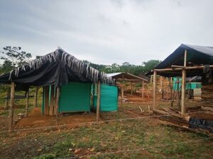
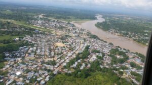
Before 9 de Agosto was a barrio, it was open land on the edge of Tierralta, a town in Colombia’s Caribbean plains. The more than 40 hectares of land belonged to a local power company, and then one night, on August 9th, it became home to 3,000 desperate people. They arrived and never left.

The invasion occurred in 2010, and Jairo Gómez was there. He was one of a multitude of victims and families displaced by the violence that had engulfed their region and pushed them out of their homes. Gómez pounded in wooden posts, hung a tarp and hammock, and braced himself for the inevitable backlash. In less than a week, the police showed up with teargas and violence to evict the families. Gómez stood his ground.


A City of Cambuches

“It was a city of cambuches,” Gómez says, using the local word for shelters made from plastic sheeting.

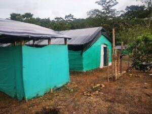
Social leaders emerged, and soon they were laying lines to create the lots for dwellings and future roads. By the end of the first year, 5,000 people lived in 9 de Agosto, which anywhere else was known as the barrio de los desplazados, or displaced people.

That’s how a neighborhood is born in the 21st century Colombia, as shanty towns built with plastic coverings and scrap wood and carved out of open lands along major roads or near towns. The county has grown this way over the last 20 years due to the conflict that has made Colombia home to a population of more than 6 million internally displaced people (IDP)—second only to Syria—and made Colombia the country with the highest number of IDPs and the least number of refugee camps.

In 2017, the local power company traded the land to the municipality, and local leaders set up services like electricity for some of the more than 4,000 parcels. Today, many shacks and tarps have been replaced by cinder blocks and bricks. Those who can afford it, have added zinc sheets to their roofs to protect them from the heavy tropical rains. Others remain the same as they were in 2010, plastic sheeting, wooden planks, and dirt floors, simple cambuches.

Titling the Properties

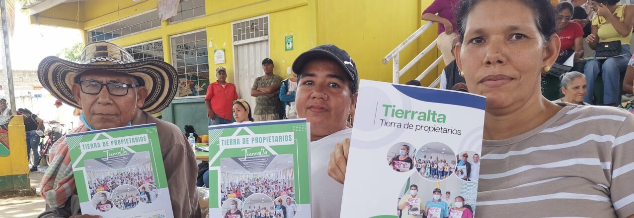
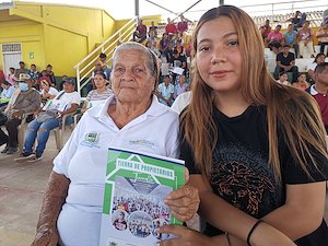
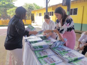
This year, with USAID support Tierralta made a giant step towards incorporating the neighborhood into the town’s masterplan by titling more than 260 parcels. The event featured Mayor Daniel Montero delivering property titles to a packed auditorium, and was significant on several levels. First, as a clear example of the government providing families with a tangible asset that will inevitably lead to improvements in their neighborhood; second, the event represents the single largest delivery of land titles made by a municipal administration in the history of Colombia. “The wait times for government services are slow and you can never get everything done, but today we have fought for something beautiful,” Montero said to the crowd. “A land title will bring you new opportunities and hopefully bring peace, happiness, and hope to your homes.”

Local Land Administration

The Colombian government has struggled to facilitate land planning in areas affected by the conflict or to provide residents with services to legalize the properties of informal settlements like 9 de Agosto.

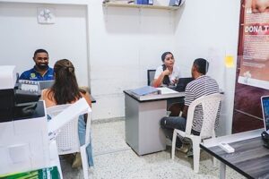
In 2021, USAID helped Tierralta reactivate its Municipal Land Office, which employs a team of land experts and surveyors who live in the municipality and work under the municipal Secretary of Planning. Under Colombian land law, municipalities have the power to process the titling of urban properties, including public properties like schools and health centers.

With USAID’s support, Tierralta’s Municipal Land Office has improved its capacity to title urban property and reduced processing times from multiple years to just a few months. Key to the process is the improvement in communication and work flow between land agencies, or in this case with Colombia’s property registry authority, the Superintendence of Notaries and Registers (SNR). By working directly with the regional SNR office, Tierralta’s Land Office can title dozens of properties at a time.

For every single property, the SNR requires a physical verification of the property as well as the property’s history. Municipal Land Offices are fulfilling these tasks.

“In municipalities with land offices supported by USAID, we see that we are delivering more titles, and our goals are achieved in a more agile and comprehensive manner.It is really important that there are professionals working in these municipalities, because this work will not be done from Bogotá. Municipal Land Offices are facilitating the cooperation between our offices,” says María José Muñoz, who works in the SNR as a Delegate for Land Protection, Restitution and Formalization.

Since 2020, 42 USAID-supported Municipal and Regional Land Offices delivered over 6,800 land titles to families living in the urban areas of rural municipalities. In addition, the land offices have formalized more than 1,600 public properties and provided land and property services to more than 16,000 citizens.

Cross-posted from USAID Exposure


The Long Road to Land Ownership

USAID is helping the municipality of Chaparral, Tolima to carry out local land administration tasks and play a larger role in the future of rural property.

Edith Vaquiro and José Preciado have had their ups and down with home ownership. When they bought their first home in rural Chaparral, Tolima, thieves entered their property and dismantled their house. It was stolen right under their noses.

In 1999, they sold that lot and bought a new parcel closer to the center of Chaparral. This time they built everything with their own hands, first with wooden boards that they later replaced with cement walls. The lot includes a garage where José works on 4×4 vehicles, the kind that are used to access the mountain towns of Southern Tolima.

“We struggled and worked hard. For many years we did not have a floor or a door. And we just kept working,” says Preciado.

Eventually, Preciado installed a concrete floor and a proper door. This year, the couple achieved a new goal: the property title.

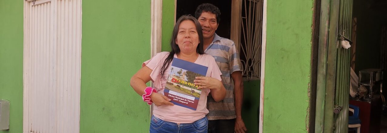
Theirs is one of 30 land titles delivered at an event earlier this year by Chaparral’s Municipal Land Office (MLO), which was created with support from the Land for Prosperity. The Land Office operates under the Municipality’s Secretary of Planning and is something of a one-stop shop for local land administration. It facilitates rural development initiatives and allows the local leaders to deliver on state-led land titling strategies that take the onus off land owners.

“Without a land title, it’s as if you had nothing. We now feel like owners of something,” says Edith Vaquiro.

Thanks to the couple’s business, they have been servicing a small loan in order to make home improvements. Now, with the land title as a qualified form of collateral, they plan to take a larger loan and build a second floor on their home.

Stronger Capacity for Land Administration

For now, the Municipal Land Office is operating thanks to Natalia Quinoñes. As the MLO’s legal expert, she reviews hundreds of urban properties and provides citizens with information to begin to understand the complexity of Colombia’s land laws and the process of property formalization. Quiñones graduated in law last year and is relatively new to the land administration. In her job, learning is a continuous process, and she studies how land laws are evolving in today’s Colombia.

“In law school, they did not spend a lot of time on property law, so I never had a deep understanding of the process. I have learned so much through the experience, and I continue to study and learn every day,” she says.

Eight of out 10 properties in the municipality of Chaparral are informally owned, meaning they lack a land title. In the urban center, the rates of informal land ownership could be lower, but the government does not have an updated cadaster of which properties have registered land titles and which do not.

“Chaparral has problems with informality. The tools of the Municipal Land Office can solve them.”

Natalia Quiñones, land formalization expert in Chaparral, Tolima

Since 2020, 42 USAID-supported Municipal and Regional Land Offices delivered over 6,800 land titles to families living in the urban areas of rural municipalities. In addition, the land offices have formalized more than 1,600 public properties and provided land and property services to more than 16,000 citizens.

A Formal Land Market

In May 2023, Land for Prosperity began implementing the Rural Property and Land Use Plan, known as POSPR by its Spanish acronym, by creating project schedules, training timetables, and plans for security, communications, and environmental management. Chaparral’s Municipal Land Office is critical to supporting the land formalization teams and is a conduit between government land agencies to process land titles, update the cadaster, and file all the information on land use, collected over the 12-month implementation period.

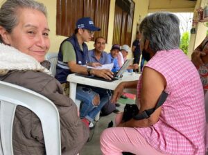
LFP helped to delineate the city’s urban perimeter, verified the geodesic network, and divided the municipality into workable intervention units. The parcel visit phase has begun and rural families in Chaparral are participating in the process. The POSPR is surveying an area of more than 88,000 hectares and approximately 8,600 parcels. More than 2,600 parcels are expected to be titled by the National Land Agency.

Chaparral is one of 11 municipalities being supported by USAID under the Rural Property and Land Use Plans. The POSPR methodology is strengthening land tenure and providing legal certainty for more than 22,000 parcels across Colombia. In each municipality, the POSPR methodology is reducing informal land ownership in rural Colombia, strengthening institutional capacity for land administration, and educating the population on formal land ownership.

Cross-posted from USAID Exposure


“The drivers of deforestation are closely associated with land issues.”

Q&A with Ayda Garzon, head of Chiribiquete National Park, Colombia

The head of the Serranía de Chiribiquete National Park within Colombia’s National Parks Authority (PNN), Ayda Garzón, manages the preservation of more than 4 million hectares of protected area, including the protection of indigenous communities, archeological heritage, and the rich biodiversity held within. At the same time, rampant deforestation continues to threaten many parts of the park. In this interview, Garzón talks about the drivers of deforestation, coordinated efforts with the government, and USAID’s support to improve land governance around the park.

What are the challenges of managing and protecting the Serrania de Chiribiquete National Park?

They are many and very big, almost proportional to Chiribiquete’s size. It is the largest protected land area in Colombia and the world, located in the departments of Caquetá and Guaviare, with the presence of indigenous and farmer communities. The northern section of the park borders the deforestation arc of the Amazon, and in the southern part, the park borders indigenous reservations, however there, the area retains a high level of conservation.

What are the factors that contribute to the deforestation of the park?

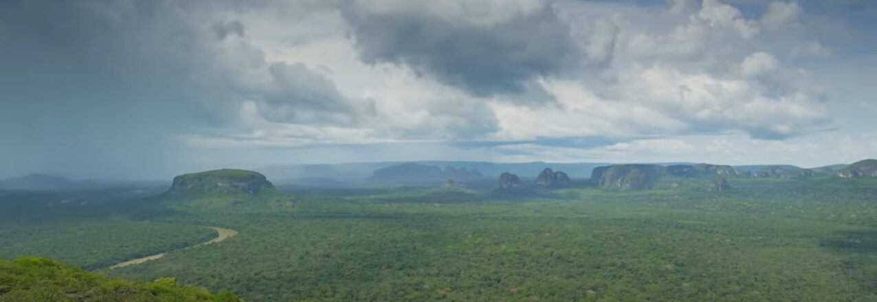
Through our analysis, we understand that deforestation in Chiribiquete is closely linked to land access and property issues and land grabbing. We see five big deforestation hotspots inside Chiribiquete that correspond to two areas in San Vicente del Caguán, two sections going towards San José del Guaviare, and one area which is the northern border of the Yaguará II indigenous reservation. Then we have zones such as San Miguel that, although they are not very large, already show evidence of deforestation.

Does deforestation increase illegal cattle ranching and illegal crops in the park?

Once deforestation processes have begun, roads appear connecting plots of land, and after two or three years, the cows start to appear. In the last year, cattle ranching increased twofold. Until a year ago, there were not more than 50 hectares of illicit crops in Chiribiquete, but since then we have also seen an increase.

What are the tools that the government needs to fight this?

A vital element is ensuring that the communities trust the government and feel they are and will continue to be taken care of. The lack of the government presence leads to communities recognizing the presence of FARC dissidents as the ones who govern the land. The government needs to make an effort to take care of these populations, and in this way build peace.

Do you think that land use planning contributes to the fight against deforestation?

I think that in the case of the areas around the national park, in theory it can contribute. We have the designations, such as the parks and forest reserves, but I think forest reserves have lost their validity, despite being a mechanism to ensure that the forests can be preserved and exploited in a sustainable way. With Colombia’s issues in terms of land access for rural communities, deforestation is a result not only of people colonizing the forests, but in many cases, it’s a result of government policies. In the case of the Amazon Forest Reserve, the government directed and promoted new colonies and occupation, and they did it with counterproductive policies that people still have ingrained in their heads in terms of what is required for someone to consider themselves the owner of a piece of land. So today, people who do not have grass or cows, do not feel they are owners. So, regulations and land use planning exist, but in the end, what transforms the land are the people who do not have the right tools or knowledge and receive no support from the government.

The USAID Land for Prosperity Activity is supporting the government to survey the park´s boundaries and its vicinity to update the rural cadaster for the first time. Why is this important?

For us, having an updated cadaster is interesting for several reasons. It forces us to work with government land entities like the rural cadaster authority IGAC. It also forces us to work with municipality leaders on a complicated topic, which is land. And once the cadaster of neighboring municipalities have also been updated, then the information must be synchronized. In addition, we already monitor deforestation, but our tools do not have the same level of detail as the land survey for the rural cadaster. For us, this is a big win.

Does the designation of national park make your job difficult?

What we do is protect and conserve that natural foundation, the base that supports all development, and it is difficult for these areas to be understood as opportunities. Sadly, when we talk to the mayors, the first thing they say is that having a protected area is the worst thing that can happen to them, because they cannot collect land taxes, for example, and they cannot intervene in the areas in any way. And this is not only in municipal or departmental administrations, but a lot of national entities also see national parks this way. Therefore, it is a challenge to promote protected areas and make people see them, Chiribiquete in particular, as drivers for development, as partners for the development of a municipality or department.

Do you think that USAID is contributing to conservation?

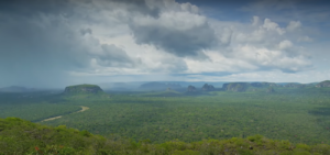
I think they are on multiple fronts, for example, in terms of prevention, patrolling, and control, and the application of environmental law. USAID has a number of actions and programs that are strengthening government entities, and they are carrying out projects and providing tools to the communities that allow them to make better use of their land. USAID has initiatives around communication and awareness raising that I think are vital, and that helps to bring that knowledge and that work closer to the communities.

How urgent is it to stop deforestation inside the park?

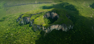
If we don’t coordinate efforts and work with the communities in the northern part, Chiribiquete does not have a high rate of survival in the medium term. The process of deforestation moves fast, and every day there is more transformation. If we don’t make the indigenous communities who are protecting the southern parts of the park our natural partners, it is very likely that a time will come when there will also be deforestation in that region. So, our first challenge is to work with the communities, to make them our natural partners for conservation. Without discriminating between indigenous and farmer communities but including everyone.

Cross-posted from USAID Exposure

Beating the Stereotype

How a land surveyor in Meta’s Regional Land Office has overcome challenges to find herself in a career dominated by men.

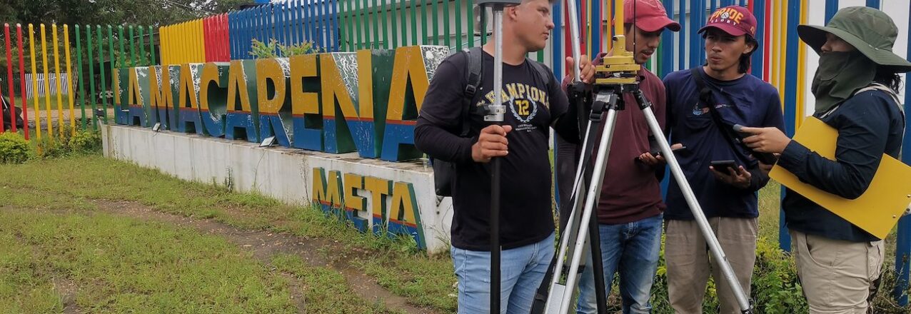
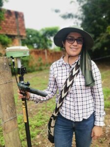
Leany Alba, 28, grew up in Bogota and dreamed of being a professional photographer, but her parents never warmed up to the idea. She always loves maps and followed a career path towards becoming a cartographer. On that path, she found a burgeoning job market for her current profession: land surveyor.

For years, geographers, cartographers, and topographers were considered occupations for “strong, young men.” Alba bucked the trend when she took her first job with Colombia’s Land Restitution Unit as a topographer, surveying properties that were being returned to displaced families in Meta. Though her parents had once worried about their daughter, imagining her measuring buildings on urban construction sites, they supported her decision to work in rural Colombia.

“These jobs were once dominated by men, because it was much more physical. But this is nonsense. A woman can endure the high temperatures and carry equipment just like a man,” says Leany.


Leany Alba works in some of Meta´s most isolated municipalities, in partnership with the regional and municipal governments, surveying urban properties to make land rights a reality for thousands of Colombians.

In 2022, she accepted a job with the Meta Regional Land Office, as the only woman topographer on a team of land formalization experts who regularly travel to rural municipalities to assist small-town mayors with the titling of urban parcels.

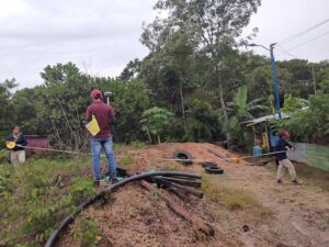
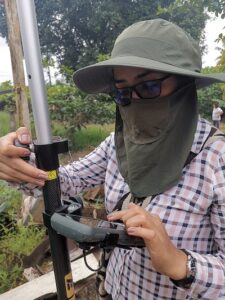
“With today’s technology, there is no excuse. Any woman can work as a land surveyor.” says Leanny.

Meta’s Regional Land Office supports municipalities like Mesetas, La Uribe and La Macarena, focusing on titling properties in the towns’ urban areas. Underfunded municipalities like Mesetas cannot afford to maintain its own land office, so the regional strategy allows it to share the costs of land titling, like labor and equipment, with a group of municipalities.

The innovative concept was first supported by USAID in the Department of Meta, and has found success in other departments like Cauca, Sucre, and Bolívar. The regional land office strategy has planted seeds for regional-level leadership in land administration and created a conduit of support for secure land rights.

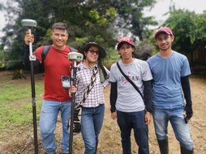
“So one of the challenges is communication with people. Women often have better communications skills, and it is necessary to have a certain tact in dealing with rural people, since almost nobody understands land” explains Leany Alba.

In a little over a year, Meta’s Regional Land Office has delivered nearly 700 urban land titles, which include 34 public properties with schools, health clinics, and municipal services like parks and recreation. The Regional Land Office has titled properties in Mesetas, La Macarena, Uribe, Vista Hermosa, San Juan de Arama, and Puerto Rico.

Cross-posted from USAID Exposure

“Now They Call Me a Farmer” – Rural Women Make an Impact in Global Agricultural Value Chains

Before becoming a community agronomist, Anamika Ghosh had never stepped foot on a farm. Like most women in her community, her family was involved in farming, but her role was confined to cutting and preparing seed potatoes at home. “I had no knowledge about farming,” she said. “I supported my husband but was not a farmer myself.” 

Anamika’s story is typical of many women. Although women make up over 50 percent of the agricultural labor force in many countries, their roles tend to be overlooked, undervalued, and underpaid. Land ownership is often required to participate in contract farming, and as women continue to face barriers to owning land, they remain underrepresented in global food and agricultural value chains. 

Closing the gender gap in agriculture could increase global GDP by US 1 trillion and reduce global food security for 45 million people. The private sector is a key partner in this effort, as more companies realize that investing in women’s empowerment has direct impacts on their bottom line, increasing productivity, expanding the supply base, meeting international standards, and enhancing company reputation

Under the Integrated Land and Resource Governance (ILRG) program, USAID worked with private sector partners to empower women and expand their access to agricultural supply chains. In India, USAID and PepsiCo partnered to empower women in PepsiCo’s potato supply chain by increasing their access to critical productive resources like land and agronomy knowledge. Over 1,800 women received agronomy and sustainable farming practices training for the first time and over 800 farmers (65 percent women) received land literacy training. In Ghana, USAID partnered with Ecom Agroindustrial Corp. (ECOM), a global commodity trading and processing company, to increase gender-responsiveness in ECOM’s internal policies and practices and to pilot targeted women’s empowerment activities in cocoa communities. ECOM reached over 2,600 farmers (55 percent women) to engage in dialogues about harmful gender norms around control of productive resources and gender-based violence. To increase women’s economic security, the company supported alternative livelihoods for women in 37 communities. 

Women’s land leasing group Eid Mubarak stands in front of their potato harvest in 2021-2022 growing season. These women collectively leased land from a local landholder under the project in order to join PepsiCo’s potato supply chain as independent suppliers. Credit: Landesa

WOMEN GAINED CONFIDENCE AND DECISION-MAKING POWER

Both partnerships achieved notable results in women’s empowerment and in the companies’ tangible and intangible business metrics. In both countries, women began to be recognized as farmers rather than “farmers’ wives” – a shift that opens the door to new opportunities. In India, access to agronomy knowledge increased women’s confidence, leading to improved social mobility, financial autonomy, and greater say in household decisions over the use of land and income. In Ghana, men and women farmers started to change their beliefs and behaviors around gender roles and responsibilities, with men recognizing the importance of women owning land and equitable sharing of household tasks and household decision-making. According to cocoa farmer Emmanuel Oboery, rethinking the division of labor in his household led to more collaboration and increased productivity, “Before, with only me working in the farm, I would make two or three bags per season.  Now working together we can make five or six bags. Before me and my wife were each on their own separate path, but we are one now.”

Woman demo farmer shares proper PepsiCo practices with women and men farmers in her community during a field visit. Giving women leadership roles in farming can increase their recognition and acceptance among both company staff and community members. Credit: Subarna Maitra

WOMEN’S EMPOWERMENT IS GOOD FOR BUSINESS

Once women had improved access to productive resources and harmful gender norms started to shift, there were improvements in company productivity, supply base retention, and brand image and loyalty. In India, families of women who received agronomy training had better gross and net yields – 84 percent of women farmers trained reported an increase in their farm yield compared to the previous year and 76 percent reported a decrease in rejection rates. PepsiCo and ECOM staff reported that women in project communities are joining the supply chain at a higher rate than men, supporting greater stability and growth of the supply base. Farmer loyalty is closely linked to better company reputation. As farmers see companies making intentional efforts to engage women farmers and the benefits that come with it, they feel more inclined to start or continue to work with the company.

A couple shows off their cocoa trees on their farm in Ghana. Both participated in gender norms training under the USAID-ECOM partnership to promote women’s recognition and participation in cocoa value chains. Credit: Thais Bessa, ILRG

THE PATH FORWARD

Private sector engagement can provide opportunities for greater sustainability and scalability of USAID investments. The USAID-PepsiCo pilot spurred a larger five-year Global Development Alliance across five countries to empower women in different supply chains. This will help PepsiCo meet its commitment to improve the livelihoods of 250,000 people in its supply chain by 2030. PepsiCo staff are now leading training with women farmers in new communities across West Bengal, using gender-responsive tools and materials developed under the partnership. In Ghana, ECOM has developed a five year gender strategy, which includes gender equality metrics the company will report against internally at the country level, and recruited dedicated staff to implement it and continue to roll out gender norms training to farmers in new communities and regions. 

ECOM gender field officers hold up peppers, one of the alternative livelihood activities the USAID-ECOM partnership is supporting for women farmers in cocoa regions in Ghana. Credit: Dan Myers, ILRG

These partnerships demonstrate that investing in women is not only critical for USAID’s development goals related to food security, economic growth, and resilience, but it is also good for business. Anamika, the once shy woman who thought that cutting potato seeds was not important, now feels confident to lead the family farming business and train other women. “Now I know I am a farmer. I have technical knowledge and I am encouraging others in my community.” When they can access the productive resources needed to thrive, women farmers like Anamika have the potential to transform global food security and supply chains, feeding their families, their communities, and the world.

Discovering Quality Coffees in Cauca

USAID is promoting women and young coffee growers in northern Cauca, raising the quality of their coffee and opening doors in global markets. 

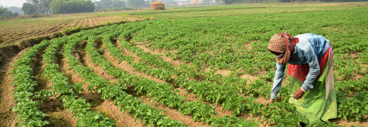
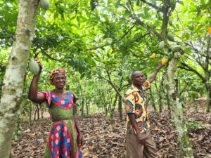
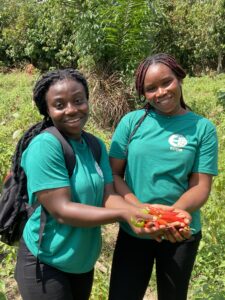
“We as coffee growers work for the common good. More than coffee, it is us, a part of the countryside who are taking care of the environment,” says Fanllany Méndez, spokeswoman for the coffee growers association Asoprodig, located in Santander de Quilichao in the heart of Cauca, one of Colombia’s most productive coffee growing regions.

Women from Cauca like Fanllany Méndez have always seen coffee as their best option to help their families and get ahead. At 31 years of age, Fanllany is a community leader who encourages other women in Asoprodig to plant coffee, improve their skills, and promote marketing.

“Thanks to coffee I was able to study, and thanks to it I will also be able to give my children an education.” says Fanllany Méndez, a coffee grower from Cauca.

The hard work paid off this year when Asoprodig was chosen to participate in the 12th version of the Specialty Coffee Fair and Competition of Cauca. In the event, 10 small coffee grower associations participated for the first time, allowing international buyers to try their specialty coffees.

Winning New Markets

Fanllany Mendez and the 10 associations participated in coffee cupping, exposition of production machinery, and business meetings with buyers from Taiwan, South Korea, Mexico, Peru, China and Colombia. The coffee growers, who a decade ago had no market channels available, came to the fair to prove that in the municipalities of Northern Cauca are also producing specialty coffee with added value.

“In Cauca there are many families that depend on coffee, and the beans offered in this fair represent the best qualities we have,” Méndez said.

Under normal circumstances, the small growers end up selling their coffee to local buyers. Thanks to the event, three Northern Cauca coffee associations sold coffee lots to international buyers two more are under negotiation. In addition, the National Federation of Coffee Growers is leading the negotiation of 10 coffee lots from the 10 associations from the region.

Effective Partnerships

During the two years of implementation of this coffee alliance in northern Cauca, 55 events have been held, including field schools and workshops on commercial organizational strengthening, reaching 414 coffee growers, with a strong participation of women and young people, 40% and 19%, respectively.

The fair forms part of a public-private partnership in the coffee value chain of Northern Cauca, which was facilitated by USAID in 2021 through the Land for Prosperity Activity. The PPP includes the Mayor’s Office of Santander de Quilichao and the National Federation of Coffee Growers, among other public and private actors.

The PPP is valued at more than COP $8,340 million (USD $3 million) and includes over 1,000 coffee growers from five Northern Cauca municipalities. The partnership is an example of USAID’s 20 years of support for Colombia’s $3 billion coffee sector. As the country’s third top export, coffee has the potential to promote formal economic opportunities in one of the Colombian regions most affected by illicit crops.

This year, in conjunction with the Mayor’s Office of Santander de Quilichao, USAID is emphasizing the promotion of Café Asociativo as an innovative initiative. The strategy promotes coffee from the PPP’s smallholder coffee farmers and seeks to promote new technologies and collaboration to improve production, quality, and open new markets.

“For the first time, our growers have the opportunity to participate in the fair’s coffee auction, following almost three years of effort and dedication. This is generating new business and opportunities for our coffee growers, but above all for the youth of our region,” says Lucy Amparo Guzmán, Santander de Quilichao’s mayor.

A Link to Rural Youth

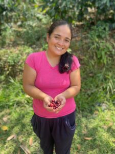
Santiago Samboní is a 21-year-old who has always grown coffee with his mother and grandmother on their farm located in the rural area of Santander de Quilichao. For Santiago, being a successful coffee grower is more than just production, it’s about training and acquiring knowledge that can improve the process. Today he is studying to become a food engineer.

“We have to understand that coffee is not only picking and selling, but adopting a broader approach to improve productivity in the farms and then our income,” says Santiago Samboní, young coffee grower in Santander de Quilichao.

“All this growth is thanks to the training and support from the PPP, which highlights trainings for youth and allows us to continue working in agriculture.”

Cross-posted from USAID Exposure

Women’s Land Rights Champion: Altaf Afridi

This interview with Altaf Afridi, USAID/Pakistan, is part of USAID’s Land and Resource Governance Division’s Women’s Land Rights Champions series, which profiles staff across USAID Missions and operating units who are working to advance women’s land rights.

Tell us about yourself.

My name is Altaf Afridi. I work as a Development Assistance Specialist at USAID/Pakistan. Currently, I manage the Land Registration in Merged Areas (LRMA) project. I am a governance specialist and have designed and managed governance projects throughout my career. In addition to managing LRMA, I also supervise another USAID governance project called Merged Areas Governance Program implemented by UNDP. Prior to my role at USAID, I worked as a Governance Officer at the Pakistan Resident Mission of the Asian Development Bank (ADB). At ADB, I managed the implementation of a large loan program called Decentralization Support Program and implemented a number of supporting technical assistance projects.

Why are women’s land rights and resource governance important to your work? And to other USAID development work?

Pakistan ranks among the world’s lowest in gender equality and women’s rights. This is especially true for the tribal regions, which recently merged into the Khyber Pakhtunkhwa (KP) Province. Here, as per the tribal code, land is owned collectively by tribes, sub-tribes, and clans. Women do not have any role in decision making in this patriarchal and conservative society. Therefore, they have virtually no control over land. To address this, USAID/Pakistan is assisting the provincial government of KP in establishing a land registration system with special emphasis on women’s access and control over assets. 

What are some of the biggest challenges in helping women secure land rights and what are some things being done to overcome them?

In 2018, the Parliament of Pakistan passed a constitutional amendment to merge the Federally Administered Tribal Areas (FATA) along the Pakistan-Afghanistan border into the neighboring Khyber Pakhtunkhwa (KP) Province. This region is now known as Merged Areas (or Merged Districts) and is part of KP Province. Historically, this particular region was governed through uncodified tribal traditions and was not under the legal jurisdiction of Pakistan law.

The cultural norms and traditions prevailing in Pakistan in general, and in Merged Areas in particular, pose the biggest challenge in helping women secure land rights. Although the Government of Pakistan has legislated extensively to ensure clear inheritance and land rights pathways for women, local men and women are mostly unaware of these laws. The government has lacked the capacity to raise sufficient awareness to effectively implement the new laws.  

USAID/Pakistan, through LRMA, is helping the Government of Pakistan bolster communications about the land laws and provide community outreach that educates local communities about the importance of women’s land rights. Because literacy is low, LRMA is developing and disseminating easy-to-understand communication products like thematic songs, radio programs, Public Service Announcements, illustrations, instructional videos, and live sessions featuring youth from Merged Areas. 

LRMA is also building capacity within the Government of Pakistan to support implementation of the new legislation. LRMA has been conducting a review of the relevant laws, regulations, and policies, and has been recommending relevant amendments to help increase uptake and effectiveness of the laws. LRMA has also been designing and delivering trainings and developing materials like manuals and posters to help raise awareness among government staff, as well as providing equipment and hardware where required.

What are some of USAID’s successes in the area of women’s land rights?

LRMA is USAID/Pakistan’s first and only activity on land rights and there have been several successes. LRMA has conducted capacity building activities for relevant government officials as well as sessions with community leaders to raise awareness of women’s land rights. 

In addition, the project also recently signed a memorandum of understanding (MOU) with the KP Province Ombudesperson, who is entitled to take action when women’s land rights are denied. As a result, LRMA  has set up a legal library in the Ombudsperson’s office to support the capacity of the pro bono lawyers working there. To fill the information gap and inform the public about the new role of the Ombudsperson, LRMA has provided ten “knowledge corner” kiosks to showcase printed information, education, and communications materials on women’s land rights, including inheritance rights. 

LRMA has also developed a video documentary that features two case studies about women litigants who have experienced barriers in registering their property. The documentary will be widely disseminated through two Pashto language satellite/cable TV channels (with wide outreach in Merged Areas) and through various social media platforms.  

Is there anything else you’d like to share?

The project is still new. We look forward to sharing more substantial results down the road.

Respecting their Autonomy

USAID is giving indigenous Pijao communities in Chaparral, Tolima the opportunity to participate in land administration initiatives.

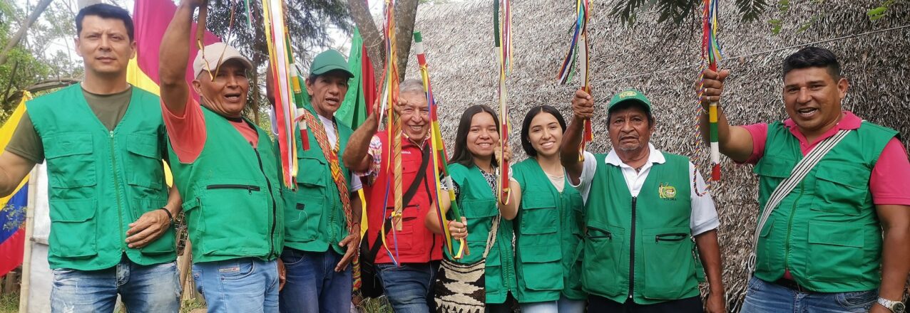
Eleven ethnic Pijao communities in the municipality of Chaparral, Tolima, took part in Free, Prior, and Informed Consent (FPIC) sessions and agreed to participate in the implementation of Rural Property and Land Administration Plan (POSPR) being carried out by USAID Land for Prosperity with support from the Colombian government.

The FPIC process is a preliminary step to ensure that the indigenous groups, which represent an estimated 2,500 people, understand the process of surveying land, formalizing property, and resolving a variety of land conflicts in the municipality. Among these objectives, the POSPR gives indigenous groups the chance to meaningfully participate in the process. This includes the opportunity to create or increase coverage of their collective territories, known in Spanish as resguardos.

Each of the 11 Pijao communities varies in terms of their relationship with collective lands and the status as indigenous group. Some communities, such as Matora de Maito, consist of dozens of families living dispersed throughout the mountainous municipality, with no sizable collective landholdings. Some of the Pijao communities have yet to achieve official designation by Colombia’s Ministry of Interior, while others live on resguardos that overlap with the Las Hermosas National Park high in the Andes.

“This is a great opportunity for indigenous communities to advance the process of establishing collective landholdings, strengthen our family bonds, and ensure the persistence of the Pijao culture,” says Maria Ximena Figueroa, Pijao social leader from the Matora de Maito Pijao community.

In Colombia, FPIC is a right that indigenous and Afro-descendant communities have to say yes or no to any proposal that could affect their territory or social structure. The FPIC process supported by USAID is inclusive and participatory and demonstrates an intercultural dialogue around land and territory.

During the FPIC process, Land for Prosperity (LFP) staff held events on Saturdays and Sundays to increase participation and invited all members of the communities. LFP presented the POSPR process, and how it affects private landowners and indigenous communities. It also opened up dialogue with members, allowing the community to ask questions about the intention of the local and national government agencies.

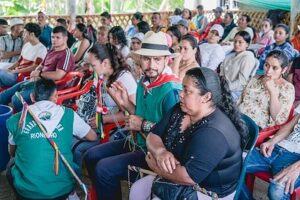
“There is confusion in the community around land formalization, ranging from ideas that the government is coming to take our land to ideas that the government is finally making reparations,” says Luis Fernando Guerrero, the current governor of Matora de Maito.

At the end of each session, the communities vote, and if they agree, sign a protocol with LFP and delegate a spokesperson, or in some cases, a guía ancestral (ancestral guide) for the entire process. Implementation of POSPR in Chaparral is expected to take place over the next 18 months. During the process, teams of legal, land, and social experts will continue meeting with Pijao leaders and community members to survey their collective lands and present requests to the National Land Agency.

Identifying Land Use

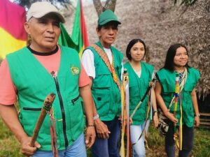
In 2010, Matora de Maito purchased a three-hectare parcel to build their maloca, or community meeting center, near the urban center of Chaparral. “The problem is that we still don’t own a larger piece of collective land where we can work together and use the land the way we always have,” explains the group’s governor, Luis Fernando Guerrero.

The implementation of POSPR is a strong departure from purely titling land parcels. The exercise has multiple objectives and allows the government to collect information on types of properties, land usage, and the number of landless farmers for agrarian reform, i.e. the redistribution of land. For indigenous communities, the POSPR can be useful to identify lands for ethnic territories.

“We expect this process to help the Colombian Government understand how much land there is and which land can be used for cultivation and which lands we need to protect with conservation initiatives, like forests and water,” says Pijao social leader Maria Ximena Figueroa Olaya.

“We all want a collective territory where we can record our own history and leave a legacy for our children. Our communities need assistance with the application for a resguardo.” says José Walter Cano, Governor of the Pijaos en Evolución, a group of 26 Pijao families.

“Being Pijao is what unites us. We are united, and we fight for our rights in a pacific manner and not through violence. We are just asking for the opportunity to return to our land to grow our crops and our medicinal plants. These are the things that hold up our communities.” says Maria Luisa Rayo, Governor of the Cañón de Amoyá Pijao community.

Cross-posted from USAID Exposure

Convincing the Public

El Bagre’s Municipal Land Office has delivered more than 500 urban land titles in one of Colombia’s largest gold mining municipalities. 

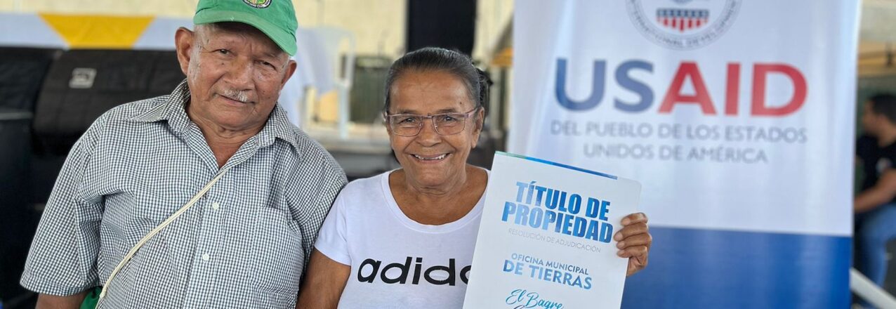
El Bagre is synonymous with gold mining. In fact, before El Bagre was a municipality, it formed part of neighboring Zaragoza and was a place where people had been mining gold for hundreds of years. For the last several decades, Colombian mining firm Mineros has carried out alluvial mining across large swathes of the gold-rich land. According to experts, El Bagre is one of Antioquia’s highest gold producing municipalities and depends on gold for 80-90% of its revenue.

Due to an abundance of gold and a general lack of state services in the tumultuous sub-region of Bajo Cauca, El Bagre’s residents have weathered years of violence and conflict between guerrilla and paramilitary groups in disputes over land, power, money, and narcotics.

The opportunity to benefit from gold mining has only exacerbated land issues in El Bagre, making land tenure security even more important for residents. Land for Prosperity began supporting El Bagre’s municipal government in 2021 with the creation of the Municipal Land Office (MLO). This office includes a legal expert, land surveyor, social worker, and secretary and is focused on working out land and property issues facing El Bagre’s urban areas, which comprise an estimated 13,000 urban parcels.

In May, El Bagre’s Land Office delivered 90 property titles to residents, bringing the total number of land titles delivered to more than 500 since the office was created.

“Finally, I can say this house is mine. I lived with uncertainty because I didn’t have the deed,” said Nancy Preciado, a neighbor in the urban area of Puerto Claver. Preciado never pursued a land title before now due to the high costs and time associated with lawyers and the land formalization process.

“Thanks to the Land Office, I am smiling ear to ear.” says Nancy Preciado, an El Bagre neighbor.

Optimizing Land Governance

As the Municipal Land Office continues towards its goal of 1,000 titled urban parcels by the end of 2023, the team’s legal expert Daniela Gomez and team face additional challenges related to community outreach and convincing residents that the services provided by the office are authentic.

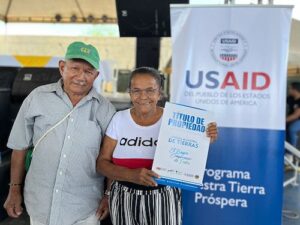
“Nobody believed the Municipal Land Office would help them with land titling services for free. But once we delivered more than 150 land titles at our first event in 2021, people gained confidence in what the administration is trying to do,” Gomez says.

LFP is currently supporting the MLO with two additional employees, a legal expert and a land surveyor. As part of their outreach strategy, the MLO team leads land formalization workshops in the two main urban zones outside of El Bagre’s main city center: Puerto Claver and Puerto Lopez.

“We teach the importance of legal land ownership, that a registered title provides legal security, legally accredits them as owners of the house, provides a secure future for their children, and can help them improve their housing. We also reiterate that the process of titling their property is 100 percent free of charge.”

A Step Forward

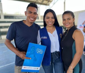
El Bagre’s Municipal Land Office is also facilitating housing subsidies for new homeowners with a registered land title who qualify for the program. In 2023, the MLO helped 66 homeowners access government subsidies offered by Antioquia’s departmental government, permitting low-income residents to improve their flooring, bathrooms, and kitchen.

“The Municipal Land Office has made many types of services available that were never available before. Together with residents, we are reducing informality and contributing to the quality of life of the population,” explains Gomez.


Cross-posted from USAID Exposure

Weaving Satellite Data into an Ecosystem of Farmer Support

At Kenya’s Ministry of Agriculture, Head of Food Crops Statistics Ms. Jane Kioko takes on the enormous task of compiling monthly crop data for the country. Small-scale farmers make up 75% of the nation’s agricultural output. As our climate changes, these farmers navigate more extreme challenges, like droughts and crop diseases. Through a collaboration between USAID and NASA, decision-makers like Kioko can use the birds-eye view of satellite tools to expand their understanding of the challenges that farmers are facing.

Kioko and her colleagues are connected to farmers through a broad network of county agricultural extension officers. These officers meet with farmers directly to provide resources and technical information, and report on farm conditions to inform national decision-making. 

This approach to gathering information can be time-consuming. Often, less than a third of the needed data made it back to Ministry staff like Kioko. To know when to distribute support, such as insurance payouts after a drought, Kioko needs to access highly localized data, like rainfall and field-level crop yield estimates. 

Enter Dr. Catherine Nakalembe, an Applied Sciences Team Principal Investigator for SERVIR. Nakalembe is an award-winning Assistant Professor at the University of Maryland and the Africa Director for NASA Harvest. Since 2016, Nakalembe has collaborated with Ministry staff in using satellite data to predict areas at risk for food shortages.

SERVIR is a collaboration of NASA and the U.S. Agency for International Development (USAID), partnering with organizations around the world to support locally led climate efforts with Earth data.

With SERVIR, Nakalembe helps to create country-specific versions of the regional Crop Monitors tool established through the Group on Earth Observation’s Global Agricultural Monitoring Initiative (GEOGLAM). Crop Monitors uses satellite data to capture a more expansive view of agricultural conditions. Nakalembe partners with agricultural ministries to combine satellite data with on-the-ground information to paint a clearer picture of where food security support is needed. Regional demand for improved crop monitoring is so high that the project now spans six countries: Kenya, Malawi, Rwanda, Tanzania, Uganda, and Zambia.

Nakalembe understands that to make these tools as useful as possible, they must be integrated into existing decision-making. Each country already has processes to gather and report on field conditions. Rather than adopt a new workflow, Nakalembe works with users to conveniently integrate the Crop Monitors tool into their own systems.

For example, Nakalembe and Kioko ensure that extension officers are actively involved in implementing the tools. Officers are trained to upload monthly field data to Crop Monitors, which Kioko can quickly assess to identify areas for intervention. Extension officers regularly share updates with Kioko which help to improve Ministry decision-making and refine Nakalembe’s work.

A group of people sit at a conference table using laptops to manipulate land mapping data.
Jane Kioko (top left) meets with representatives of Kenya’s Ministry of Agriculture and the Kenya Space Agency during a 2023 training to review SERVIR field data collection tools.
Credit: NASA/Catherine Nakalembe

“There’s nothing better than getting a text message that says ‘When do you come back? When do we go collect data again?” Nakalembe shared.

Ms Kioko referenced a 2022 outbreak of African armyworm when the Ministry used Crop Monitors reports to deploy resources like pesticides to avoid crop losses across approximately 2,100 km2.

“You’re much more confident with more sources of information than if only relying on one source of information…especially when it comes to pest infestation in the field, the officers are able to report through the Crop Monitor and [farmers] are able to get timely assistance from the government, which is critical,” Kioko said.

As droughts become more frequent, farmers are seeing the importance of crop insurance. In 2016, only 900 farmers opted into the national agricultural insurance program. By 2021, that number soared to nearly 300,000.

Nakalembe’s work continues to expand. SERVIR’s West Africa hub is integrating the tool in Senegal, and national Crop Monitors are being used to create Regional Food Balance Sheets, which help multinational decision-makers avoid food shortages. With the help of satellite data, USAID and NASA are amplifying the existing efforts of food security champions like Jane Kioko and her team.