How documented property rights gave a Tanzanian widow financial stability
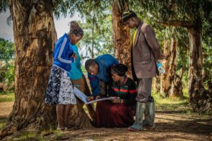
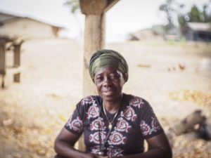
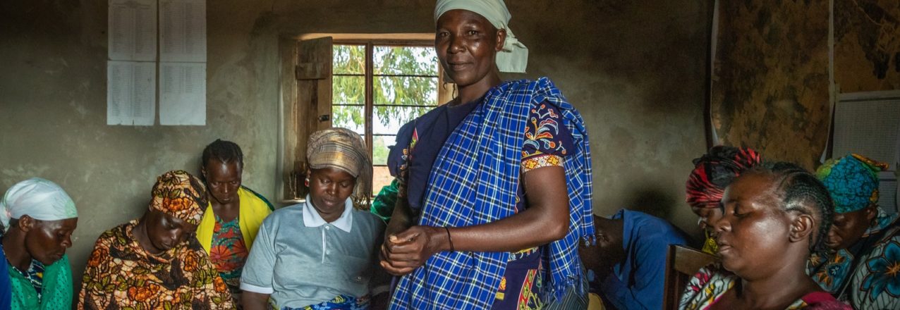
Asiah Samila is a farmer with five children. She lives in Mlanda, a village located outside Iringa in central Tanzania.
When Asiah’s husband died, their youngest child was just a newborn. He left her with their house and farmland in Mlanda village. However, she did not have a title deed for the property, putting her in a difficult position.
In rural villages like Mlanda, women typically are not involved in family decisions. A woman is seen as a caregiver to children, a homemaker, and someone who is responsible for taking care of the needs of the husband. Few women own land.
Lacking Land Rights
Widowed women face many challenges when they don’t have official paperwork proving ownership of their land. In some cases, a widow’s in-laws may forcefully claim the land, displacing her.
Without documented property rights, widows can’t buy or sell their land, nor can they obtain access to bank loans.
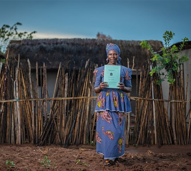
In Asiah’s case, the neighboring school claimed that she was occupying part of their land, and Asiah was unable to show the paperwork needed to defend herself and her right to the property.
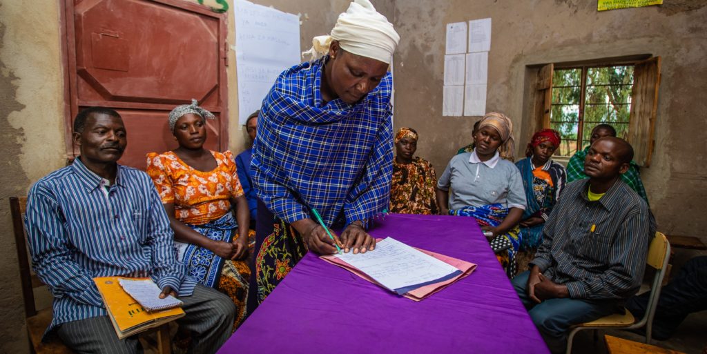
But with USAID’s help, Asiah was able to find a solution to the conflict.
By Deborah Espinosa and Patrick Gallagher, USAID’s Land Technology Solutions Program
Persistent and pervasive gender inequality is a global development challenge that constrains economic growth, educational opportunities, and health outcomes. It jeopardizes food security and undermines poverty reduction strategies. The world over, some formal and many informal laws and customs operate to hinder women’s empowerment and thus their full potential as agents of economic and social change.
A woman holding her land certificate in rural Zambia. Photo: Jeremy Green/USAID.
Arguably, in no sector are gender disparities so prevalent and disempowering to women as in the land and property rights sector. For women, documented land rights can confer direct economic benefits and lead to greater autonomy, increased bargaining power within their communities and households, and enhanced resilience. Worldwide evidence suggests that when women enjoy secure rights to land, their control over household income increases.[1]
In much of the world, however, the ownership and control of land is a source of power, prestige, and profit. Not surprisingly then, women’s ownership and control over land is almost always constrained by entrenched traditions and practices that limit women’s participation in public life, even if formal laws recognizing women’s land rights are in place.
Importantly, USAID’s new and innovative tool for documenting land rights has proved impactful in reversing these trends. USAID’s Mobile Application to Secure Tenure (MAST) has worked to reduce gender equality and promote women’s empowerment in communities where it has been implemented. MAST is a suite of easy-to-use tools and methods that help communities efficiently, transparently and affordably map and document their land and resource rights. MAST combines a mobile application with a robust data management platform to capture and manage land information, including names and photographs of people using and occupying land, details about land used, and information regarding an occupant’s claim to the land.
Working with local governments, customary leaders, and civil society organizations, USAID is leveraging MAST to recognize and record both women and men’s rights to rural land, with positive women’s empowerment outcomes in Tanzania and Zambia.
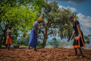
In Tanzania, for example, although Tanzanian women comprise 50 percent of the population and provide 80 percent of total agricultural labor (a sector which employs 77 percent of Tanzanians), country data indicates that only 27 percent of women are landowners.[2] The country ranks 119th (out of 189) on the UNDP’s 2013 Gender Inequality Index. In 2018, Tanzania’s ranking has even fallen since its 2013 ranking of 130th. [3][4]A key reason cited for Tanzania’s drop in the rankings is the persistence of gender inequalities in access to and control over land and other financial resources, and the additional burden that poverty places on Tanzanian women.[5] Another gender disparity in Tanzania is the low proportion of women in decision-making positions at regional and local government levels.[6]
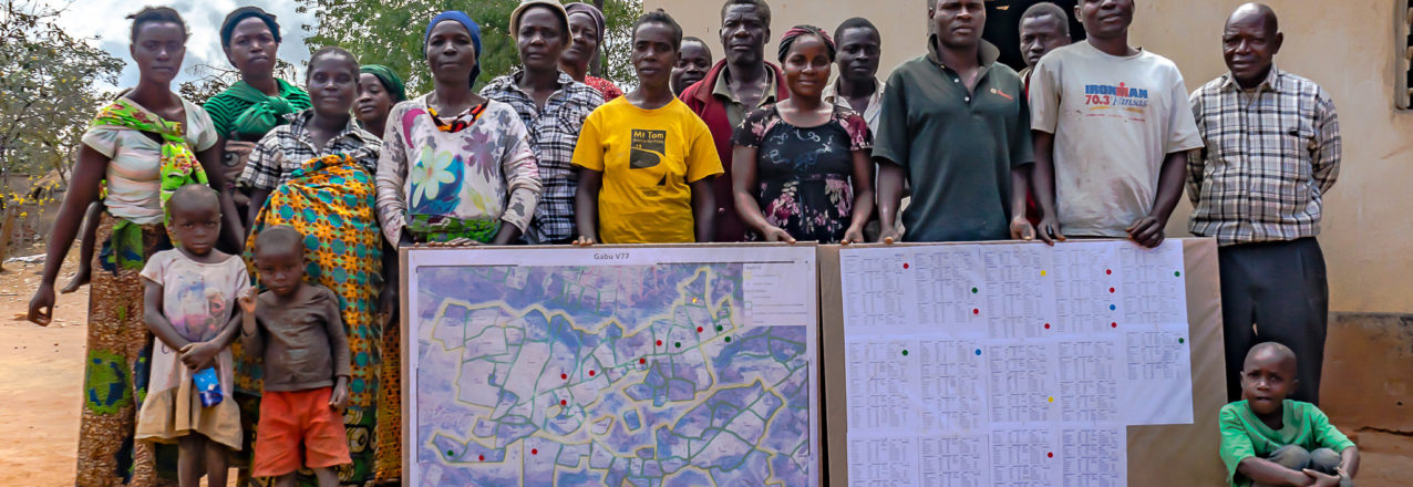
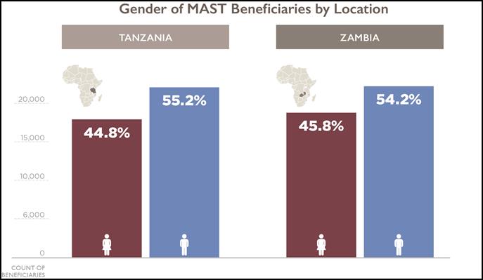
Figure 1. Gender of MAST beneficiaries by location. In Iringa, Tanzania and Zambia, approximately 45% of MAST beneficiaries are female.
And yet, four years into USAID’s MAST-based Land Tenure Assistance (LTA) Program, almost 45 percent of project beneficiaries receiving land certificates are women (see Figure 1). Similarly, under USAID’s Tenure and Global Climate Change program in Zambia, two civil society organizations, Chipata District Land Alliance (CPLA) and Petauke District Land Alliance (PDLA), used MAST to also register about 45 percent of customary land in the names of women in a country with similar traditional constraints on women.
In both of these countries, MAST’s approach has been critical in promoting gender equality and women’s empowerment in the land sector. MAST includes on-the-ground trainings, using inclusive and participatory approaches to build capacity of communities to document, manage information about, and understand their land and resource rights. The MAST approach operates transparently, encourages full participation of community members, and increases the understanding of land rights of all beneficiaries, particularly women’s rights.
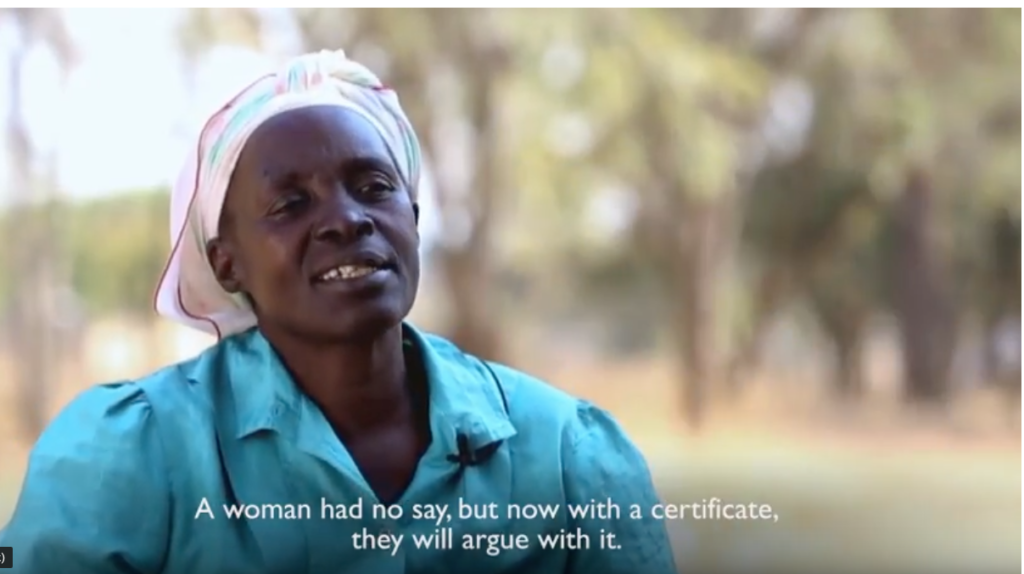
To hear directly from Zambian women on their experiences obtaining land certificates, see the USAID video, In My Own Name, Empowering Women Through Secure Land Rights.
What Does the Data Say?
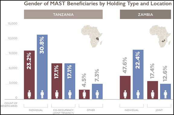
Figure 2. Gender of MAST-assisted landowners by their occupancy type and location. Percentages are calculated within each site, and Tanzania data is representative of Iringa region only. Though men dominate the single occupant/landholder types, women are equally represented in the co-occupancy/joint types.
A gender analysis of data on individual versus collective landholdings provides further insight useful for future programming. In both Tanzania, and Zambia, more men hold land individually, while more women hold land jointly or in co-tenancy arrangements. This finding is backed by research indicating that female ownership of land is generally held together with husbands, whereas men are more likely to be sole owners of land.[7]
Despite that, men currently represent a higher proportion of individual landowners, the implementation of MAST has proven effective in promoting gender equality and empowering women by providing a technology coupled with an inclusive approach for recognizing and documenting land rights. In Zambia, land documentation had positive impact on household perceptions of improved tenure security,[8] and in Tanzania, there was an11% increase in respondents who felt that disputes over land will improve in the next year.[9]
Under USAID’s Tenure and Global Climate Change program, about 45% of all customary land certificates have been issued to women using Mobile Applications for Secure Tenure (MAST). Photo: USAID.
To learn more about MAST, visit USAID’s MAST Learning Platform at:
[1] Meinzin-Dick, et al. 2017. “Women’s Land Rights As A Pathway to Poverty Reduction: Framework and Review of Available Evidence, in Agricultural Systems, https://www.sciencedirect.com/science/article/pii/S0308521X1730505X. [2] FAO. 2014. Gender Inequalities in Rural Employment in Tanzania Mainland An Overview. [3] UNDP. 2018. Human Development Report. [4] UNDP. 2018. Human Development Report. [5] UNDP. 2018. Tanzanian Human Development Report 2017: Social Policy in the Context of Economic Transformation. Tanzanian women spend 13.6 percent of their time per day on unpaid care work compared to 3.6 percent for their male counterparts. Id. As a consequence, women’s availability for income-generating activities is reduced, to the detriment of themselves and the household and local economies. [6] Id. [7] Land Alliance and ODI. (2017). “Prindex Analytical Report.” [8] USAID. 2018. USAIDTenure and Global Climate ChangeEvaluation Report. [9] USAID. 2017. Baseline Report: Impact Evaluation of the Feed the Future Tanzania Land Tenure Assistance Activity.
By Deborah Espinosa and Patrick Gallagher, USAID’s Land Technology Solutions Program
There is much debate about the extent to which our prolific use of mobile technology affects our lives. While the broader debate rages on, the results on how smartphones can lead to improved development outcomes is becoming clearer. For example, a recent study in Ghana found that smallholder farmers’ mobile phone ownership and use significantly improves agricultural productivity when also combined with provision of extension services, and enhanced market participation.[1]
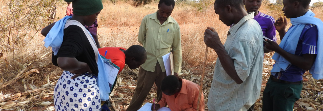
Land tenure and property rights is another emerging area where mobile technology can enhance development in powerful ways. USAID’s Mobile Applications for Secure Tenure (MAST) initiative is empowering rural communities to define, map, record, and document their land and resources. MAST combines participatory approaches and mobile technology platforms with on-the-ground training to engage communities to map and document land and resource rights through efficient, transparent, and accurate processes. Significantly, these communities are applying this technology more efficiently than more traditional methods and at scale.
The MAST approach is comprised of easy-to-use mobile phone and tablet applications, combined with a robust data management platform, which captures and manages land information that can include names and photos of the people using and occupying land, details about what the land is used for, and information regarding occupants’ claims to land. In addition, on-the ground training of community members builds their capacity to document and manage information about land and resource rights, while participatory approaches ensure that communities understand those rights.
In Burkina Faso, the MAST approach proved to be roughly nine times faster than traditional methods. With MAST tools in hand, and in partnership with the community members, the country’s Rural Land Service required only four months to complete the process of mapping 2,638 parcels in four villages, with verifications averaging 30 minutes each. In comparison, using traditional methods, the same authorities mapped only 3,706 parcels over a four-year period.[2]
By working in tandem with community members—especially youth—MAST enables citizens to map and document their own land and resources in less time, while promoting community autonomy in land tenure processes. For instance, MAST has been implemented on a variety of time scales; the technology can be deployed to map an area intensely for a short time, or more gradually over longer periods of time. Paired with community ownership, this means that the technology is flexible enough to meet the needs of the community.
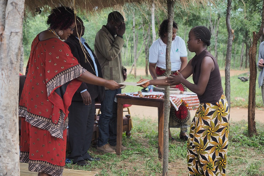
Chieftainess Mkanda distributes land certificates documented through MAST in Zambia’s Eastern Province. Photo: USAID Tenure and Global Climate Change Program.
Efficiencies in mapping are also evident through entire certification processes in Burkina Faso, Tanzania, and Zambia, demonstrating that MAST is a scalable tool. As MAST implementations scale up, the duration between demarcation and certification shortens. MAST allows the certification process to become more efficient as time passes. In contrast, traditional processes generally do not become more efficient over time because of their reliance on older technologies, significant labor, and time-intensive manual processes.
Thus, despite MAST having higher upfront costs related to adapting or customizing the technology suite to specific land tenure context, its significant efficiency gains over time have allowed implementers to leverage mobile tools and citizen-centric approaches for replication and scaling regardless of the context. Ultimately, the MAST approach is not only a rapid and scalable tool, it also becomes more efficient over time as users become familiar with the technology. And this means that land documents get in the hands of the landholders even sooner.
To learn more about MAST, visit USAID’s MAST Learning Platform at:
[1] Haruna Issahaku, Benjamin Musah Abu & Paul Kwame Nkegbe (2018) “Does the Use of Mobile Phones by Smallholder Maize Farmers Affect Productivity in Ghana?”, Journal of African Business, 19:3, 302-322. [2] A Mobile Application to Secure Land Tenure, Michael Graglia and Christopher Mellon, Aug. 3, 2017 (https://www.newamerica.org/future-property-rights/blog/mobile-application-secure-land-tenure/); Issifou Ganou, Medard Some, Raymond Soumbougma, and Anne Girardin, Using Mobile Phones, GPS, and the Cloud to Deliver Faster, Cheaper, and More Transparent Land Titles: The Case of Burkina Faso. Paper prepared for presentation at the “2017 WORLD BANK CONFERENCE ON LAND AND POVERTY,” The World Bank – Washington DC, March 20-24, 2017.
This blog post was originally published on the DAI website.
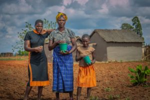
After Monika Lalika’s husband passed away, her in-laws did not allow her to use the land he had left her and she used to worry that they would one day claim the property for themselves. For Martha Paulo Mwilongo, a land dispute with her neighbor kept her from selling or renting part of her 11 acres to pay her children’s school fees. Joti Kihongo wanted to expand his general store, but could not get a large enough loan because banks would not recognize his undocumented land as collateral.
This lack of official land documentation is not unusual in rural Tanzania, since property in most villages is handed down from generation to generation, typically through male family members. However, for Monika, Martha, and Joti, and thousands of Tanzanians like them, this historically informal system of land ownership had become an impediment to their ambitions.
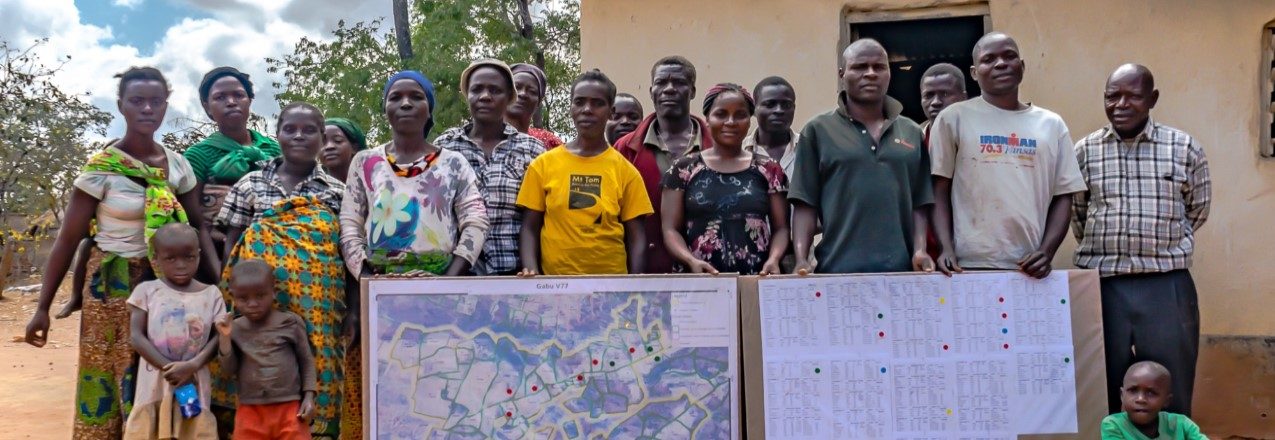
All that started to change after the Feed the Future Tanzania Land Tenure Assistance (LTA) project began holding meetings in their villages. The U.S. Agency for International Development project works with 41 communities in central Tanzania to register land and issue Certificates of Customary Right of Occupancy to individual landholders, with a focus on increasing women’s inclusion in property ownership. LTA has worked with villages to demarcate and digitally map and record almost 63,000 parcels. These previously undocumented parcels are now registered in the country’s official land registry system, providing secure property tenure to 21,000 Tanzanians. Read the full story
This blog post was originally published on the World Bank’s Sustainable Cities blog.
More than 1,000 years.
That’s how long recent estimates suggest it would take in some developing countries to legally register all land – due to the limited number of land surveyors in country and the use of outdated, cumbersome, costly, and overly regulated surveying and registration procedures.
But I am convinced that the target of registering all land can be achieved – faster and cheaper. This is an urgent need in Africa where less than 10% of all land is surveyed and registered, as this impacts securing land tenure rights for both women and men – a move that can have a greater effect on household income, food security, and equity.
Perhaps one of our answers can be found in rural Tanzania where I recently witnessed the use of a mobile surveying and registration application. In several villages, USAID and the government of Tanzania are piloting the use of the Mobile Application to Secure Tenure (MAST), one of several (open-source) applications available on the market. DFID, SIDA, and DANIDA are supporting a similar project.
The LandPKS app (landpotential.org) helps users make more sustainable land management decisions by assisting users to collect geo-located data about their soils, vegetation and site characteristics; and returning back to users useful results and information about their site. The LandPKS app is a global app that can be used in any location around the world. As visible on the LandPKS Data Portal (landpotential.org/data-portal/), there have been LandPKS sites completed on 6 continents!
While being a global app has major advantages, it also comes with design challenges in order to assist our global users. In order to address this, we have developed three major design guidelines:
1. Simplicity
2. Usability
3. Usefulness
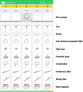
In order to maximize simplicity, the LandPKS team aims to minimize the number of components and screens. We aim to break tasks into manageable chunks so that users are not overwhelmed. Additionally, we strive to have the LandPKS app be as visual as possible by using simple graphics and charts. For example, in the vegetation monitoring module, LandCover, users select vegetation types based on simple images.
Selection of vegetation and cover types in the LandCover module of the LandPKS app. Users choose from these simple images to determine what types of vegetation are present at their site.
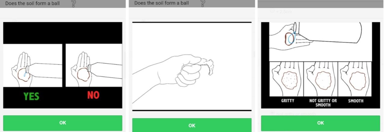
In order to maximize usability of the LandPKS app we aim to design the navigation of the app to be intuitive and seamless. Most importantly, the LandPKS app is designed and built to be useable by non-technical experts. Therefore, we aim to use minimal technical language, include question marks with brief text and/or graphical explanations, and include explanatory videos when needed. For example, in the LandInfo module, we include videos that help explain how to hand-texture the soil for a user who is not a soil scientist and may be unfamiliar with how to hand-texture the soil.
Lastly, we focus on the usefulness of the LandPKS app globally. This includes soliciting feedback from our users in order to help mold the LandPKS app to meet their needs. The LandPKS team conducts a bi-annual online user survey to gain feedback about various components of the app. We also spent a month in Tanzania last year testing the app with smallholder farmers and agricultural extension agents, making sure they found the app useful and were able to understand the outputs.
While the effort to create a global app is guided by the three steps outlined here, it is still very much a work in progress. The LandPKS app Version 3.0 is free and available now on the Google Play Store and iTunes Store. Learn more about the LandPKS app on the landpotential.org website. The LandPKS app was developed by the LandPKS Team for the Land-Potential Knowledge System (LandPKS) with support from USAID and USDA-ARS. Please contact us at contact@landpotential.org with any questions, comments, or feedback.
In lieu of our weekly scan of recent land tenure and resource management media items, we are highlighting the latest content on LandLinks at the end of each month. In case you missed it, here is a roundup of the new content on LandLinks, from USAID land-related project documents to blogs by our land experts, and more:
7 Ways USAID is Strengthening Land Rights (3/21/18) – Written by Carrie Thompson, Deputy Assistant Administrator, USAID Bureau for Economic Growth, Education and Environment (E3)
USAID’s Land Technology Solutions Project (LTS) has recently completed a comprehensive update to Mobile Applications to Secure Tenure (MAST) which uses innovative technology, including GPS enabled phones and tablets, to efficiently and effectively document land rights. Countries, communities and companies interested in meeting their commitments to establish deforestation-free value chains, boost agricultural productivity, quickly inventory land and document holdings or clarify and document land uses can now harness a much-improved suite of tools to expedite their work.
LTS now provides a suite of integrated support services to USAID Missions to promote and scale the use of MAST worldwide. LTS services focus on meeting the needs and interests of USAID Missions and their implementing partners to achieve host country strategic development objectives, including those outlined in the Global Food Security Strategy, the USAID Gender Equality and Women’s Empowerment Policy, and the USAID Biodiversity Policy. The tool is yet another example of how USAID works as a catalyst to help others, including civil society, corporate partners and other governments, expedite their efforts to achieve development goals and create a durable path out of poverty.
What is MAST?
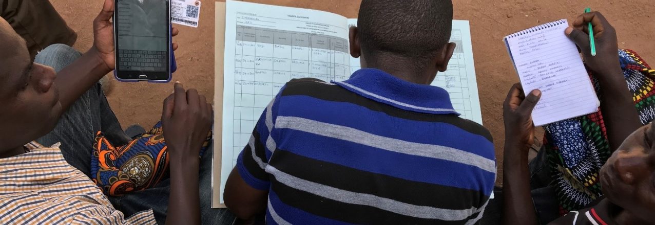
USAID’s MAST is a suite of innovative technology tools paired with inclusive training and approaches that use mobile phones and tablets to efficiently, transparently and affordably map and document land and resource rights. MAST can help people and communities define, record and register local land boundaries and important information, such as the names and photographs of people who use the land and information about how they use it. MAST combines an easy-to-use mobile phone application with a participatory approach that empowers citizens in the process of understanding, mapping and registering their own rights and resources.
The MAST application provides a suite of tools to support the collection and management of land rights information, including a mobile application to capture land rights information in the field and a back-end land rights data management application with tools to manage an inventory of land information. MAST Mobile is an Android mobile application.
Since 2014, MAST has been used by stakeholders in Tanzania,Zambia and Burkina Faso, to clarify and document claims to land. In these countries, MAST has provided transparent and effective mechanisms to improve land governance, build institutional capacities, engage citizens and help them understand their rights and responsibilities.
Enhanced Technology
Over the last eight months, LTS has refined and improved MAST technologies and approaches. LTS has updated key components of the MAST software application framework and upgraded the MAST data model from Social Tenure Domain Model (STDM) to more common standard Land Administration Domain Model (LADM). With an updated Data Model, MAST is now more compatible with models used in larger, more formal land administration or registration systems.
Enhanced Land Record Management
A more robust land registration module has been integrated into MAST based on feedback and lessons learned in Tanzania and Burkina Faso. In these countries, users identified the need for a land registration module. This has been integrated and configured to manage a series of prototypical subsequent land registration transactions such as transfers, sales, leases and mortgages. The modular nature of its integration into MAST provides enhanced functionality, and an important base for country-specific customization, but doesn’t reduce its flexibility and responsiveness for community mapping.
Improving Efficiencies and Eliminating Errors
To improve data capture of individual land holdings, a tasking and data collection manager has been implemented in MAST. The tasking manager does away with the need to manually assign work areas to surveyors and uses integrated geospatial tools. Integrated tools allow users to define and assign work allocation units to surveyors to increase efficiencies and avoid capture of redundant data. To further address issues associated with online data management and mapping tools on slow and unstable internet connections, a QGIS plugin has been modified to be used with MAST. Integrating QGIS tools allows administrators the ability to download geospatial data, utilize QGIS to edit data in offline mode and to sync data back to the main MAST database. Such editing functions have been augmented by the integration of topology tools that can be used to flag and check errors.
Extending Tools for Resource Management
The MAST mobile application has also been updated. The parcel mapping tool has been extended to incorporate tool sets derived from USAID’s Land Tenure Assistance program in Tanzania, which extended MAST to include more robust data editing functions and to document new, existing and/or disputed claims to land. MAST mobile has also been linked via Bluetooth connection to several consumer-grade GPS tools to improve accuracy of mapping available on native mobile devices. Most importantly, MAST Mobile has recently been extended to include a resource mapping module. The resource mapping module uses a hybrid land classification system to collect resource information such as point of interest, road networks, forest areas or water bodies to enrich the base data in MAST and the availability of data to communities.
Continued Deployments, Continued Refinements
These improvements to MAST will enable users to capture and process land and resource rights more efficiently, although MAST still requires technical knowledge and advanced skills to set up and configure.
As the suite of tools is used in other geographies and for new purposes, LTS will incorporate new features and/or improve existing ones. And as an open source project, MAST will be continually improved upon and updated. LTS will maintain a core MAST platform and incorporate the best of these improvements.
LTS will continue to work across organizational boundaries to make MAST a truly global tool, and an empowering experience, to address land tenure insecurity.
The Land Potential-Knowledge System (LandPKS; landpotential.org) team is happy to announce that we have released a new and improved version of the LandPKS app. This new version is a result of months of hard work for everyone on our team, as well as helpful feedback from our users around the world. The LandPKS app helps users make more sustainable land management decisions by assisting users to collect geo-located data about their soils, vegetation and site characteristics; and returning back to users useful results and information about their site. It also provides free cloud storage and sharing, which means that you and others can access your data from any computer from our Data Portal at portal.landpotential.org. The LandPKS app does not require a data connection to be used, and users can upload their data when they next have connectivity. The LandPKS app includes two modules: LandInfo and LandCover. The LandInfo module walks a user through how to determine the texture of their soil, which is critical information for smallholder farmers and can help them plant crops suitable to their soil type. The LandCover module walks a user through how to collect vegetation cover data, important for vegetation monitoring and ecosystem restoration. The LandPKS app Version 3.0 is free and available now on the Google Play Store and iTunes Store.
What’s New?
Updated and improved user interface
Easy navigation between data input and report (results) screens
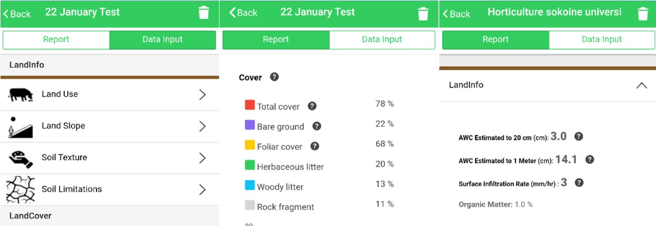
Graphical LandCover results including cover trends over time
Graphical LandInfo results with a table of texture and rock fragment volume by depth
Available Water Holding Capacity and Infiltration calculations for your soil
Upload data to the Data Portal at any time by hitting the “Synchronize Now?” button
Other Improved Features Include:
A simple, primarily graphics-based interface that minimizes language and literacy requirements
Embedded tutorials and explanations to guide the user through the app
Learn more about the LandPKS app on the landpotential.org website. Training resources, including guides and online trainings, are also available on the website. The LandPKS app was developed by the LandPKS Team for the Land-Potential Knowledge System (LandPKs) with support from USAID and USDA-ARS. Please contact us at contact@landpotential.org with any questions, comments or feedback.
In dozens of countries, we’re addressing a wide range of issues, including conflict minerals, women’s rights and policy reform
Around the world, millions of people, communities and businesses lack secure rights to one of their most important economic assets — land.
Up to 70 percent of land in developing countries is unregistered and, in many countries, the systems that govern land access and property rights are weak or ineffective. For women, who generally have less access, control and ownership of land than men, this insecurity impacts them disproportionately.
Weak property rights and poor land management represent fundamental barriers to our top priority at USAID — advancing free and prosperous societies that progress beyond the need for foreign assistance. Also, given the role it plays as a source of wealth and power, land is often at the center of violent conflicts.
The evidence is clear that strong property rights are an essential foundation for economic growth and responsive democratic governance. And from Colombia to Kosovo, experience has shown that resolving land disputes and clarifying property rights can help reduce tension, create lasting stability and set the stage for productive investments and economic growth.
So, what is USAID doing to advance land rights around the world? The answer is — a lot!
We are working in dozens of countries to address a wide range of land and property rights issues — from conflict minerals to women’s rights to policy reform. Here are seven examples of some of USAID’s most promising and effective programs from across the world:
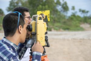
Land surveyors document property boundaries in Meta, Colombia with the support of USAID. / Jeremy Green, USAID
1. Formalizing property rights in post-conflict Colombia
Land issues were at the heart of Colombia’s long-running violent conflict, displacing an estimated 6 million people and leaving large portions of the country essentially ungoverned. Now, with a landmark peace agreement in place, USAID is working to help resolve critical land issues by supporting the Government of Colombia to formalize property rights across the country, organize the national land registry and return land to those who lost it in the civil war.
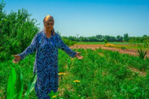
A woman in Tajikistan proudly displays the crops growing on her land. / Sandra Coburn, The Cloudburst Group
2. Enabling a land market to take root in Tajikistan
Transitioning from Soviet-style collective farms to property rights for individual farmers and a fully functioning land market are essential steps for unlocking Tajikistan’s economic growth potential and setting the country on a path to greater self-reliance. USAID is supporting land policy reforms and capacity building programs that are enabling a nascent land market, in which individual land use rights can be bought and sold, to take root.
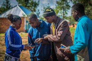
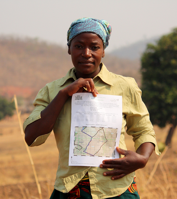
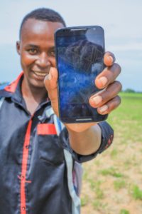
A Tanzanian youth proudly displays USAID’s Mobile Application to Secure Tenure, a simple smartphone-based mapping tool for documenting land rights. / Freddy Feruzi for USAID
3. Documenting land rights in Tanzania with a mobile app
In rural Tanzania, USAID is using an inexpensive mobile phone-based mapping app to document land rights. Traditional land surveying equipment and processes can be very expensive and time consuming. To map and document all of the unregistered areas in rural Sub-Saharan Africa using traditional methods would take decades and cost billions. USAID’s low-cost solution has produced remarkable results — 15,000 land certificates issued to date, many to women who had been locked out of land ownership in the traditional system.
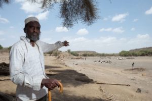
A pastoralist points to his herd of animals in Afar, Ethiopia. / Antonio Fiorente for USAID
4. Reducing tensions between farmers, herders in Ethiopia
Disputes over land access and grazing rights have long been a source of conflict between farmers and herders in Ethiopia. Since 2014, USAID has been working with pastoral herding communities to certify their rights to rangelands, building on successful previous work certifying farmers’ land use rights. Clarifying and documenting the rights of each group is helping reduce tensions and create incentives for investments and economic growth.
In Liberia, as in much of the world, women have less access and control of land than men. / Ben Ewing, The Cloudburst Group
5. Ensuring Liberian women’s land rights
Even when countries enshrine protections for women’s land rights in national laws and policies, traditions and customs can block women from actually exercising their rights. That’s why USAID is working with Government of Liberia and community leaders to address the complex mix of social and institutional barriers to women’s land rights that persist despite the country’s progress on legal reforms. This nuanced approach is working to change behavior on the ground, not just amend laws on the books.
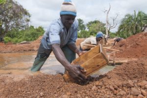
Artisanal miners sifting for diamonds from a deposit outside of Bobi, Côte d’Ivoire. / Moustafa Cheaiteli for USAID
6. Reducing conflict over minerals
Competition over scarce minerals like diamonds and gold has driven destabilizing conflicts in countries like Cote d’Ivoire, the Central African Republic and the Democratic Republic of the Congo, with property rights struggles often at the core of these disputes. USAID is working in these three countries to reduce conflict over minerals, including by clarifying property rights and access to subsurface resources for small-scale miners.
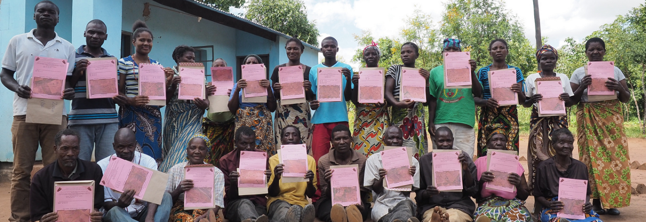
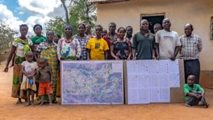
A community in Zambia’s Eastern Province proudly displays the maps resulting from USAID-supported community participatory mapping efforts. / Sandra Coburn, The Cloudburst Group
7. Using participatory community mapping
When it comes to land rights, sometimes the best solutions come from the ground up. In Burma, Ghana, Paraguay, Vietnam and Zambia, USAID is using bottom-up participatory community mapping to directly engage land users who have traditionally been overlooked. This will help empower land users themselves with the tools and understanding to better control and manage their own resources.
 Asiah Samila is a farmer with five children. She lives in Mlanda, a village located outside Iringa in central Tanzania.