USAID and its partners have used MAST across multiple countries to improve land and resource governance and to achieve multiple objectives ranging from women’s empowerment and food security to climate change mitigation and biodiversity conservation. Here’s where the MAST approach has been used thus far:
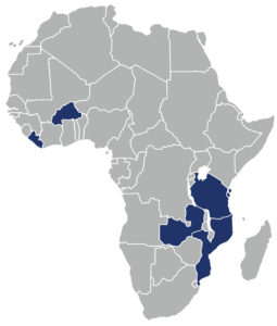
Tanzania
Burkina Faso
Zambia
Liberia
Mozambique
Click or scroll down for more information on how each country used MAST.
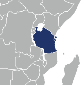
Tanzania
Cross-sectoral uses: In Tanzania, USAID and its partners have used MAST to promote land tenure security, women’s empowerment, food security, biodiversity conservation, conflict mitigation, land use planning, and water tenure objectives.
Examples in practice: As part of the Tanzania Land Tenure Assistance (LTA) Activity, USAID/Tanzania used MAST to deliver nearly 100,000 customary certificates (CCROs) between 2016 and 2021. The UK Foreign, Development and Commonwealth Office (FCDO) has adopted the MAST approach for its own land programming, delivering another 300,000 CCROs.
The Jane Goodall Institute is using MAST to conduct land use planning and issue CCROs in four communities as part of the Landscape Conservation in Western Tanzania (LCWT) project, which is working to protect chimpanzee habitats in Tanzania’s Kigoma and Katavi Regions.
USAID’s Water Resources Integration Development Initiative, which worked across multiple regions of Tanzania to address water scarcity and climate change impacts, also used MAST to assist with land use planning in villages that were experiencing land use conflicts.
And the Lawyers Environmental Action Team (LEAT), a Tanzanian NGO, is using MAST to assist with land use planning as part of its Resilient Natural Resources Governance project in southwest Rukwa Region.
Burkina Faso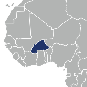
Cross-sectoral uses: In Burkina Faso, USAID and its partners have used MAST to promote women’s land rights, land tenure security, food security, and conflict mitigation objectives.
Examples in practice: In Burkina Faso, the National Land Observatory adopted MAST to collect demographic and tenure information, and customized the user interface to include French-language forms needed by local land offices and cadastral agents to secure land rights. The MAST approach mapped and documented customary land holdings roughly nine times faster than traditional mapping and surveying techniques. Also in Burkina Faso, USAID’s Amélioration et Sécurisation des Terres vers la Résilience project has since scaled the use of MAST to 30 villages.
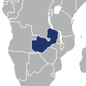 Zambia
Cross-sectoral uses: In Zambia, USAID and its partners have used MAST to promote land tenure security, women’s empowerment, food security, biodiversity conservation, and land use planning.
Examples in practice: In Zambia, USAID’s Integrated Land and Resource Governance (ILRG) program used MAST to map nearly 40,000 parcels in over 900 villages in customary land areas, registering the land rights of more than 163,000 people. The MAST approach in Zambia brings community level information together with government records and works with government, chiefs, and civil society leaders to customize MAST for local uses. This data has been used to develop local area plans with the district government, resolve long-standing disputes, empower women as local leaders, and improve wildlife planning.
Liberia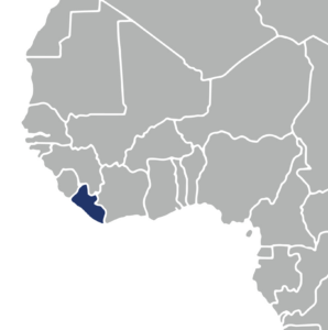
Cross-sectoral uses: In Liberia, USAID and its partners have used MAST to promote land tenure security, forest and biodiversity conservation, land use planning, and conflict mitigation objectives.
Examples in practice: In Liberia, USAID’s Land Technology Solutions project used MAST to help communities living in and around the Blei Community Forest to document their forest resources. The pilot demonstrated a new model for community forestry programming based on the MAST approach and technology, with a particular emphasis on community-level engagement. Prior to MAST, two-thirds of community members said that they understood the process for documenting their forest resources. But after the MAST pilot was implemented, that number grew to 96 percent.
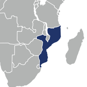 Mozambique
Cross-sectoral uses: In Mozambique, USAID and its partners have used MAST to promote land tenure security, women’s empowerment, economic growth, and agricultural productivity objectives.
Examples in practice: In Mozambique, USAID’s Integrated Land and Resource Governance (ILRG) program has implemented MAST via a platform called CaVaTeCo to map and register communal and individual land rights throughout the country. The local MAST platform is open-source, adaptable to many different contexts, and offers robust data access and security through cloud-based storage, allowing for widespread deployment in Mozambique. An easy roll-out of MAST for new projects, partners, and geographies has led to its use by nine organizations in five provinces across Mozambique’s northern, central, and southern regions. Local partners have used MAST to map and register land rights for over 40,000 beneficiaries in parallel with other development goals.
To learn more about MAST, contact Ioana Bouvier, USAID Senior Geospatial Analyst