Geospatial analysis of landscapes can reveal important patterns and relationships between natural systems and human socio-economic systems, providing insight and evidence for more effective program design.
Critical steps in environmental program design include analyzing the interlinked characteristics that comprise and shape landscapes, developing a theory of change, and clarifying intended outcomes. As the availability of timely and relevant data has improved, geospatial analysis has become a powerful tool to highlight connections between development sectors. Spatial analysis can be used to test development scenarios and to reveal relationships not easily detected using non-spatial analytic methods.
Among other benefits, spatial data analysis:
- provides a rigorous, more holistic view of the full programming landscape;
- enables exploration of relationships between people, land and resource use, and environmental objectives;
- uncovers linkages and helps to identify entry points for integration across sectors; and
- supports evidence-based solutions to environmental challenges.
For example, geospatial analysis can be used to evaluate opposing or competing land uses, or to understand the potential impact of an intervention within a landscape.
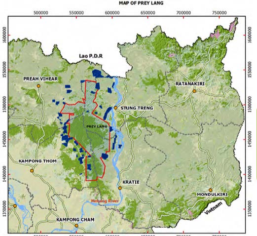
In Cambodia, USAID used spatial analysis and a landscape approach to guide decisions as part of an integrated activity design process for the extended Prey Lang Landscape. The activity encompasses biodiversity, sustainable landscape and governance/land management objectives. Spatial analysis helped to identify and prioritize landscapes, better understand resource availability and pressures, consider programming scenarios, and determine historical land conversion trends. The analysis also supported mapping of relevant USAID and other donor programs.
CROSS-SECTORAL PROGRAM INTEGRATION: LAND AND RESOURCE GOVERNANCE
Social and Spatial Aspects of Tenure
Understanding spatial connections between people and resources, including how land is owned, used, and managed, is central to meeting the objectives of USAID environment programming. As a cross-cutting issue, land tenure affects many other sectors, including:
- agriculture and food security;
- biodiversity conservation;
- climate change mitigation/adaptation and resilience;
- forest management; and
- urban development.
Consideration of the land tenure context and analysis of land tenure data can highlight potential pathways, risks, and constraints during the program design cycle. Secure land tenure and governance can contribute to improved natural resource management, ecosystem services, and other environmentally beneficial investments. It can also lead to increased farm investment, soil conservation, tree planting, land productivity and food security. Importantly, research indicates that women’s control over land can have differentiated impacts compared to men on a range of development goals. For example, studies have shown that women who were granted land rights made more conservation investments than men, and female-headed households with stronger tenure security were more likely to adopt agroforestry. Spatial analysis that incorporates tenure and gender aspects, such as size and distribution of land plots accessed by men and women, can strengthen understanding of disparities in land access or availability, and help to identify gaps or opportunities for integrated programming.
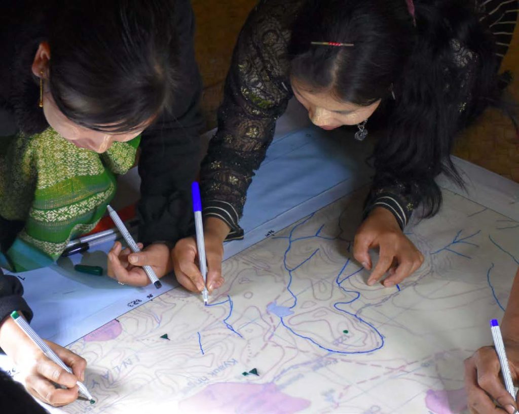
USAID and other stakeholders are increasingly using geospatial analysis and technology for crowdsourcing and community-based approaches to mapping and documenting resource rights. USAID’s Mobile Applications to Secure Tenure (MAST) process uses participatory methods and technology tools to efficiently, transparently, and affordably map and document land and resource rights. Analysis of the community-validated data produced through the MAST process enhances understanding of linkages between land tenure issues and environmental outcomes.
REFERENCES
Robinson, B.E.,Y.J. Masuda,A. Kelly et al. 2018. Incorporating Land Tenure Security into Conservation. Conservation Letters, 11(2), 1-12
USAID, 2017. Incorporating Geospatial Analysis into USAID Biodiversity Program Design. https://rmportal.net/biodiversityconservation-gateway/resources projects/measuring-impact/mi-project-resources/incorporating-geospatial-design-into-usaid-biodiversity-programming/view.
USAID, 2018. Impact Evaluation of the Tenure & Global Climate Change Project in Zambia. https://www.land-links.org/2018/03/impact-evaluation-tenure- global-climate-change-project-zambia/