USAID and NASA Support Bangladesh Land Planning for Food Security and Sustainable Development

Read the full-length op-ed published in GIS Resources magazine. This version has been edited for length and clarity.

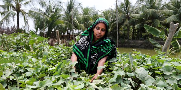
Bangladesh is a land-scarce country with a high-density population. As the majority of the population still lives in rural areas and depends on agricultural activities for their food and livelihoods, proper rural land management is critical to their well-being. However, land use changes and the impacts of climate change are rapidly reducing the amount of arable land, which has major implications for food production. Bangladesh requires an increased investment in sustainable land use planning to both increase economic growth and ensure food security for its growing population.

Since 2019, SERVIR Hindu Kush Himalaya, a joint project of NASA and USAID  implemented by the International Centre for Integrated Mountain Development (ICIMOD), has provided technical support to Bangladesh to develop and use a national land cover monitoring system to track land cover changes across the country. The land cover monitoring system uses open-source satellite imagery to generate land cover maps annually. Bangladesh uses the land cover maps to monitor forest inventory and plans to expand to using them to strengthen sustainable rural land use planning.

Changing Rural Landscapes

In villages across Bangladesh, human populations are expanding, creating greater demand for housing. To meet this demand, houses are now being built on fertile agricultural land, a limited resource. Restoring agricultural land or forest land is extremely difficult after it has been converted to other uses like housing.

Haphazard planning of rural dwellings negatively affects Bangladesh’s village ecosystems. Houses built on floodplains or canal banks cause stream bank erosion, flooding, and obstruction of water flow. Because village infrastructure cannot handle heavy rains, water accumulation causes flooding. The densely built areas also disrupt natural habitats and contribute to air and noise pollution. These risks are compounded by the impacts of climate change–Bangladesh is the seventh most affected country in the world by extreme weather events.

Detailed spatial land-use planning is critical to counter threats from changes in rural land use. Spatial land-use planning is a collective effort to develop and approve land-based activities. It provides a basis for the creation of zoning laws and defines specific uses of land that balance economic priorities with protecting the natural environment, strengthening living conditions, conserving natural resources, and  promoting social cohesion. It requires up-to-date information on how land has changed over time, such as from forest to agriculture or agriculture to urban.

How Geospatial Technologies Help

Geospatial information is a critical component of land use planning and sustainable natural resource management. Geographic information systems (GIS) integrate diverse Earth observation imagery, spatial data (including land cover maps), and information on how human activities have historically affected and currently affect land use over time. GIS also makes it possible to project how anthropogenic environmental changes may affect land use and land cover in the future. It can be used to develop suitability maps for agricultural and infrastructure development by analyzing factors such as soil type, slope, water availability, and existing infrastructure.

Land use mapping and spatial planning allow decision makers to  assess complex alternative development scenarios and model possible future changes, providing a basis for making informed, evidence-based decisions for rural land use.

Aerial views of Pirojpur villlage in 2003 and 2021 for the purpose of comparing expansion of human activity.
Satellite images show how human activities have expanded in Pirojpur village since 2003. Credit: GIS Resources

As one of the world’s most flood-prone countries, Bangladesh also needs flood risk and flood shelter suitability maps for different climate change scenarios. Geospatial data provide decision makers the information they need to choose building sites that do not encroach on productive land, are not at risk of being submerged in floodwaters, and are reachable by human populations.

Appropriate and effective land use planning, implementation, and management can ensure rural development that is sustainable, environmentally sound, and strengthens food security. SERVIR is committed to ongoing collaboration with partners in Bangladesh to achieve these goals.

This blog was originally published on Climatelinks

A Community Willing to Exchange Illicit Crops for Land Titles

USAID is helping farming families title their land and access licit economic opportunities in exchange for eradicating their coca crops.

When Víctor Ruíz heard that a massive land formalization initiative was coming to Cáceres, his municipality in Antioquia, he never imagined the impact it would have on his community. Throughout his life, Ruíz has grown coca, the main ingredient in cocaine. His family farm extends over 79 hectares, and they usually reserve three hectares for these illegal, yet lucrative crops.

But now Víctor, president of the Los Lloros community action board, will no longer grow coca. When he has his registered land title, he understands there is a range of opportunities that could benefit his family, his community, and his region.

“The most important thing for landowners is to have our land titled,” says Ruíz. “If we don’t have land titles, we can’t access state resources. We know that a plot of land that does not have its documents up to date is not going to obtain benefits.”

The Rural Property and Land Administration method was designed by USAID with contributions from the National Land Agency

A Disconnected Past

The lack of a legal connection to their property facilitates the decision to plant illicit crops, says Ruíz. When combined with the municipality’s history of violence and the lack of goods and services provided by the state, informal land markets aggravate the economic situation of thousands of farmers who feel there are no viable options to access competitive markets and improve their lives. As a result, growing coca plants is less a crime and more a sensible choice for survival. It’s a vicious circle in which the two elements of an absent government and illicit trade have inexorably led to a worsening of the security situation.

Currently in Cáceres, there are more than 600 families involved in growing illicit crops on more than 1,400 hectares, according to a study derived from the latest aerial photographs taken for updating the rural cadaster and titling properties. The current levels show that the number of hectares planted with illicit crops grew by 16 percent during the pandemic years 2020-2022, according to figures from the United Nations-funded Integrated Illicit Crop Monitoring System (SIMCI).

The formalization initiative, known as the Rural Property and Land Administration Plan (POSPR by its Spanish acronym), compiles parcel information, land use data, and strives to resolve land conflicts among neighbors. This makes it possible to update the rural cadaster, deliver property titles to landowners, and support a functioning land market, all of which contribute to the 2016 Peace Accords.

“It is no secret to anyone that, nationwide, not just here in Bajo Cauca, there is a lot of illicit cultivation,” says Ruíz. “If that plot or farm has these crops, it is logical that they will not be legalized until they are eradicated.”

original (5)

For Colombia’s National Land Agency, the Cáceres parcel sweep has made it clear just how difficult it is for some communities to go from one village to the next. Parcel sweep operators visited every parcel in the municipality, exposing the needs of locals to access legal markets with their products.

Cáceres, Center of Transformation

The Government of Colombia has selected Cáceres as the first municipality to implement the 3T Strategy, which seeks the voluntary substitution of illicit crops in exchange for the formalization of property. The three T’s stand for Titling, Transition and Transformation, and the strategy is novel because it leverages USAID’s ongoing support for land tenure programming in partnership with the Ministry of Justice and the United Nations Office on Drugs and Crime (UNODC) for compliance.

In addition to the titling of rural property, the 3T Strategy includes a plan to support food security for rural families, investments in small infrastructure projects, and funds to plan and improve agricultural projects in key value chains like cocoa, honey and dairy.

Like the family of Víctor Ruíz, more than 450 households in rural villages in Cáceres could potentially opt for land titling and support from the government over growing illicit crops. So far, over 100 families have confirmed their participation in the 3T Strategy.

“The massive property sweep is transforming lives and territory,” says Ruíz.Once the 3T Strategy has been tested in Cáceres, the government aims to replicate it in four municipalities which, together with Cáceres, concentrate 13 percent of Colombia’s coca, according to SIMCI: Puerto Rico (Meta), Santander de Quilichao (Cauca), Sardinata (Norte de Santander) and Tumaco (Nariño).

The 3T Strategy’s innovative feature is the combination of property titling, state interventions, and support from development aid with a previously invisible ingredient: the decision-making power of the communities who choose a culture of formal land ownership and responsible economic development in their villages over the short-term benefits of illicit crops.

Reaching communities with these services depends on the leadership of people like Víctor Ruíz. As president of the community action board, Ruíz was involved in the parcel sweep as a community manager. His role is to motivate local residents to voluntarily eradicate coca crops. His participation is fundamental to making them see why obtaining a registered land title is what they have dreamed of for years.

The land titling component of the 3T Strategy has already begun delivering land titles to rural families in Cáceres and will continue throughout 2023.

Like Víctor, there are 20 social leaders who worked in the massive property sweep as community managers in Cáceres. Edid Medina is a community manager and president of the community action board in the village of Vijagual. She also encourages her community to voluntarily eradicate coca and plant other crops such as cassava and corn on their land. For her, having a title deed to her land represents hope and is the document that supports her when she needs to acquire a loan or apply for a subsidy to improve her home.

“After uprooting the coca, what we have is a grass pasture. Right now, we are planting corn, rice and cassava. I have the hope that you can go to any bank, anywhere, and with a land title, you don’t come empty-handed, you come with hope,” she says.

A Voluntary Choice

In 2023, following the finalization of the land sweep and the validation of over 11,500 parcels, the National Land Agency began holding public hearings, which is a final step before land titles are emitted. In the first public hearing, where more than 150 people attended, and17 families that grow illicit crops signed agreements for voluntary eradication.

original (8)

In Cáceres, POSPR implementation identified 1,263 parcels covering 58,600 hectares that are subject to agrarian reform processes, and 1,024 applications for access to land by landless families.

Women’s Land Rights Champion: Serge Ramanantsoa

This interview with Serge Ramanantsoa, USAID/Madagascar, is part of USAID’s Land and Resource Governance Division’s Women’s Land Rights Champions series, which profiles staff across USAID Missions and operating units who are working to advance women’s land rights.

Tell us about yourself

Serge Ramanantsoa headshot
Serge Ramanantsoa, USAID/Madagascar

My name is Ramanantsoa Serge and I hold several roles in the Sustainable Environment and Economic Development (SEED) office: Project Management Specialist / Climate Integration Lead for USAID/Madagascar, the point of contact for the Mission regarding land issues, and activity manager for the Integrated Land and Resource Governance (ILRG) activity in Madagascar. Our USAID SEED office is responsible for all programs related to the preservation and protection of biodiversity, sustainable landscapes, climate change, and the fight against wildlife trafficking while also improving the living conditions of local communities through cooperation with the private sector. In my former work at UN Habitat Madagascar, I investigated land tenure and land planning for slums located around large and medium cities in Madagascar. This experience allowed me to share my knowledge with the ILRG activity to carry out analyses on the complexity of land and resource governance in Madagascar, and then develop a roadmap for land tenure considering women’s access to land and the preservation of watersheds and forests.

Why are women’s land rights and resource governance important to your work? And to other USAID development work?

Women’s land rights and resource governance are important to our work in the Sambirano Valley of Madagascar, and to USAID, because women occupy important roles in the Malagasy community– specifically related to the collection of wood for energy, collection of water, and providing education for children. Yet, women’s access to land and leadership positions are limited by culture and customs in addition to their rights to crucial resources and access to income-generating activities needed to meet their families’ daily needs. This is especially true in the case of single mothers. 

One way we work to counter this issue is by ensuring ample participation by women in our development activities and ensuring that there is equal representation of women to men within the target communities that we reach. We also work to build the participation of women in leadership boards of the communities and organizations that we work with, and increase the rates of women’s land ownership. 

What are some of the biggest challenges in helping women secure land rights and what are some things being done to overcome them?

The biggest challenges are the exclusionary customs that make it difficult for women to inherit land, and high rates of illiteracy.

To overcome the challenges, USAID/Madagascar conducts educational awareness campaigns on land rights, which has been customized to address the needs of those who are illiterate, to change existing customs and exclusionary mentalities. In addition, we are working on systematic integration of women into local community organizations so they can advance in land acquisition procedures. These activities, as well as others, are reported on the GNDR-2 (Gender Equality/Female Empowerment) indicator, which details the percentage of female participants in U.S. government-assisted programs for the sake of increasing access to productive economic resources (assets, credit, income or employment).

What are some of USAID’s successes in the area of women’s land rights?

Some specific successes so far have been the constitution and promotion of Women Land Leaders (WLL), then the integration of WLL in the consultation, advocacy and decision-making platform (FIVEDISAB “Sambirano Women’s Association”) on land issues in the Sambirano Valley.

FIVEDISAB has developed a plan for monitoring and strengthening its structure and has received support for insertion in the national networking platform with the SIF (national platform of civil society working in land).

There has also been support for the updating and official regularization of administrative documents which improve access to resources (especially land) for women.

Returning the Land they Own

The Municipality of Santander de Quilichao is delivering land titles and improving compliance with land restitution rulings

In the early 2000’s, the small town of Lomitas, located in southern Colombia, was the epicenter of several years of paramilitary operations. The violence took the lives of many and displaced hundreds more. When residents returned to their lands, their crops were destroyed and their animals were gone. What’s worse, their properties were in the hands of several sugarcane companies.

Orfanis Sandoval returned to Lomitas in 2008 to find her house had been destroyed. Sandoval’s land was first owned by her grandfather more than 60 years ago. Her father inherited the land, and she and her siblings inherited it from her father.

“Before my father died, my siblings and I decided who would get what pedacito (piece) of land. We worked hard and built what we could,” explains Sandoval.

In 2012, with the support of Colombia’s Land Restitution Unit, the Sandovals and the people of Lomitas began a multi-year legal battle to recover their land and seek compensation for their suffering. Over the years, restitution judges have issued several rulings in their favor, including orders for reparation measures that benefit the entire community. More than 20 restitution rulings have come down in favor of the town, including one that requires the Government of Colombia to title their property.

Orfanis Sandoval (right) and her neighbor, live in Lomitas.

The Guarantees of a Land Title

The titling of the victims’ property is an essential part of land restitution rulings and provides people with a guarantee that their property cannot be stolen from them again. In 2023, Orfanis Sandoval and some of her neighbors received the land titles that were promised to them under the restitution rulings. The land titles, which were delivered more than five years after the initial ruling, may have taken longer if it weren’t for the efforts of the Municipal Land Office.

The municipality of Santander de Quilichao is the main city in the mountains of northern Cauca, approximately 80 kilometers south of Cali. The Municipal Land Office was created in 2017 with USAID support and plays a prominent role in land administration as liaison with Colombia’s National Land Agency as well as with the victims of Lomitas.

Equipped with the capacity to quickly survey a property or research the history of a property deed, the land office team overcomes the typical challenges associated with land administration in Colombia, and they do it from the Municipal building.

The Santander de Quilichao Municipal Land Office has delivered over 600 land titles and mobilized nearly US $15 M in public funding for infrastructure and city improvements thanks to secure land tenure.


“The mere presence of the Land Office is important. We are the social workers who reach out and coordinate with victims in Lomitas, and we provide assistance to the National Land Agency when they come to make technical visits to the parcels being titled,” explains Bernardo Pinzón, a social worker in Santander de Quilichao’s Municipal Land Office.

Over the last decade, USAID has invested resources and expertise to strengthen Santander de Quilichao’s capacity to respond to land restitution rulings. USAID helped create a localized Land Restitution Subcommittee, which supports compliance with restitution rulings. Thanks to the land administration experts embedded in the administration, the municipality has developed and implemented a portion of the collective and individual measures contained in the ruling, proving to be crucial for the community.

The Municipal Land Office has formalized community spaces such as the soccer field, and the municipality built a children’s playground. USAID and the municipality have also organized service fairs in the community, where health entities offered vaccinations to children and adults, dentists provided check-ups, and banks offered financial products.

“Knowing that the public spaces of Lomitas have been legalized by the Municipality gives us the chance to enjoy them without worrying about landowners showing up to claim they own the land,” explains Orfanis Sandoval. “We have more confidence to hold community events.”

Santander de Quilichao's Municipal Land Office Team

“Now we are the owners of the property, and they can’t take that right away. Now we can plant our gardens without fear. We can have chickens. We can invest in ourselves and not feel like we could lose it all again.

Our community feels that the Municipality has been aware of our issues. And we hope that more residents will get the same opportunity.”

-Orfanis Sandoval, Community Leader in Lomitas, Santander de Quilichao

A Future of Forests

USAID is providing the Colombian government with the tools to improve land administration and reduce deforestation in the Amazon

More than half of Colombia is forested, and the majority is concentrated in the Amazon. The country’s forests are one of its most valuable resources, but are threatened by the expansion of cattle ranching, illicit crop plantations, and illegal mining. All of these activities drive deforestation and put rural communities in a vulnerable position.

In the northwestern corner of Colombia’s Amazon rainforest, the government is fighting land grabbing for cattle ranching in an attempt to protect the ecosystems and biodiversity of the country’s treasured wilderness. As land is cleared, ranchers dig deeper towards protected areas like the Chiribiquete National Park, a UNESCO World Heritage Site covering more than 4 million hectares.

The National Park includes 13 geomorphologically distinct types of tepuis as well as arches, labyrinths, and caverns. (PNN Colombia)

A 2021 special investigation by the International Environmental Agency found a connection between illegal deforestation and the region’s armed conflict. According to the investigation, illegal cattle production has increased threefold since 2015, and in a four-year period, 17,000 hectares were cleared in the buffer zones surrounding areas of Chiribiquete National Park.

To counter deforestation, the government first requires knowledge about land and forest use in these areas. The USAID Land for Prosperity Activity is providing the government with tools to improve land administration in and around the park, starting with updating the cadaster of the Chiribiquete National Park and its buffer zones.

Chiribiquete is home to many iconic species including Jaguar, Puma, Lowland Tapir, Giant Otter, Howler Monkey, Brown Woolly Monkey. A high level of endemism occurs, and the number of endemic species is likely to rise substantially once new research programs are implemented. (Photos: PNN Colombia)

“The country needs to know how much land we have, which of it is public and which is private, how much it is worth, how it contributes to productivity, environmental conservation and the country’s development.”

Gustavo Marulanda, Director of Colombia’s catastro authority IGAC.

USAID has supported the government with high-quality aerial photography, on a scale of 1:10,000, of more than 500,000 hectares of land currently occupied by rural families in Chiribiquete’s buffer zones. With more accurate photography, the government can improve deforestation monitoring, community engagement, and law enforcement.

Proper land use management and administration in protected areas like national parks disincentivizes illicit crop cultivation. The strategy is based on the logic that addressing land tenure issues and strengthening sustainable rural development will disincentivize further deforestation and promote biodiversity conservation and climate change mitigation.

“The Government of Colombia conducts periodic flights to identify the deforestation and illegal occupation areas. These are public parcels that need to be identified to control and restore the area while reducing the possibility of affecting the natural and cultural heritage.”

-Carolina Jarro, deputy administrator in the National Parks Authority.

In the remaining area of Chiribiquete, USAID is supporting aerial photography to survey more than 3.7 million hectares. The scale of the aerial photography for the forested areas of the park is 1:50,000. Once the entire area has been surveyed, the government will validate the information only after carrying out free, prior, and informed consent methodologies with indigenous groups living in the park.

“Protecting the uncontacted indigenous groups in this territory is a challenge because of the risk of cultural loss after contact with land grabbers,” explains Jarro.

Despite the fact that limited scientific research has been undertaken in the property, data available shows that 2,939 species have been recorded, according to the UNESCO. (Photos courtesy of PNN Colombia and Colombia Oculta).

In the Limelight

A USAID facilitated Public Private Partnership looks to expand production and market linkages for lime producers in the Eastern Plains of Colombia

Colombian Limes

From mojitos to margaritas, limes have played a role in how society interacts for generations. Today, limes are ubiquitous with bars and restaurants and featured in cuisine across the globe thanks to a unique citrus taste, and the demand for limes grows every year.

Limes are one of Colombia’s top three fresh fruit exports behind banana and avocado, and over the last decade have become a cash crop for thousands of fruit farmers. The Tahiti lime (Citrus latifolia) is the most prevalent species grown in Colombia.

Due to Colombia’s varied climates and elevations, lime exports nearly doubled in the four-month period of January to April 2022, compared to the same period in 2021, according to government data. In 2021, Colombian farmers harvested more than 257,000 tons of lime from 17,500 hectares of orchards.

The Department of Meta, which is one of Colombia’s most important food growing regions, represents just 8% of the total. In Meta, which is known for sweeping plains and rivers, there are only seven lime orchards with export registrations and a lot of room for growth.

There are only seven lime orchards with export registrations in the Department of Meta, located in the Eastern Plains of Colombia.

“In Meta, if you want it, you can get it. The tahiti lime from Meta is good and a new product for many farmers here. I want to tell everybody about this big opportunity that is just beginning to be recognized internationally,” says Julio Eastman, CEO of Merlet, a Meta based fruit processor and exporter.

The Lime PPP

Thanks to a public-private partnership facilitated by USAID Land for Prosperity, Meta’s lime farmers are getting the chance to improve their businesses and access export markets. The PPP, which is valued at more than US$ 450,000, initially targets over 100 growers from Puerto Lleras and Puerto López municipalities.

Under the PPP, these two groups of smallholder farmers will receive new skills and knowledge about tree maintenance, post-harvest processing, and agribusiness to improve the management of 120 hectares of lime orchards. Two fruit exporters, including Merlet, signed onto the partnership to provide farmers with market channels abroad like Europe and USA.

In Meta, farmers face issues with proper orchard management, a lack of technical support, and little investment in irrigation systems. With no collective marketing schemes, each producer must pay logistical and operational costs to bring the product to the local market.

“Meta’s growers are facing challenges to deliver larger quantities on time and with traceability, that is, certification,” explains Eastman. “The opportunity is to work together on large deliveries. There is a lot of land in Meta, and the lime has already proven that it is a good product that our customers like and want more.”

original (7)
The Lime PPP in Meta seeks to strengthen the lime value chain in Meta by transferring skills and strengthening the knowledge of production systems and agribusiness. PPP stakeholders will develop the business capacities of producers and focus on youth.

Orchards Expanding

The PPP includes a chorus of public sector support, including the Rural Development and Territorial Renovation Agencies (ARD, ART), the National Agricultural Institute (ICA), and Agrosavia, which is the government’s agro research and innovation agency. In addition, the PPP is building on the work carried out by the Sinchi Amazonic Institute of Scientific Research (SINCHI), which is using European Union funding to expand coverage of lime orchards in Puerto Lleras.

“As an environmental research institute, SINCHI is participating in the PPP to transfer skills, raise awareness, and train on issues around environmental management, sustainable development, sustainable production systems, and guidelines for territorial management,” explains Uriel Murcia, agriculture investigator for SINCHI.

For the regional government’s Secretary of Agriculture, José Zárate, the PPP represents a valuable opportunity to learn about and improve understanding of export markets.

“Knowledge of the market does not mean we just produce more limes because they will pay us more, but also understanding that the international market is governed by supply and demand,” says Zárate.

“The stakeholders of this PPP also include the Chamber of Commerce and the academic partners. We have to capitalize on the allies who are here to facilitate how we view the market, allowing us to make better decisions and be more accurate.”

José Zárate, Sectretary of Agriculture in Meta’s regional government.

Partnering to Close the Gender Gap in Agrifood Systems

Farming is risky business and for women farmers, the risks are compounded. As the Food and Agriculture Organization of the United Nations (FAO’s) new Status of Women in Agrifood Systems (SWAS) report makes clear, women farmers and agricultural workers face hurdles that men do not.  Women have unequal access to and control over key productive assets and resources compared to men. In many countries, women have lower levels of education and limited access to finance and technology.  Women continue to bear a greater burden of unpaid domestic and care work and they receive lower wages than men. Globally, these constraints contribute to a gap of 24 percent in the productivity of similarly sized male- and female-managed farms.

Closing the persistent gender gap between women and men in agrifood systems would, FAO estimates, increase global gross domestic product by nearly $1 trillion, reduce food insecurity for 45 million people, significantly raise the incomes of another 58 million and increase the resilience of 235 million. In other words, if we want to achieve food security, nutrition, and resilience goals, we need to help more women succeed as farmers, workers, and entrepreneurs in agrifood systems.

Increasing Women’s Access and Agency

Promoting gender-transformative ownership of a variety of natural resources is an important component of reaching these goals. Land ownership, or secure land rights, remains out of reach for women in far too many countries. Forty percent of the world’s economies still place limits on women’s property rights. Approximately 480 million women feel insecure about their land and property rights. Beyond unequal legal standing, the source of this insecurity is often located at home and comes from family members. Social and gender norms keep many women who may have legal rights to own, inherit or receive land and property from claiming their share.

The problems women farmers face go beyond limited agricultural land ownership. On average, women own less livestock than men do, and the livestock they do control tends to consist of less profitable breeds. They have less access than men to irrigation and fewer formal rights to use water for irrigation. They may face legal or customary barriers to planting and using certain trees and tree products. Women have less access to inputs and technologies like seeds, fertilizers and mechanized farm equipment. All of these items are forms of property that can help increase resilience, income and food security. This suggests that finding ways to diversify and secure natural resource assets and property women control should be an important element of gender-transformative agricultural programming. A focus on helping women navigate and negotiate social and gender norms in agrifood systems is also a necessary component of this work. Combined with efforts to support collective action and improve access to education, training and financial products, integrated programming can help transform women’s lives while transforming agrifood systems.

Empowering Women Farmers in Mozambique

As Administrator Power’s recent announcement of USAID’s $335 million Generating Resilience and Opportunities for Women (GROW) effort demonstrates, USAID is committed to addressing the ongoing challenges that women in agrifood systems face, righting persistent imbalances in gender equality. USAID has good examples to build on. In the central Zambézia Province of Mozambique, USAID is partnering with domestic agribusiness firm Grupo Madal to reduce some of the risks women farmers and the company face. Grupo Madal has operated in Mozambique for a century. Over the past several years, local people have been encroaching on the company’s land, using it for subsistence farming. A majority of these farmers are women, working parcels of less than a quarter hectare with no real security.

In 2016, the company adopted a more inclusive business model designed to increase and improve engagement with surrounding communities. To support this work, USAID is helping Madal create land use agreements and farming contracts for 1,300 in-growers (85 percent of whom are women). Women who previously used the risky strategy of encroachment to produce food now have secure access to demarcated parcels as well as contracts that allow them to grow crops for their own consumption and for sale to the company. At the same time, in surrounding communities, which contain many out-growers, USAID is helping to register community land rights to increase their economic security. The company is providing both groups, in-growers and out-growers, with gender-responsive extension services, inputs including coconut saplings and seeds, and purchase guarantees for some crops. Following the devastation wrought by Cyclone Freddy, which destroyed thousands of homes in Zambézia and flooded low-lying areas, Madal rapidly pivoted and distributed cowpea seeds to farmers to provide a quick-growing crop that could deliver food and some income after the storm washed away recently planted sesame from in-growers fields.

The Madal approach is showing early promise and helping build resilience by increasing women’s access to agricultural land, providing inputs and training, and addressing social and gender norms. Women farmers have increased their productivity and incomes. USAID-supported training to producer groups addressed women’s empowerment, including the benefits of expanding women’s decision-making over land uses and household expenditures. For Grupo Madal, the integrated programming efforts have reduced disputes with community members, expanded their supply base by integrating more women producers into their supply chain and improved yields. The Madal partnership has been so encouraging as a model on how to close the gender gap in agrifood systems that Mozambique’s Ministry of Agriculture and Rural Development is exploring possible expansion to other companies and provinces.

Improving Community Resilience

As the global community grapples with the climate crisis with resulting threats to food security, we know women are powerful change agents. While we have made some progress shifting long-held discriminatory gender practices in agrifood systems, there is much more work to be done to ensure that the powerful ripple effects that happen when women’s contributions to productivity and food security are broadly valued, including unlocked economic opportunities that benefit women, their families and communities and that build inclusive, equitable, and resilient food systems, benefit us all.

Cross-posted from AgriLinks

The Seeds of Reconstruction

A USAID-facilitated public private partnership is supporting agribusiness in the sesame value chain in post-conflict Colombia.

In Colombia’s Caribbean region, sesame was often viewed as a secondary crop that farmers planted in the months following a cotton or tobacco harvest. Sesame is known for resiliency, and farmers covered their fields with it to improve soil health and moisture retention. In the late 80s, as tobacco markets diminished, and then in the 90s, when the Montes de María region erupted in violence, farmers all but forgot about sesame cultivation.

In its heyday in the eighties, experts estimated that farmers in the Montes de María region (Sucre, Bolívar, and Córdoba) produced up to 25,000 MT of sesame each year. Three decades later, sesame production has been reduced by 95% to just 800 MT in 2021.

Besides being one of the most drought tolerant crops in the world, sesame cultivation is low risk, in that it offers high returns for little investment. Today, sesame enjoys high demand for its oil that is used in a variety of cuisines and global sesame markets are stable. Thanks to a public private partnership in the sesame value chain, facilitated by USAID, Colombian farmers are getting a new opportunity to cultivate high quality sesame for export.

The PPP, which is valued at nearly USD 1.8M, was signed in March and includes 21 farmer associations representing 565 farmers (41% women). The objective of the PPP is to increase planting and production of sesame to 2,000 MT by 2025. As farmers increase production, a chorus of public sector partners are supporting the value chain and local capacity.

Colombian food retailer and exporter Sumapaz Foods joined the partnership to provide purchasing agreements with the associations. Sumapaz Foods works with vulnerable groups and victims of the conflict to offer a diverse portfolio of Colombian products to gourmet food retailers in Europe and beyond.

“Through this PPP, we hope to close the gap that has existed due to middlemen buyers. With direct sales, now we are ensured fair prices. That is why we are excited to be part of this partnership, it builds our confidence and gives us a guarantee to continue our work to plant and harvest sesame.”

– Yoleida Salcedo, a member of a the Pativaca Women’s Association, a group of 35 women who grow a variety of products including sesame.

Cutting out middlemen is a benefit, but the women of Pativaca are organized for an additional reason: women’s empowerment. Many of the members are single mothers with families to support.

“We no longer just procreate and take care of the children. That was a thing in the past. We are awake and capable of making business, leading our own projects, and putting food on the table for our children,” says Salcedo.

For Salcedo, sesame has been a part of her community for her entire life, but only recently did the women focused on turning it into a business. With support from the PPP, women’s associations like Pativaca will receive technical assistance in agronomy and business administration. They will also participate in the creation of a regional sesame seed bank that will help to guarantee sesame quality and traceability.

“For us, sesame is on the table at every meal. Thanks to this partnership, our vision is changing and we see opportunities. We no longer see it as a product that feeds our families, it will create revenue, and we are making business.

Women’s Land Rights Champion: Semaly Kisamo

This series features Women’s Land Rights Champions within USAID to learn more about their work. We’re pleased to share this interview with Semaly Kisamo, USAID Tanzania’s Project Management Specialist for Policy. 

Semaly Kisamo, USAID/Tanzania

Tell us about yourself

I joined the USAID/Tanzania mission in July 2016 as the Project Management Specialist for Policy in the Economic Growth (EG) Office, which is responsible for planning, managing, and evaluating projects and activities in support of USAID/Tanzania’s 2nd development objective (empowerment, productivity, and engagement of Tanzanians aged 15 to 35 increased). The EG Office is also responsible for implementing Feed the Future, Power Africa and other Presidential Initiatives in Tanzania and coordinating with Regional and Global programs.

As a key member of the Resilience and Food Security Team (RFS) within the Economic Growth Office, my role includes providing technical direction in designing programs that seek to accelerate Tanzania’s adoption of more effective policies to drive broad-based agricultural sector growth in the country. In addition, I oversee activity performance, financial reports, and manage the assigned portfolio. My work also involves building and strengthening relationships with key relevant partner institutions, including the Prime Minister’s Office, the ministry

of Agriculture, the Ministry of Industry and Trade, the Ministry of Lands, Housing, and Human Settlements Development, and other key national, sub-national and non-governmental institutions in Tanzania to encourage optimal coordination, harmonization, and alignment of U.S. Government policy programs.

Currently, I serve as the Agreement/Contracting Officer’s Representative (A/COR) for USAID/Tanzania’s Feed the Future flagship policy activity, SERA BORA ( “Better Policies”). Prior to that, I managed the Feed the Future Tanzania Land Tenure Assistance (LTA) activity. Before joining USAID/Tanzania, I worked for over 12 years with the Government of Tanzania (GoT) as a Senior Economist in the Ministry of Finance and the Ministry of Home Affairs. Before serving in the GoT, I worked as a Programme Officer Grants for the Foundation for Civil Society Limited, an international Non-Governmental Organization. I hold a Bachelor of Arts in Economics and a Master of Arts in Public Policy specializing in Development Policy from Crawford School of Public Policy in Australia.

Why are women’s land rights and resource governance important to your work? And to other USAID development work?

The demand for and pressure on Tanzania’s land and resources is growing rapidly. Global interest in acquiring arable land for commercial agriculture combined with population growth, rapid urbanization, and conservation pressure is driving competition for Tanzania’s increasingly scarce land. As part of  USAID/Tanzania’s Country Development Cooperation Strategy (CDCS 2020-2025), which puts a lot of emphasis on empowering women and youth, USAID funded the Land Tenure Assistance (LTA) project from the period of 2015-2021, implemented in the Iringa and Mbeya regions. The project worked to clarify and document land ownership, supported land use planning initiatives, increased local residents’ understanding of land use and property rights, established land ownership, and ensured broad, inclusive community involvement in a transparent titling process, particularly for women and youth. According to Tanzania’s recent population census, Tanzania will grow by over 10 million individuals by 2030, putting pressure on social services, yet creating great economic potential if appropriately managed. Tanzania’s economy relies heavily on farming, raising animals, fishing, preserving wildlife, and managing forests. Together, these industries contribute about 65% of the country’s gross domestic product (GDP), make up 60% of the earnings from exports, and provide employment for over 80% of the population. Out of this, 65 percent is dominated by women and youth, who comprise a large segment of the labour-force in rural areas.

What are some of the biggest challenges in helping women secure land rights and what are some things being done to overcome them?

Tanzanian law grants equal land rights to men and women. The reality, however, is that women own and control only a small portion of land assets, and, in many communities, are either unaware of their land rights or are prohibited from owning land because of traditional patriarchal norms. Tanzania’s marriage and inheritance laws are often unfavorable towards women and their children, and frequently dispossess them of their rightful land. 

The success of the Land Tenure Assistance project (LTA) rested heavily on its consistent focus on community engagement and education. Specialized awareness training on land rights was provided to women and men so that women’s rights to occupy land were well understood and implemented. In addition, awareness training was provided to all women’s groups and small groups of residents at the hamlet level to ensure that men and women have a thorough understanding of their rights and responsibilities, and of the legal framework underpinning the registration of village land in Tanzania. By the end of the project’s implementation, as a result of the strong emphasis on raising awareness about women’s land rights in Tanzania, LTA achieved a 50/50 gender balance of land claims.

What are some of USAID’s successes in the area of women’s land rights?

When the Land Tenure Assistance (LTA) project began in 2015, the participation of women in village meetings was very low due to men’s traditional dominance in public gatherings. Culturally, women do not speak freely before men in a public meeting with the exception of very few educated and courageous women. It is a deeply entrenched cultural belief that men must have dominance in land ownership. Women do not have equal rights in making decisions on financial and property related matters. For example, although working on the farm is a major role for most women, the husband controls all aspects of selling the agricultural products. Women are also often burdened with many other concerns such as tending to children, working in gardens, and making sure that children attend school while men might spend their time drinking local beer.  

LTA acknowledged the difficulties encountered by women in its designated villages and implemented specialized training programs specifically for them. These training initiatives fostered a safe space where women could openly address concerns related to land rights, free from any apprehension or pressure from men. As a result of this special training, women were empowered to claim their land rights. In LTA’s target villages, the ratio of formal land certificate ownership was evenly divided between men and women. LTA also initiated women’s focus groups to empower women in rural economic activities and small businesses such as gardening, poultry, and piggery, and to teach them about credit and savings skills.  

Is there anything else you’d like to share?

Local sustainability is a critical component in systematic rural land registration. In order to have a successful system that is inclusive, it is imperative to work closely with indigenous communities and to empower district and village land institutions to carry out the work on their own. This will ensure sustainability and enable indigenous communities to develop their capacity and skills, and to carry forward the process independently once outside support ends.

A Guarantee for Ataco’s Ethnic Communities

Robust safeguards help manage social risks during USAID land tenure programming and contribute to the social well-being of ethnic communities

A Forgotten History

The Pijao ethnic community has lived in the mountains of Tolima since before European colonization. Organized in federations, Pijao communities gradually lost their control over vast areas of land in southern Tolima and other parts of Colombia’s central region. In the 20th century, the Pijao saw a resurgence to reclaim their ancestral lands, and the government officially recognized several reservations.

Despite the violence that displaced families, leading to widespread dispossession and social and cultural disintegration, social indigenous movements managed to recover an estimated 20 percent of the Pijao landholdings that were established under colonial rule. Most of these achievements were made with dozens of small communities scattered throughout southern Tolima.

In the municipality of Ataco, three of its 10 Pijao communities are officially recognized by the government, allowing the Pijao to live and farm on land that is protected under the rule of law.

In 2022, The USAID-supported parcel sweep in Ataco provided the remaining seven communities the opportunity to make a case to the government for their land rights. To do this, USAID adhered to free, prior and informed consent (FPIC) best practices to assure the community agreed to participate. FPIC is a right that indigenous and Afro-descendant communities have to say yes or no to any proposal that could affect their territory and social structure.

original (3)

Seven Pijao communities in Ataco worked with the parcel sweep teams to meet the requirements to request the creation of protected indigenous reservations, including: Brisas de Atá; Mesa de Pole; Ico Valle de Anape; Kalapicá Ambulú Territorio Sagrado; Ancestral Pijao Buena Vista; Caciques de Agua Dulce; and Casa de Zinc.

original (8)1

The FPIC strategy is inclusive and participatory and demonstrates a successful intercultural dialogue around land and territory. Following the FPIC process, which included meetings with more than 100 Pijao leaders and community members, the remaining seven Pijao communities voted to participate in the parcel sweep, and worked with teams to survey their land. With the technical information, the seven Pijao reservations, representing some 600 families, presented requests to the National Land Agency to create protected reservations for their communities.

“The parcel sweep helped us to strengthen our land claims and defend our territory. This shows that we can work as a community and reach agreements through dialogue and that we can indeed achieve differential treatment as indigenous people,” says Rosmira Luna, 60-year-old governor of the Pijao indigenous cabildo in the Mesa de Pole village.

Keys to success include respect for the Pijao’s autonomy and self-determination, a series of consultations with Pijao leaders, and the wide participation of the community.

“Now we can finally move forward with the reservation.” –Rosmira Luna, Pijao indigenous cabildo in the Mesa de Pole, Ataco, Tolima

USAID developed the parcel sweep method in partnership with contributions from the National Land Agency and Colombian land agencies. The initiative seeks to update the nation’s rural cadaster, resolve land conflicts, and deliver land titles to rural landowners, and helps the government meet the commitments made in the 2016 Peace Accords.

In the process, USAID updated the parcel sweep methodology with guidelines on working with ethnic communities. The guidelines will improve the government’s application of FPIC in relation to land formalization and are part of fulfilling USAID’s guiding principles to promote the rights of indigenous groups in relation to Colombian land laws.

In late 2022, the Ataco parcel sweep finished field work, identifying 11,843 parcels covering approximately 100,000 hectares. As the parcel data is processed, it is then sent to the National Land Agency, which determines which parcels are immediately subject to formalization. With an estimated 5,000 parcels ready to be titled, the Ataco parcel sweep is Colombia’s largest land formalization initiative yet.

“For us it was important that LFP and the agencies came to consult with our community in Ataco, because it is a fundamental right and part of the governance of our indigenous territories. With USAID we achieved success in the support for the documentation to constitute the seven Pijao communities’ reservations before the National Land Agency. If it were not for USAID it would not have been possible.” 

-Diana Maritza Figueroa, Governor of the Kalapika Ambulú sacred territory of the Pijao (Ataco)