This report provides baseline context for a mixed-methods impact evaluation (IE) of the USAID-supported “Land for Prosperity (LfP)” activity in Colombia. The evaluation aims to provide an evidence base for outcomes of LfP with respect to strengthening land rights and land governance, reducing illicit crop cultivation, and enhancing local livelihoods. The evaluation was commissioned by USAID’s Land and Resource Governance (LRG) unit in the Bureau for Development, Democracy and Innovation’s Center for Energy, Environment and Infrastructure (USAID/DDI/EEI), along with USAID/Colombia, and is led by NORC at the University of Chicago under the Communication, Evidence and Learning (CEL) Project.
This document provides findings from the baseline data collection for the evaluation, including background context on key demographics, household characteristics, and baseline measures on outcome variables. The report also examines balance across LfP (treated) and comparison communities for the IE components of the evaluation, and revisits power calculations from the Evaluation Design Report (EDR) using parameters from the baseline data.
Land for Prosperity Activity Description
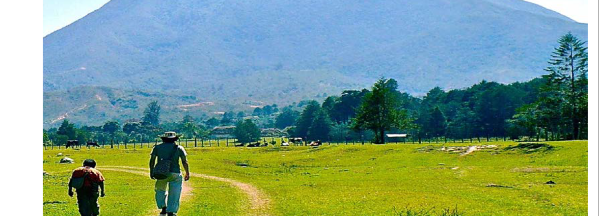
LfP began in August 2019 and is a five-year activity that is implemented by Tetra Tech ARD under the Strengthening Tenure and Resource Rights (STARR) II IDIQ.[1] The activity is envisioned to improve the conditions of conflict-affected rural households in a sustainable manner that will support USAID/Colombia’s effort to promote peace and stability, and contribute to reducing illicit crops and help the Government of Colombia (GoC) strengthen state presence in under-attended regions.[2]
LfP comprises three main intervention components: (1) advancing massive land titling[3] in rural areas along with continued support in land restitution for forcibly displaced households; (2) strengthening local capacity to maintain formalized land transactions; and (3) strengthening land governance and economic development through strategic Public Private Partnerships (PPPs). The LfP activity takes place in a total of seven regions, as well as the vicinity of Chiribiquete National Park.[4] The IE of LfP focuses on ten of the eleven so-called pilot municipalities within these regions, each of which will receive all three components of the intervention.
Together, the three intervention components aim to improve tenure security and access to markets and State services, increase private sector engagement and opportunities for generating income through licit activities, strengthen local land administration systems and infrastructure, reduce land conflict, and improve youth, ethnic, and women’s empowerment.
Evaluation Questions
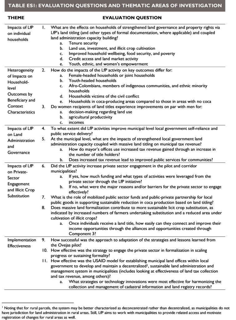
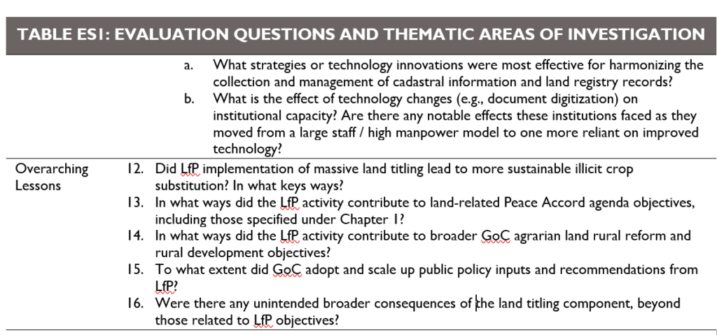
Table 1 lists the six evaluation themes addressed by the LfP evaluation. The evaluation questions, which the team developed in collaboration with USAID, focus on meeting USAID’s priority learning interests for this activity and were derived from the LfP theory of change.
[1] LfP grew out of a pilot activity implemented in the municipality of Ovejas, Sucre, which was part of the Land and Rural Development Program (LRDP).
[2] Program municipalities were selected from among a larger group of municipalities that have suffered disproportionately from the Colombian conflict and a lack of State presence, and were identified during the 2016 Peace Accords between the GoC and the FARC guerrilla group to be the focus of targeted investment and programming. This larger group of municipalities is known as the Programa de Desarrollo con Enfoque Territorial (Territorially Focused Development Plans – PDET) municipalities.
[3]Land titles are issued by GoC, while LfP provides all necessary inputs for titling and works with relevant entities to ensure the titles are processed. LfP’s stated goal is to facilitate titling for 100 percent of eligible plots, excluding plots that may be located on protected public lands, in hazardous areas such as flood zones, encroach upon indigenous reserves, or otherwise found to be ineligible for titling.
[4] Southern Tolima, Montes de Maria, Meta, Catatumbo, Tumaco, Northern Cauca, and Bajo Cauca