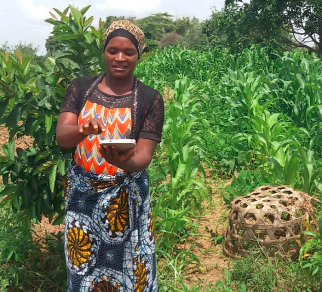
In January 2015, USAID tested an early version of the mobile application it is developing to map and register land rights information in rural Tanzania. The Mobile Application to Secure Tenure (MAST) project is being piloted in Ilalasimba village in the Iringa Rural District. The project will provide an easy-to-use, open-source mobile phone application that local people can employ to capture parcel boundaries and the household information needed to apply for formal documentation of rural land rights. The mobile application is coupled with a cloud-based data management system that stores the collected geospatial and household information. Together, these components test whether a bottom-up, participatory approach to mapping and registering rights, provides a low-cost and timely alternative to current approaches that often involve significant delays and costs and that are not as transparent as possible.
The project consists of two components: an Android-based smartphone application that will capture the information needed to apply for a Certificate of Customary Rights of Occupancy, and a cloud-based data management infrastructure that will securely store information that is gathered directly from villagers. Data can be captured in an offline mode and transferred to the cloud-based data management server when a connection is available. These components provide land administration tools that can be customized to meet different objectives (e.g., land use planning, sustainability planning, spot or systematic registration, among others). The MAST technology is configured based on the Land Administration Domain Model/Social Tenure Domain Model frameworks and is attentive to concerns related to a wide variety of land and resource rights and access issues.
Early testing was conducted with officials from the Ministry of Lands and the District Land Office in Iringa Rural District. The testing allowed USAID to determine the accuracy of the GPS technology that is built into the application. It also allowed USAID to work with local women and men to get a feel for how user-friendly the technology is. Finally, testing also allowed USAID to get immediate feedback from government land officials. The project began community engagement and sensitization regarding Tanzania’s land laws in March 2015 and will begin mapping and working with local families to collect the information needed to apply for thecertificates in April 2015.