Q&A with Gustavo Marulanda, Director of IGAC, Colombia’s cadaster and mapping agency
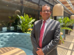 USAID’s Land for Prosperity Activity is updating the cadaster of 11 municipalities in eight regions of Colombia and the Chiribiquete National Park, the largest protected area in Colombia, to support formal land markets and protect biodiversity. In this interview, Gustavo Marulanda, IGAC’s Director, talks about the cadaster as an essential component of property formalization and regional land administration.
How up-to-date is Colombia’s rural cadaster?
Approximately 905 of the country’s 1,101 municipalities have an outdated cadaster, and some were updated 30 years ago. This means that there are people that are only paying a small percent of what they should be paying in property taxes. The average property tax payment is just COP $28,000 (USD $7). This is what everyone pays, not just smallholder farmers but also the large landowners. So, updating the cadaster allows us to make significant progress with the process of promoting equality and improving tax redistribution.
How does updating the cadaster help with the implementation of the Peace Accords?
Point 1 of the Peace Accords is comprehensive rural reform, and an updated cadaster is fundamental here. The Peace Accords aim to formalize seven million hectares and redistribute three million hectares, but the first thing we need to achieve this is detailed property information, to know who are owners and who are occupants. By updating the cadaster, we can achieve more equity in the distribution of land. For example, many of the large landowners in the country, who often have unproductive and unused land, are not paying property tax.
How does the IGAC support land formalization?
 At IGAC we have a legal responsibility to know the current and allowed land uses, we have to know what each piece of land is good for and how we need to protect it. The cadaster is the map of landowners who have secure tenure rights to their property. The cadaster generates knowledge and detailed information about our rural territories and provides us with inputs that are fundamental to administer land and property in a way that is socially responsible and promotes sustainable land use and production.
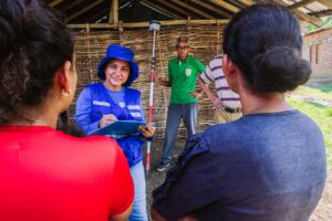
How do the communities benefit from the cadastral update?
Citizens benefit from the cadaster when they ask themselves things like “Where is my farm located? What are its boundaries? Who are my neighbors?”. It is similar to opening your smartphone and using mapping and navigation apps to know your location. An updated cadaster allows the municipality to make better decisions and to know where its population lives and what their needs are. The municipality knows if there are schools, health centers, or where to build infrastructure such as roads in a more efficient way. Additionally, by collecting property taxes, the municipality will increase its budget. The cadaster ensures that taxes are fair, so the ones who have more, pay more. Today no one is paying, neither the ones who have the most nor the ones who have the least.
How have you involved citizens more in these topics?
 Before, the community was not actively involved and that was a problem. That is why our logic is that the cadaster is made for the people and with the people. This is advantageous, because we can explain to the public why the cadaster is useful. People say “they update the cadaster and then my taxes increase, so I will have to pay more”, but they forget that they are also supporting land formalization and will receive a property title. And without a title they cannot access loans or subsidies.
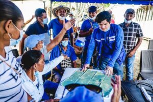
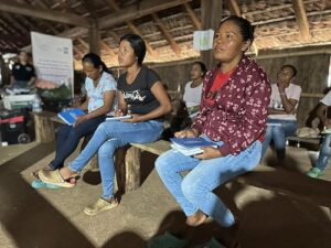
What are the Intercultural Cadaster Schools that USAID is supporting in Chiribiquete about, and how are they connected to the communities?
When we talk about the cadaster with the communities, we have to work with people, empower them, engage them with all these messages so they can make significant contributions to the information collection process and its sustainability. This is what the Intercultural Schools are doing, under the Geography for Life motto. They learn mapping exercises in an effective way, they understand why it is useful and how the community fits into their territory. Through mapping, communities can get to know their surroundings better and strengthen their spatial relationships. Sustainability is only achieved when people are empowered.
How does the cadaster contribute to conservation and environmental protection?
The information collected through the multipurpose cadaster contributes to the defense of strategic ecosystems in our country and continent, because we are connected to the Amazon and to the rivers that flow through it. This is why we have to know about them, their location, and have detailed information that allows us to make better decisions to defend and protect the environment. We have to monitor the levels of deforestation and illegal mining to defend our regions effectively.
How does the IGAC work with other government entities for land formalization?
 In Colombia, the land administration trio of agencies includes IGAC, the National Land Agency (ANT) and the Superintendence of Notaries and Registers (SNR). IGAC is responsible for collecting and managing detailed information, and in areas that have been prioritized by the government, we receive support from the ANT as a cadastral operator. The ANT then administers the land that has been formalized or that will be redistributed and continues with the formalization and title delivery processes. The cycle then finishes with the SNR, which registers and issues the land titles.
USAID coordinates inter-institutional cooperation among Colombia’s land administration entities.
Why is the support of international donors important?
Donors, such as USAID, play a vital role, not just because they provide financing, but they also transfer knowledge, best practices, and technical capacities, which make us more efficient. We can also learn from international experiences, of how it has been done in other places or how we can improve information processing. The Intercultural Schools come from international experiences and from what donors have done elsewhere. The Land for Prosperity Activity has carried out property surveys and through trial and error helped to create a lot of the new methodologies we have today. Donors also have an added value because they coordinate institutions, because sometimes we are so busy with our day-to-day tasks that we have no time left to sit down and coordinate actions together.